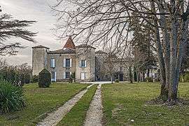
Falga
| Falga | ||
|---|---|---|
| Commune | ||
 | ||
| ||
 Falga Location within Occitanie region  Falga | ||
| Coordinates: 43°28′46″N 1°51′39″E / 43.4794°N 1.8608°ECoordinates: 43°28′46″N 1°51′39″E / 43.4794°N 1.8608°E | ||
| Country | France | |
| Region | Occitanie | |
| Department | Haute-Garonne | |
| Arrondissement | Toulouse | |
| Canton | Revel | |
| Intercommunality | Lauragais-Revel-Sorezois | |
| Government | ||
| • Mayor (2008–2014) | Isabelle Coutureau | |
| Area1 | 5.38 km2 (2.08 sq mi) | |
| Population (2008)2 | 100 | |
| • Density | 19/km2 (48/sq mi) | |
| Time zone | UTC+1 (CET) | |
| • Summer (DST) | UTC+2 (CEST) | |
| INSEE/Postal code | 31180 /31540 | |
| Elevation |
209–286 m (686–938 ft) (avg. 270 m or 890 ft) | |
|
1 French Land Register data, which excludes lakes, ponds, glaciers > 1 km2 (0.386 sq mi or 247 acres) and river estuaries. 2 Population without double counting: residents of multiple communes (e.g., students and military personnel) only counted once. | ||
.svg.png)
Falga is a commune in the Haute-Garonne department in southwestern France.
Population
| Historical population | ||
|---|---|---|
| Year | Pop. | ±% |
| 1962 | 24 | — |
| 1968 | 67 | +179.2% |
| 1975 | 57 | −14.9% |
| 1982 | 60 | +5.3% |
| 1990 | 73 | +21.7% |
| 1999 | 79 | +8.2% |
| 2008 | 100 | +26.6% |
See also
References
| Wikimedia Commons has media related to Falga. |
This article is issued from
Wikipedia.
The text is licensed under Creative Commons - Attribution - Sharealike.
Additional terms may apply for the media files.