Avignonet-Lauragais
| Avignonet-Lauragais | ||
|---|---|---|
| Commune | ||
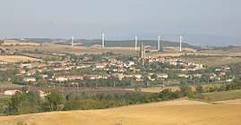 A general view of Avignonet-Lauragais | ||
| ||
 Avignonet-Lauragais Location within Occitanie region  Avignonet-Lauragais | ||
| Coordinates: 43°22′00″N 1°47′23″E / 43.3667°N 1.7897°ECoordinates: 43°22′00″N 1°47′23″E / 43.3667°N 1.7897°E | ||
| Country | France | |
| Region | Occitanie | |
| Department | Haute-Garonne | |
| Arrondissement | Toulouse | |
| Canton | Revel | |
| Intercommunality | CC Terres Lauragais | |
| Government | ||
| • Mayor (2014-2020) | Jean-François Pages | |
| Area1 | 40.66 km2 (15.70 sq mi) | |
| Population (2014)2 | 1,443 | |
| • Density | 35/km2 (92/sq mi) | |
| Time zone | UTC+1 (CET) | |
| • Summer (DST) | UTC+2 (CEST) | |
| INSEE/Postal code | 31037 /31290 | |
| Elevation |
176–274 m (577–899 ft) (avg. 215 m or 705 ft) | |
|
1 French Land Register data, which excludes lakes, ponds, glaciers > 1 km2 (0.386 sq mi or 247 acres) and river estuaries. 2 Population without double counting: residents of multiple communes (e.g., students and military personnel) only counted once. | ||
.svg.png)
Avignonet-Lauragais is a commune in the Haute-Garonne department in southwestern France.
Population
| Historical population | ||
|---|---|---|
| Year | Pop. | ±% |
| 1962 | 963 | — |
| 1968 | 1,040 | +8.0% |
| 1975 | 938 | −9.8% |
| 1982 | 931 | −0.7% |
| 1990 | 954 | +2.5% |
| 1999 | 1,069 | +12.1% |
| 2008 | 1,262 | +18.1% |
| 2014 | 1,443 | +14.3% |
See also
References
| Wikimedia Commons has media related to Avignonet-Lauragais. |
This article is issued from
Wikipedia.
The text is licensed under Creative Commons - Attribution - Sharealike.
Additional terms may apply for the media files.