Red Mountain (Costilla County, Colorado)
| Red Mountain | |
|---|---|
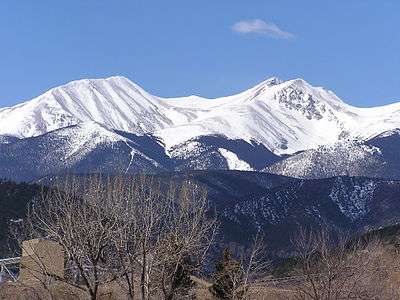 Red Mountain (left) and Culebra Peak (right) | |
| Highest point | |
| Elevation | 13,914 ft (4,241 m) [1][2] |
| Prominence | 448 ft (137 m) [2] |
| Isolation | 0.74 mi (1.19 km) [2] |
| Coordinates | 37°06′44″N 105°10′52″W / 37.112242°N 105.1811176°WCoordinates: 37°06′44″N 105°10′52″W / 37.112242°N 105.1811176°W [3] |
| Geography | |
 Red Mountain | |
| Location | Costilla County, Colorado, U.S.[3] |
| Parent range | Culebra Range[2] |
| Topo map |
USGS 7.5' topographic map Culebra Peak, Colorado[3] |
| Climbing | |
| Easiest route | hike |
Red Mountain, elevation 13,914 ft (4,241 m), is a summit in the Culebra Range of south central Colorado. The peak is on private land 15 mi (24 km) southeast of San Luis.
Historical names
- Espinazo Rojo – 1972
- Red Mountain – 1972 [3]
See also
References
- ↑ The elevation of Red Mountain includes an adjustment of +1.728 m (+5.67 ft) from NGVD 29 to NAVD 88.
- 1 2 3 4 "Red Mountain, Colorado". Peakbagger.com. Retrieved November 6, 2014.
- 1 2 3 4 "Red Mountain". Geographic Names Information System. United States Geological Survey. Retrieved November 6, 2014.
External links

This article is issued from
Wikipedia.
The text is licensed under Creative Commons - Attribution - Sharealike.
Additional terms may apply for the media files.