Washington County, Colorado
| Washington County, Colorado | |
|---|---|
 | |
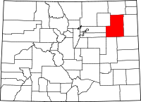 Location in the U.S. state of Colorado | |
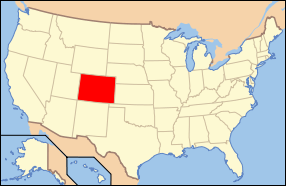 Colorado's location in the U.S. | |
| Founded | February 9, 1887 |
| Named for | George Washington |
| Seat | Akron |
| Largest town | Akron |
| Area | |
| • Total | 2,524 sq mi (6,537 km2) |
| • Land | 2,518 sq mi (6,522 km2) |
| • Water | 5.9 sq mi (15 km2), 0.2% |
| Population (est.) | |
| • (2015) | 4,864 |
| • Density | 1.9/sq mi (0.7/km2) |
| Congressional district | 4th |
| Time zone | Mountain: UTC−7/−6 |
| Website |
co |
Washington County is one of the 64 counties of the U.S. state of Colorado. As of the 2010 census, the population was 4,814.[1] The county seat is Akron.[2] The county was named in honor of the United States President George Washington.
Geography
According to the U.S. Census Bureau, the county has a total area of 2,524 square miles (6,540 km2), of which 2,518 square miles (6,520 km2) is land and 5.9 square miles (15 km2) (0.2%) is water.[3]
Adjacent counties
- Logan County - northeast
- Yuma County - east
- Kit Carson County - southeast
- Lincoln County - southwest
- Adams County - west
- Arapahoe County - west
- Morgan County - northwest
Trails and byways
Demographics
| Historical population | |||
|---|---|---|---|
| Census | Pop. | %± | |
| 1890 | 2,301 | — | |
| 1900 | 1,241 | −46.1% | |
| 1910 | 6,002 | 383.6% | |
| 1920 | 11,208 | 86.7% | |
| 1930 | 9,591 | −14.4% | |
| 1940 | 8,336 | −13.1% | |
| 1950 | 7,520 | −9.8% | |
| 1960 | 6,625 | −11.9% | |
| 1970 | 5,550 | −16.2% | |
| 1980 | 5,304 | −4.4% | |
| 1990 | 4,812 | −9.3% | |
| 2000 | 4,926 | 2.4% | |
| 2010 | 4,814 | −2.3% | |
| Est. 2016 | 4,908 | [4] | 2.0% |
| U.S. Decennial Census[5] 1790-1960[6] 1900-1990[7] 1990-2000[8] 2010-2015[1] | |||
As of the census[9] of 2000, there were 4,926 people, 1,989 households, and 1,408 families residing in the county. The population density was 2 people per square mile (1/km²). There were 2,307 housing units at an average density of 1 per square mile (0/km²). The racial makeup of the county was 96.39% White, 0.04% Black or African American, 0.57% Native American, 0.10% Asian, 0.02% Pacific Islander, 2.03% from other races, and 0.85% from two or more races. 6.29% of the population were Hispanic or Latino of any race.
There were 1,989 households out of which 31.30% had children under the age of 18 living with them, 60.70% were married couples living together, 6.40% had a female householder with no husband present, and 29.20% were non-families. 26.20% of all households were made up of individuals and 11.60% had someone living alone who was 65 years of age or older. The average household size was 2.46 and the average family size was 2.97.
In the county, the population was spread out with 26.50% under the age of 18, 6.30% from 18 to 24, 24.80% from 25 to 44, 24.20% from 45 to 64, and 18.20% who were 65 years of age or older. The median age was 40 years. For every 100 females there were 103.40 males. For every 100 females age 18 and over, there were 100.10 males.
The median income for a household in the county was $32,431, and the median income for a family was $37,287. Males had a median income of $26,225 versus $21,558 for females. The per capita income for the county was $17,788. About 8.60% of families and 11.40% of the population were below the poverty line, including 16.30% of those under age 18 and 9.40% of those age 65 or over.
Communities
Politics
Washington is a powerfully Republican county in Presidential elections. Among Colorado counties only Washington, Elbert and Hinsdale were carried by Barry Goldwater in 1964, and no Democratic Presidential nominee has carried Washington County since Franklin Delano Roosevelt in 1936. The last five Republican Presidential candidates have all obtained over 75 percent of Washington County's vote.
| Year | Republican | Democratic | Others |
|---|---|---|---|
| 2016 | 84.1% 2,299 | 10.8% 296 | 5.1% 138 |
| 2012 | 80.1% 2,076 | 18.1% 468 | 1.8% 47 |
| 2008 | 77.6% 1,949 | 21.1% 529 | 1.4% 35 |
| 2004 | 81.0% 2,050 | 18.0% 455 | 1.0% 25 |
| 2000 | 76.8% 1,878 | 19.5% 477 | 3.7% 90 |
| 1996 | 64.2% 1,566 | 26.6% 649 | 9.2% 225 |
| 1992 | 48.5% 1,266 | 25.3% 660 | 26.3% 687 |
| 1988 | 62.9% 1,707 | 35.3% 958 | 1.8% 50 |
| 1984 | 77.5% 2,080 | 21.2% 568 | 1.3% 36 |
| 1980 | 71.4% 2,007 | 20.2% 568 | 8.4% 236 |
| 1976 | 52.6% 1,440 | 44.3% 1,211 | 3.1% 85 |
| 1972 | 69.9% 1,837 | 24.5% 643 | 5.7% 149 |
| 1968 | 60.9% 1,634 | 25.9% 694 | 13.2% 354 |
| 1964 | 51.6% 1,434 | 48.3% 1,341 | 0.1% 4 |
| 1960 | 65.5% 1,979 | 34.4% 1,039 | 0.1% 4 |
| 1956 | 65.2% 2,020 | 34.4% 1,067 | 0.4% 11 |
| 1952 | 69.7% 2,398 | 29.3% 1,009 | 1.1% 36 |
| 1948 | 55.3% 1,636 | 44.1% 1,304 | 0.6% 18 |
| 1944 | 67.9% 2,259 | 31.8% 1,058 | 0.3% 11 |
| 1940 | 62.6% 2,390 | 36.8% 1,403 | 0.6% 23 |
| 1936 | 44.3% 1,723 | 53.3% 2,071 | 2.4% 92 |
| 1932 | 35.4% 1,385 | 60.8% 2,378 | 3.8% 150 |
| 1928 | 70.0% 2,132 | 27.9% 851 | 2.1% 63 |
| 1924 | 54.3% 1,851 | 21.1% 720 | 24.6% 840 |
| 1920 | 63.4% 2,117 | 31.8% 1,060 | 4.8% 160 |
| 1916 | 34.1% 989 | 60.3% 1,748 | 5.6% 161 |
| 1912 | 18.3% 361 | 38.9% 765 | 42.8% 842[lower-alpha 1] |
In other statewide elections, Washington County also leans Republican, although the county was carried by Democrat Roy Romer by a narrow margin in 1990[12] – when he carried all but three counties statewide – by Dick Lamm in 1982[13] and by Constitution Party candidate Tom Tancredo in 2010.[14] Since 1994, no Democratic senatorial candidate has won thirty percent of Washington County's vote.
Education
There are 5 school districts in Washington County:[15]
- Akron R-1
- Arickaree R-2
- Lone Star 101
- Otis R-3
- Woodlin R-104.
Akron R-1 includes:[16]
- Akron High School
Arickaree R-2 includes:[17]
- Arickaree School (all grades K-12)
Lone Star 101 includes:[18]
- Lone Star School (all grades K-12)
Otis R-3 includes:[19]
- Otis Elementary School
- Otis Jr.-Sr. High School
See also
Note
- ↑ The leading "other" candidate, Progressive Theodore Roosevelt, received 719 votes, while Socialist candidate Eugene Debs received 71 votes, Prohibition candidate Eugene Chafin received 34 votes, and Socialist Labor candidate Arthur Reimer received 18 votes.
References
- 1 2 "State & County QuickFacts". United States Census Bureau. Retrieved February 11, 2014.
- ↑ "Find a County". National Association of Counties. Retrieved 2011-06-07.
- ↑ "US Gazetteer files: 2010, 2000, and 1990". United States Census Bureau. 2011-02-12. Retrieved 2011-04-23.
- ↑ "Population and Housing Unit Estimates". Retrieved June 9, 2017.
- ↑ "U.S. Decennial Census". United States Census Bureau. Retrieved June 11, 2014.
- ↑ "Historical Census Browser". University of Virginia Library. Retrieved June 11, 2014.
- ↑ "Population of Counties by Decennial Census: 1900 to 1990". United States Census Bureau. Retrieved June 11, 2014.
- ↑ "Census 2000 PHC-T-4. Ranking Tables for Counties: 1990 and 2000" (PDF). United States Census Bureau. Retrieved June 11, 2014.
- ↑ "American FactFinder". United States Census Bureau. Retrieved 2011-05-14.
- ↑ Dave Leip's U.S. Election Atlas; 1960 Presidential General Election Data Graphs – Colorado (and subsequent years)
- ↑ Scammon, Richard M. (compiler); America at the Polls: A Handbook of Presidential Election Statistics 1920-1964; pp. 64-72 ISBN 0405077114
- ↑ Dave Leip's U.S. Election Atlas; 1990 Gubernatorial General Election Results – Colorado
- ↑ Dave Leip's U.S. Election Atlas; 1980 Gubernatorial General Election Results – Colorado
- ↑ Dave Leip's U.S. Election Atlas; 2010 Gubernatorial General Election Results – Colorado
- ↑ Education, Colorado Department of (2008–2009). "2008-2009 Colorado Education & Library Directory" (PDF). Retrieved 2009-05-26.
- ↑ School, Akron High. "Contacts". Retrieved 2009-05-26.
- ↑ School, Arickaree. "Home of the Indians". Retrieved 2009-05-26.
- ↑ School, Lone Star. "Lone Star School » About". Retrieved 2009-05-26.
- ↑ School District R-3, Otis (September 2004). "Otis School District R-3 - Schools". Archived from the original on October 1, 2008. Retrieved 2009-05-26.
External links
- Washington County Government website
- Colorado County Evolution by Don Stanwyck
- Colorado Historical Society
Places adjacent to Washington County, Colorado | ||||||||||
|---|---|---|---|---|---|---|---|---|---|---|
| ||||||||||
Municipalities and communities of Washington County, Colorado, United States | ||
|---|---|---|
| Towns | | |
| Unincorporated communities | ||
| Ghost town | ||
