Moffat County, Colorado
| Moffat County, Colorado | |
|---|---|
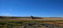
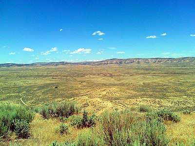 Wolf Creek Wildlife Management Area in Moffat County, Colorado | |
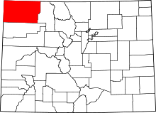 Location in the U.S. state of Colorado | |
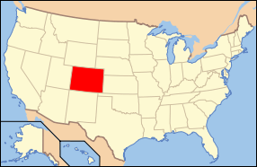 Colorado's location in the U.S. | |
| Founded | February 27, 1911 |
| Named for | David H. Moffat |
| Seat | Craig |
| Largest city | Craig |
| Area | |
| • Total | 4,751 sq mi (12,305 km2) |
| • Land | 4,743 sq mi (12,284 km2) |
| • Water | 7.6 sq mi (20 km2), 0.2% |
| Population (est.) | |
| • (2015) | 12,937 |
| • Density | 2.9/sq mi (1.1/km2) |
| Congressional district | 3rd |
| Time zone | Mountain: UTC−7/−6 |
| Website |
www |
Moffat County is the northwesternmost of the 64 counties in the U.S. state of Colorado. As of the 2010 census, the population was 13,795.[1] The county seat is Craig.[2]
Moffat County comprises the Craig, CO Micropolitan Statistical Area, which is also included in the Steamboat Springs-Craig, CO Combined Statistical Area.
History
Moffat County was created out of the western portion of Routt County on February 27, 1911. The county was named for David H. Moffat, a Colorado tycoon who died in 1911. His railroad, the Denver, Northwestern & Pacific, attempted to build a route from Denver to Salt Lake City. In 1913, a reorganized railroad, the Denver & Salt Lake, reached as far as Craig, the county seat, but no further. In the late 1890s and early 1900s, all Colorado District Courts were held in Denver, Colorado, in the State courthouse there, due to a lack of funds to build courthouses locally. All murder trials were held in Denver, in the District Courts.
Allegedly, so many murders occurred between the sheep farmers from Wyoming and cattle ranchers from Colorado that the presiding judges—tired of presiding over these murder trials—requested that the State legislature split Routt County into what is now Routt and Moffat County; the legislature complied.
Geography
According to the U.S. Census Bureau, the county has a total area of 4,751 square miles (12,310 km2), of which 4,743 square miles (12,280 km2) is land and 7.6 square miles (20 km2) (0.2%) is water.[3] It is the second-largest county by area in Colorado.
Adjacent counties
- Routt County – east
- Rio Blanco County – south
- Uintah County, Utah – west
- Daggett County, Utah – west
- Sweetwater County, Wyoming – north
- Carbon County, Wyoming – north
National protected areas
Scenic byway
Major highways
Demographics
| Historical population | |||
|---|---|---|---|
| Census | Pop. | %± | |
| 1920 | 5,129 | — | |
| 1930 | 4,861 | −5.2% | |
| 1940 | 5,086 | 4.6% | |
| 1950 | 5,946 | 16.9% | |
| 1960 | 7,061 | 18.8% | |
| 1970 | 6,525 | −7.6% | |
| 1980 | 13,133 | 101.3% | |
| 1990 | 11,357 | −13.5% | |
| 2000 | 13,184 | 16.1% | |
| 2010 | 13,795 | 4.6% | |
| Est. 2016 | 13,109 | [4] | −5.0% |
| U.S. Decennial Census[5] 1790-1960[6] 1900-1990[7] 1990-2000[8] 2010-2015[1] | |||
As of the census[9] of 2000, there were 13,184 people, 4,983 households, and 3,577 families residing in the county. The population density was 3 people per square mile (1/km²). There were 5,635 housing units at an average density of 1 per square mile (0/km²). The racial makeup of the county was 93.61% White, 0.21% Black or African American, 0.88% Native American, 0.33% Asian, 0.02% Pacific Islander, 3.17% from other races, and 1.77% from two or more races. 9.46% of the population were Hispanic or Latino of any race.
There were 4,983 households out of which 38.20% had children under the age of 18 living with them, 58.70% were married couples living together, 8.20% had a female householder with no husband present, and 28.20% were non-families. 23.60% of all households were made up of individuals and 8.10% had someone living alone who was 65 years of age or older. The average household size was 2.58 and the average family size was 3.05.
In the county, the population was spread out with 28.50% under the age of 18, 8.60% from 18 to 24, 29.90% from 25 to 44, 23.80% from 45 to 64, and 9.40% who were 65 years of age or older. The median age was 35 years. For every 100 females, there were 107.70 males. For every 100 females age 18 and over, there were 106.20 males.
The median income for a household in the county was $41,528, and the median income for a family was $45,511. Males had a median income of $37,288 versus $22,080 for females. The per capita income for the county was $18,540. About 6.90% of families and 8.30% of the population were below the poverty line, including 8.30% of those under age 18 and 9.30% of those age 65 or over.
Communities
City
Town
Census-designated place
Other unincorporated places
- Elk Springs
- Greystone
- Hamilton
- Massadona
- Lay
Politics
Moffat is a Republican county in Presidential elections. No Democratic presidential candidate has carried Moffat County since Lyndon Johnson’s 1964 landslide, and indeed no Democrat post-1964 has obtained even forty percent of the county’s vote. Moffat was one of fifteen counties (two in Colorado) to give a plurality to Ross Perot in the 1992 election, but every other Republican candidate since 1968 has obtained an absolute majority in Moffat County.
| Year | Republican | Democratic | Others |
|---|---|---|---|
| 2016 | 81.3% 5,305 | 13.4% 874 | 5.3% 346 |
| 2012 | 76.1% 4,695 | 21.6% 1,330 | 2.3% 143 |
| 2008 | 70.4% 4,135 | 27.0% 1,582 | 2.6% 154 |
| 2004 | 74.2% 4,247 | 23.7% 1,355 | 2.2% 123 |
| 2000 | 72.0% 3,840 | 22.9% 1,223 | 5.1% 274 |
| 1996 | 51.0% 2,466 | 33.8% 1,635 | 15.2% 735 |
| 1992 | 35.5% 1,809 | 27.2% 1,386 | 37.3% 1,900 |
| 1988 | 61.0% 2,757 | 36.2% 1,634 | 2.8% 128 |
| 1984 | 72.9% 3,630 | 24.7% 1,228 | 2.5% 123 |
| 1980 | 67.9% 3,344 | 21.9% 1,079 | 10.2% 502 |
| 1976 | 55.7% 2,099 | 38.5% 1,451 | 5.8% 220 |
| 1972 | 67.7% 1,928 | 20.8% 591 | 11.6% 329 |
| 1968 | 62.1% 1,785 | 26.6% 765 | 11.3% 325 |
| 1964 | 46.3% 1,438 | 53.4% 1,657 | 0.3% 8 |
| 1960 | 59.3% 1,754 | 40.6% 1,200 | 0.1% 3 |
| 1956 | 68.8% 1,762 | 31.1% 797 | 0.1% 2 |
| 1952 | 70.1% 1,922 | 29.5% 808 | 0.4% 11 |
| 1948 | 52.7% 1,261 | 46.1% 1,101 | 1.2% 29 |
| 1944 | 60.9% 1,445 | 38.9% 923 | 0.3% 6 |
| 1940 | 59.2% 1,556 | 40.2% 1,056 | 0.6% 15 |
| 1936 | 42.1% 954 | 48.1% 1,090 | 9.7% 220 |
| 1932 | 36.6% 880 | 57.7% 1,388 | 5.8% 139 |
| 1928 | 64.6% 1,346 | 34.1% 710 | 1.4% 29 |
| 1924 | 50.7% 1,009 | 32.5% 647 | 16.8% 334 |
| 1920 | 65.4% 1,294 | 29.8% 589 | 4.8% 95 |
| 1916 | 39.7% 512 | 57.4% 740 | 2.9% 37 |
| 1912 | 31.3% 294 | 43.6% 409 | 25.1% 235 |
In gubernatorial elections, Moffat County has also generally been Republican, but was nonetheless carried by Democrat Roy Romer by a narrow margin in 1990[11] – when he carried all but four counties statewide – by Dick Lamm in 1982[12] and by Constitution Party candidate Tom Tancredo in 2010.[13] In senatorial elections, the Republican candidate has consistently garnered over sixty percent of Moffat County voters since future party-switcher Ben “Nighthorse” Campbell won the county for the Democratic Party in 1992.[14]
See also
References
- 1 2 "State & County QuickFacts". United States Census Bureau. Archived from the original on July 15, 2011. Retrieved June 8, 2014.
- ↑ "Find a County". National Association of Counties. Retrieved 2011-06-07.
- ↑ "US Gazetteer files: 2010, 2000, and 1990". United States Census Bureau. 2011-02-12. Retrieved 2011-04-23.
- ↑ "Population and Housing Unit Estimates". Retrieved June 9, 2017.
- ↑ "U.S. Decennial Census". United States Census Bureau. Retrieved June 8, 2014.
- ↑ "Historical Census Browser". University of Virginia Library. Retrieved June 8, 2014.
- ↑ "Population of Counties by Decennial Census: 1900 to 1990". United States Census Bureau. Retrieved June 8, 2014.
- ↑ "Census 2000 PHC-T-4. Ranking Tables for Counties: 1990 and 2000" (PDF). United States Census Bureau. Retrieved June 8, 2014.
- ↑ "American FactFinder". United States Census Bureau. Retrieved 2011-05-14.
- ↑ Leip, David. "Dave Leip's Atlas of U.S. Presidential Elections". uselectionatlas.org. Retrieved May 26, 2017.
- ↑ Dave Leip’s U.S. Election Atlas; 1990 Gubernatorial General Election Results – Colorado
- ↑ Dave Leip’s U.S. Election Atlas; 1982 Gubernatorial General Election Results – Colorado
- ↑ Dave Leip’s U.S. Election Atlas; 2010 Gubernatorial General Election Results – Colorado
- ↑ Dave Leip’s U.S. Election Atlas; 1992 Senatorial General Election Results – Colorado
External links
| Wikimedia Commons has media related to Moffat County, Colorado. |
- Moffat County official website
- Dinosaur National Monument
- Colorado County Evolution, by Don Stanwyck
- Colorado Historical Society
Places adjacent to Moffat County, Colorado | ||||||||||
|---|---|---|---|---|---|---|---|---|---|---|
| ||||||||||
Municipalities and communities of Moffat County, Colorado, United States | ||
|---|---|---|
| City | | |
| Town | ||
| CDP | ||
| Unincorporated communities | ||
| Ghost town | ||
