Craig, Colorado
| Craig, Colorado | |
|---|---|
| Home Rule Municipality | |
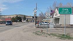 Entering Craig from the south on South Ranney Street. | |
 Location of Craig in Moffat County, Colorado. | |
| Coordinates: 40°31′01″N 107°33′20″W / 40.517034°N 107.555674°WCoordinates: 40°31′01″N 107°33′20″W / 40.517034°N 107.555674°W[1] | |
| Country |
|
| State |
|
| County | Moffat County Seat[2] |
| Incorporated | 1908-07-15[3] |
| Government | |
| • Type | Home Rule Municipality[2] |
| Area[4] | |
| • Home Rule Municipality | 5.13 sq mi (13.30 km2) |
| • Land | 5.13 sq mi (13.30 km2) |
| • Water | 0.00 sq mi (0.00 km2) |
| Elevation[5] | 6,198 ft (1,889 m) |
| Population (2010) | |
| • Home Rule Municipality | 9,464 |
| • Estimate (2016)[6] | 8,952 |
| • Density | 1,743.33/sq mi (673.05/km2) |
| • Metro | 13,200 |
| Time zone | UTC−7 (MST) |
| • Summer (DST) | UTC−6 (MDT) |
| ZIP Codes[7] | 81625 & 81626 (PO Box) |
| Area code(s) | 970 |
| FIPS code | 08-17760 |
| GNIS feature ID | 0171304 |
| Website |
www |
Craig is a small city that is the county seat of and the most populous place in Moffat County, Colorado, United States.[8] The city population was 9,464 at the 2010 United States Census.[9]
History
Founded by William H. Tucker, Craig was incorporated as a city on April 24, 1908. The town was named for one of the town's financial backers, Reverend William Bayard Craig.[10][11]
Craig became the county seat when Moffat County was created out of the western portion of Routt County on February 27, 1911. In the same area as Craig, at the confluence of the Yampa River (then known as the Bear River) and Fortification Creek, were previous towns known as Yampa (as early as 1885) and Windsor (as early as 1878). In 1878, the area consisted of a number of ranches and at least two businesses: Himley's Ferry (which allowed crossing of the Yampa River) and Peck's Store (a one-room trading post).
In the 1970s and early 1980s, the largest power generation plant in Colorado[12] and several coal mines were constructed near Craig.
Geography
Craig is located at 40°31′1″N 107°33′1″W / 40.51694°N 107.55028°W (40.516896, -107.550389).[13]
According to the United States Census Bureau, the city has a total area of 5.1 square miles (13.3 km2), all land.[9]
Climate
| Climate data for "Craig 4 SW", Colorado (1981–2010 normals) | |||||||||||||
|---|---|---|---|---|---|---|---|---|---|---|---|---|---|
| Month | Jan | Feb | Mar | Apr | May | Jun | Jul | Aug | Sep | Oct | Nov | Dec | Year |
| Average high °F (°C) | 31.3 (−0.4) |
35.1 (1.7) |
46.4 (8) |
56.9 (13.8) |
66.6 (19.2) |
77.3 (25.2) |
85.0 (29.4) |
83.1 (28.4) |
73.9 (23.3) |
60.9 (16.1) |
44.5 (6.9) |
32.5 (0.3) |
57.8 (14.3) |
| Average low °F (°C) | 7.3 (−13.7) |
10.8 (−11.8) |
21.1 (−6.1) |
28.6 (−1.9) |
36.7 (2.6) |
43.8 (6.6) |
50.2 (10.1) |
49.3 (9.6) |
40.1 (4.5) |
30.0 (−1.1) |
19.4 (−7) |
9.3 (−12.6) |
28.9 (−1.7) |
| Average precipitation inches (mm) | 1.08 (27.4) |
1.12 (28.4) |
1.36 (34.5) |
1.67 (42.4) |
1.47 (37.3) |
1.30 (33) |
1.21 (30.7) |
1.22 (31) |
1.75 (44.4) |
1.78 (45.2) |
1.44 (36.6) |
1.16 (29.5) |
16.55 (420.4) |
| Average snowfall inches (cm) | 14.8 (37.6) |
12.7 (32.3) |
10.9 (27.7) |
5.9 (15) |
1.1 (2.8) |
0.1 (0.3) |
0.0 (0) |
0.0 (0) |
0.3 (0.8) |
3.4 (8.6) |
11.1 (28.2) |
14.5 (36.8) |
74.8 (190) |
| Source: NOAA[14] | |||||||||||||
Demographics
| Historical population | |||
|---|---|---|---|
| Census | Pop. | %± | |
| 1910 | 392 | — | |
| 1920 | 1,297 | 230.9% | |
| 1930 | 1,418 | 9.3% | |
| 1940 | 2,123 | 49.7% | |
| 1950 | 3,080 | 45.1% | |
| 1960 | 3,984 | 29.4% | |
| 1970 | 4,205 | 5.5% | |
| 1980 | 8,133 | 93.4% | |
| 1990 | 8,091 | −0.5% | |
| 2000 | 9,189 | 13.6% | |
| 2010 | 9,464 | 3.0% | |
| Est. 2016 | 8,952 | [6] | −5.4% |
| U.S. Decennial Census[15] | |||
As of the census[16] of 2000, there were 9,189 people, 3,525 households, and 2,432 families residing in the city. The population density was 1,886.6 people per square mile (728.5/km²). There were 3,851 housing units at an average density of 790.6 per square mile (305.3/km²). The racial makeup of the city was 92.56% White, 0.30% African American, 0.96% Native American, 0.42% Asian, 0.02% Pacific Islander, 3.84% from other races, and 1.89% from two or more races. Hispanic or Latino of any race were 10.80% of the population.
There were 3,525 households out of which 38.3% had children under the age of 18 living with them, 54.3% were married couples living together, 9.6% had a female householder with no husband present, and 31.0% were non-families. 25.9% of all households were made up of individuals and 8.9% had someone living alone who was 65 years of age or older. The average household size was 2.53 and the average family size was 3.05.
In the city, the population was spread out with 28.5% under the age of 18, 9.6% from 18 to 24, 30.1% from 25 to 44, 21.9% from 45 to 64, and 9.9% who were 65 years of age or older. The median age was 34 years. For every 100 females, there were 106.3 males. For every 100 females age 18 and over, there were 103.4 males.
The median income for a household in the city was $41,091, and the median income for a family was $45,504. Males had a median income of $38,038 versus $21,806 for females. The per capita income for the city was $18,140. About 6.9% of families and 8.6% of the population were below the poverty line, including 10.5% of those under age 18 and 6.5% of those age 65 or over.
Transportation
Craig was the terminus of the never-finished Denver and Salt Lake Railway. While the tracks still exist to Craig, the effort to finish this line was abandoned, and the tracks to Craig became a spur route.[17]
U.S. 40 is the primary east-west highway serving Craig, while Colorado State Highway 13 runs south to Interstate 70 and north to Wyoming, where it becomes Wyoming State Highway 789, ending in the north at Interstate 80.
Craig-Moffat Airport serves as the local airfield. Scheduled passenger jet airline service is available at the Yampa Valley Airport located east of Craig on U.S. 40.
Hunting
Craig is, according to the local chamber of commerce, "Elk Hunting Capital of the World".[18]
Notable people
- Jennifer LeRoy (b. January 7, 1974) is an American model and actress. She was chosen as Playboy's Playmate of the Month in February 1993.
- Chance Phelps (July 14, 1984 – April 9, 2004) was a Lance Corporal in the United States Marine Corps who became known when Lt. Col. Michael Strobl escorted his remains from Iraq. Lt. Col. Strobl recorded his account of the escort in "Taking Chance", an article which was later made into a full-length movie by HBO under the same title.
- Dennis Preece (March 4, 1940 - April 25, 1997) was a Hall of Fame wrestling coach who attended the local high school in Craig, Colorado graduating in 1958.
- Angus Ellis Taylor (October 13, 1911 – April 6, 1999) was a Mathematician and Chancellor of UC Santa Cruz.
See also
References
- ↑ "2014 U.S. Gazetteer Files: Places". United States Census Bureau. July 1, 2014. Retrieved January 5, 2015.
- 1 2 "Active Colorado Municipalities". State of Colorado, Department of Local Affairs. Archived from the original on November 23, 2010. Retrieved 2007-09-01.
- ↑ "Colorado Municipal Incorporations". State of Colorado, Department of Personnel & Administration, Colorado State Archives. 2004-12-01. Retrieved 2007-09-02.
- ↑ "2016 U.S. Gazetteer Files". United States Census Bureau. Retrieved Jul 25, 2017.
- ↑ "US Board on Geographic Names". United States Geological Survey. 2007-10-25. Retrieved 2008-01-31.
- 1 2 "Population and Housing Unit Estimates". Retrieved June 9, 2017.
- ↑ "ZIP Code Lookup". United States Postal Service. Archived from the original (JavaScript/HTML) on November 23, 2010. Retrieved September 6, 2007.
- ↑ "Find a County". National Association of Counties. Archived from the original on May 31, 2011. Retrieved 2011-06-07.
- 1 2 "Geographic Identifiers: 2010 Demographic Profile Data (G001): Craig city, Colorado". U.S. Census Bureau, American Factfinder. Retrieved January 31, 2013.
- ↑ "Profile for Craig, Colorado, CO". ePodunk. Retrieved 2012-06-22.
- ↑ Dawson, John Frank. Place names in Colorado: why 700 communities were so named, 150 of Spanish or Indian origin. Denver, CO: The J. Frank Dawson Publishing Co. p. 15.
- ↑ 1. Craig, Colorado Chamber of Commerce Website
- ↑ "US Gazetteer files: 2010, 2000, and 1990". United States Census Bureau. 2011-02-12. Retrieved 2011-04-23.
- ↑ "NOWData - NOAA Online Weather Data". National Oceanic and Atmospheric Administration. Retrieved May 4, 2013.
- ↑ "Census of Population and Housing". Census.gov. Archived from the original on May 12, 2015. Retrieved June 4, 2015.
- ↑ "American FactFinder". United States Census Bureau. Archived from the original on September 11, 2013. Retrieved 2008-01-31.
- ↑ "The Moffat Railroad". Museum of Northwest Colorado. Retrieved March 20, 2016.
- ↑
External links
| Wikimedia Commons has media related to Craig, Colorado. |
- City of Craig official website
- CDOT map of the City of Craig
- Moffat County School District
- W.B. Craig
Municipalities and communities of Moffat County, Colorado, United States | ||
|---|---|---|
| City | 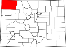 | |
| Town | ||
| CDP | ||
| Unincorporated communities | ||
| Ghost town | ||
