Clear Creek County, Colorado
| Clear Creek County, Colorado | |
|---|---|
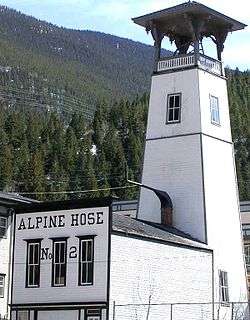 Alpine Hose, historic firehouse in Georgetown. | |
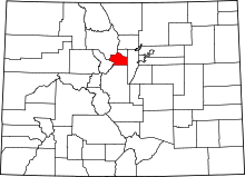 Location in the U.S. state of Colorado | |
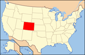 Colorado's location in the U.S. | |
| Founded | November 1, 1861 |
| Named for | Clear Creek |
| Seat | Georgetown |
| Largest city | Idaho Springs |
| Area | |
| • Total | 396 sq mi (1,026 km2) |
| • Land | 395 sq mi (1,023 km2) |
| • Water | 1.3 sq mi (3 km2), 0.3% |
| Population (est.) | |
| • (2016) | 9,436[1] |
| • Density | 23/sq mi (9/km2) |
| Congressional district | 2nd |
| Time zone | Mountain: UTC−7/−6 |
| Website |
co |
| Wikimedia Commons has media related to Dixie Mine. |
Clear Creek County is one of the 64 counties of the U.S. state of Colorado. As of the 2010 census, the population was 9,088.[3] The county seat is Georgetown.[4]
Clear Creek County is part of the Denver-Aurora-Lakewood, CO Metropolitan Statistical Area.
History
Clear Creek County was one of the original 17 counties created by the Colorado legislature on 1 November 1861, and is one of only two counties (along with Gilpin) to have persisted with its original boundaries unchanged. It was named after Clear Creek, which runs down from the continental divide through the county. Idaho Springs was originally designated the county seat, but the county government was moved to Georgetown in 1867.
Geography
According to the U.S. Census Bureau, the county has a total area of 396 square miles (1,030 km2), of which 395 square miles (1,020 km2) is land and 1.3 square miles (3.4 km2) (0.3%) is water.[5]
Adjacent counties
- Jefferson County - east
- Gilpin County - northeast
- Park County - south
- Summit County - west
- Grand County - northwest
Major highways
National protected areas
Scenic trails and byways
Politics
Clear Creek County tends to be somewhat divided between Republicans and Democrats. In the 2012 election, Barack Obama won over Mitt Romney 54% to 42%.
| Year | Republican | Democratic | Others |
|---|---|---|---|
| 2016 | 43.9% 2,575 | 46.5% 2,729 | 9.6% 562 |
| 2012 | 42.3% 2,430 | 54.3% 3,119 | 3.4% 194 |
| 2008 | 39.9% 2,300 | 57.8% 3,332 | 2.3% 135 |
| 2004 | 44.9% 2,522 | 53.3% 2,989 | 1.8% 102 |
| 2000 | 45.6% 2,247 | 44.4% 2,188 | 9.9% 489 |
| 1996 | 42.0% 1,746 | 44.8% 1,863 | 13.2% 551 |
| 1992 | 30.4% 1,356 | 39.1% 1,744 | 30.5% 1,360 |
| 1988 | 50.1% 1,820 | 46.8% 1,698 | 3.1% 114 |
| 1984 | 65.3% 2,151 | 33.1% 1,089 | 1.6% 52 |
| 1980 | 56.2% 1,784 | 26.4% 837 | 17.4% 552 |
| 1976 | 55.4% 1,477 | 40.1% 1,069 | 4.6% 122 |
| 1972 | 62.2% 1,557 | 32.6% 815 | 5.2% 130 |
| 1968 | 52.7% 1,011 | 37.5% 719 | 9.8% 188 |
| 1964 | 38.3% 676 | 61.5% 1,086 | 0.3% 5 |
| 1960 | 58.4% 964 | 41.7% 688 | 0.0% 0 |
| 1956 | 64.9% 973 | 34.7% 520 | 0.5% 7 |
| 1952 | 67.7% 1,145 | 31.9% 540 | 0.4% 6 |
| 1948 | 48.7% 810 | 50.2% 836 | 1.1% 18 |
| 1944 | 55.3% 795 | 44.2% 636 | 0.5% 7 |
| 1940 | 44.2% 1,018 | 55.6% 1,281 | 0.3% 7 |
| 1936 | 34.7% 720 | 64.6% 1,340 | 0.8% 16 |
| 1932 | 38.2% 597 | 60.0% 939 | 1.8% 28 |
| 1928 | 61.1% 790 | 37.2% 481 | 1.8% 23 |
| 1924 | 61.9% 722 | 24.3% 284 | 13.8% 161 |
| 1920 | 58.3% 765 | 39.5% 518 | 2.2% 29 |
| 1916 | 26.4% 474 | 71.7% 1,289 | 2.0% 36 |
| 1912 | 23.8% 469 | 59.3% 1,166 | 16.9% 333 |
Demographics
| Historical population | |||
|---|---|---|---|
| Census | Pop. | %± | |
| 1870 | 1,596 | — | |
| 1880 | 7,823 | 390.2% | |
| 1890 | 7,184 | −8.2% | |
| 1900 | 7,082 | −1.4% | |
| 1910 | 5,001 | −29.4% | |
| 1920 | 2,891 | −42.2% | |
| 1930 | 2,155 | −25.5% | |
| 1940 | 3,784 | 75.6% | |
| 1950 | 3,289 | −13.1% | |
| 1960 | 2,793 | −15.1% | |
| 1970 | 4,819 | 72.5% | |
| 1980 | 7,308 | 51.6% | |
| 1990 | 7,619 | 4.3% | |
| 2000 | 9,322 | 22.4% | |
| 2010 | 9,088 | −2.5% | |
| Est. 2016 | 9,436 | [7] | 3.8% |
| U.S. Decennial Census[8] 1790-1960[9] 1900-1990[10] 1990-2000[11] 2010-2015[3] | |||
As of the census[12] of 2000, there were 9,322 people, 4,019 households, and 2,608 families residing in the county. The population density was 24 people per square mile (9/km²). There were 5,128 housing units at an average density of 13 per square mile (5/km²). The racial makeup of the county was 96.37% White, 0.28% Black or African American, 0.73% Native American, 0.36% Asian, 0.03% Pacific Islander, 1.02% from other races, and 1.20% from two or more races. 3.87% of the population were Hispanic or Latino of any race.
There were 4,019 households out of which 28.20% had children under the age of 18 living with them, 54.60% were married couples living together, 6.90% had a female householder with no husband present, and 35.10% were non-families. 27.20% of all households were made up of individuals and 4.30% had someone living alone who was 65 years of age or older. The average household size was 2.31 and the average family size was 2.81.
In the county, the population was spread out with 22.60% under the age of 18, 5.60% from 18 to 24, 32.60% from 25 to 44, 32.20% from 45 to 64, and 7.10% who were 65 years of age or older. The median age was 40 years. For every 100 females there were 108.80 males. For every 100 females age 18 and over, there were 110.20 males.
The median income for a household in the county was $50,997, and the median income for a family was $61,400. Males had a median income of $41,667 versus $30,757 for females. The per capita income for the county was $28,160. About 3.00% of families and 5.40% of the population were below the poverty line, including 6.80% of those under age 18 and 5.60% of those age 65 or over.
Communities
City
Towns
Census-designated places
Historic areas
See also
- Outline of Colorado
- Index of Colorado-related articles
- Arapahoe County, Kansas Territory
- Montana County, Jefferson Territory
- Colorado census statistical areas
- Denver-Aurora-Boulder Combined Statistical Area
- Front Range Urban Corridor
- National Register of Historic Places listings in Clear Creek County, Colorado
References
- ↑ "Population and Housing Unit Estimates". U.S. Census Bureau. August 15, 2017. Retrieved August 15, 2017.
- ↑ Lamartine Mining District at Mindat.org
- 1 2 "State & County QuickFacts". United States Census Bureau. Retrieved January 25, 2014.
- ↑ "Find a County". National Association of Counties. Archived from the original on 2011-05-31. Retrieved 2011-06-07.
- ↑ "US Gazetteer files: 2010, 2000, and 1990". United States Census Bureau. 2011-02-12. Retrieved 2011-04-23.
- ↑ Leip, David. "Dave Leip's Atlas of U.S. Presidential Elections". uselectionatlas.org. Retrieved May 26, 2017.
- ↑ "Population and Housing Unit Estimates". Retrieved June 9, 2017.
- ↑ "U.S. Decennial Census". United States Census Bureau. Archived from the original on May 12, 2015. Retrieved June 7, 2014.
- ↑ "Historical Census Browser". University of Virginia Library. Retrieved June 7, 2014.
- ↑ "Population of Counties by Decennial Census: 1900 to 1990". United States Census Bureau. Retrieved June 7, 2014.
- ↑ "Census 2000 PHC-T-4. Ranking Tables for Counties: 1990 and 2000" (PDF). United States Census Bureau. Retrieved June 7, 2014.
- ↑ "American FactFinder". United States Census Bureau. Archived from the original on 2013-09-11. Retrieved 2011-05-14.
External links
- Clear Creek County Government website
- Clear Creek County Colorado Tourism and Visitors Site
- Colorado Historical Society
Places adjacent to Clear Creek County, Colorado | ||||||||||
|---|---|---|---|---|---|---|---|---|---|---|
| ||||||||||
Municipalities and communities of Clear Creek County, Colorado, United States | ||
|---|---|---|
| Cities | ||
| Towns | ||
| CDPs | ||
| Unincorporated communities | ||
| Ghost towns |
| |
| Footnotes | ‡This populated place also has portions in an adjacent county or counties | |
