Westminster, Colorado
| Westminster, Colorado | ||
|---|---|---|
| City | ||
 Houses in Westminster, with the Rocky Mountains in the background | ||
| ||
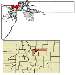 Location of Westminster in Adams County and Jefferson County, Colorado | ||
| Coordinates: 39°50′10″N 105°2′14″W / 39.83611°N 105.03722°WCoordinates: 39°50′10″N 105°2′14″W / 39.83611°N 105.03722°W | ||
| Country | United States | |
| State | Colorado | |
| Counties[1] |
Adams County Jefferson County | |
| Settled | 1859 | |
| Platted | 1885 as DeSpain Junction, later Harris | |
| Incorporated | May 24, 1911[2] as the Town of Westminster | |
| Government | ||
| • Type | Home Rule Municipality[1] | |
| • Mayor | Herb Atchison | |
| • City Manager | Donald M. Tripp | |
| Area[3] | ||
| • Total | 34.05 sq mi (88.19 km2) | |
| • Land | 31.73 sq mi (82.18 km2) | |
| • Water | 2.32 sq mi (6.01 km2) | |
| Elevation[4] | 5,384 ft (1,641 m) | |
| Population (2010) | ||
| • Total | 106,114 | |
| • Estimate (2016)[5] | 113,875 | |
| • Density | 3,588.99/sq mi (1,385.74/km2) | |
| Time zone | UTC−7 (MST) | |
| • Summer (DST) | UTC−6 (MDT) | |
| ZIP codes[6] | 80003, 80005, 80020-80021, 80023, 80030-80031, 80035-80036, 80221, 80234, 80241, 80260 | |
| Area code(s) | Both 303 and 720 | |
| FIPS code | 08-83835 | |
| GNIS feature ID | 0204703 | |
| Highways | I-25, US 36, US 287, SH 95, SH 121, SH 128 | |
| Website |
www | |
|
| ||

Westminster is a Home Rule Municipality in Adams and Jefferson counties in the U.S. state of Colorado. Westminster is a northwest suburb of Denver. The Westminster Municipal Center is located 9 miles (14 km) north-northwest of the Colorado State Capitol. As of the 2010 census the population of Westminster was 106,114,[7] and as of 2016 the estimated population was 113,875.[5] Westminster is the seventh most populous city in Colorado and the 237th most populous city in the United States. Westminster is a part of the Denver-Aurora-Lakewood, CO Metropolitan Statistical Area and the Denver-Aurora-Boulder Combined Statistical Area. In July 2006, it was ranked as the 24th best place to live in the USA by Money magazine.[8]
History
Gold discovered in the South Platte River Valley in 1858 brought national attention to the area that would become Westminster, Colorado. The promise of fortune and the Land Act of 1862 encouraged many settlers from the east to make Colorado their home instead of heading on to California. Before the settlements came, wildlife like antelope and buffalo made their homes in this area. There is also evidence of Arapaho Indians near the Crown Point (Gregory Hill) area.[9]
After the first permanent white settler, Pleasant DeSpain, built his home in 1870 on 160 acres (near what is now West 76th Avenue and Lowell Street), the area became known as DeSpain Junction and began attracting other settlers including horse breeder Edward Bruce Bowles who was instrumental in constructing the town's train depot in 1881. In 1885, Connecticut real estate developer C. J. Harris arrived in DeSpain Junction and began buying up land. Soon the town was renamed Harris, but was also known as Darell Park.[9]
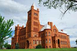
In 1891, construction began on the Westminster Castle, which can still be seen as of today at West 83rd Avenue and Federal Boulevard. By 1911, the town had incorporated and was renamed one final time to Westminster, in honor of Westminster University.[10]
Geography
Westminster is located in western Adams County and northeastern Jefferson County at 39°52′N 105°03′W / 39.867°N 105.050°W (39.862, -105.048).[11] It is bordered to the north by Broomfield, to the northeast by Thornton, to the east by Northglenn and Federal Heights, to the southeast by Sherrelwood, Twin Lakes and Berkley, and to the south by Arvada.
According to the United States Census Bureau, Westminster has a total area of 34.05 square miles (88.19 km2), of which 31.73 square miles (82.18 km2) are land and 2.32 square miles (6.01 km2), or 6.81%, are water.[3]
Demographics
| Historical population | |||
|---|---|---|---|
| Census | Pop. | %± | |
| 1920 | 235 | — | |
| 1930 | 436 | 85.5% | |
| 1940 | 534 | 22.5% | |
| 1950 | 1,686 | 215.7% | |
| 1960 | 13,850 | 721.5% | |
| 1970 | 19,512 | 40.9% | |
| 1980 | 50,211 | 157.3% | |
| 1990 | 74,625 | 48.6% | |
| 2000 | 100,940 | 35.3% | |
| 2010 | 106,114 | 5.1% | |
| Est. 2016 | 113,875 | [5] | 7.3% |
| U.S. Decennial Census[12] | |||
As of the census[13] of 2000, there were 100,940 people, 38,343 households, and 26,034 families residing in the city. The population density was 3,203.9 people per square mile (1,236.9/km²). There were 39,318 housing units at an average density of 1,248.0 per square mile (481.8/km²). The racial makeup of the city was 84.19% White, 1.23% African American, 0.74% Native American, 5.48% Asian, 0.08% Pacific Islander, 5.52% from other races, and 2.76% from two or more races. Hispanic or Latino of any race were 15.23% of the population.
There were 38,343 households out of which 35.7% had children under the age of 18 living with them, 53.6% were married couples living together, 9.6% had a female householder with no husband present, and 32.1% were non-families. 23.7% of all households were made up of individuals and 4.5% had someone living alone who was 65 years of age or older. The average household size was 2.62 and the average family size was 3.15.
In the city, the population was spread out with 26.9% under the age of 18, 9.6% from 18 to 24, 36.0% from 25 to 44, 21.0% from 45 to 64, and 6.5% who were 65 years of age or older. The median age was 33 years. For every 100 females, there were 100.2 males. For every 100 females age 18 and over, there were 98.9 males.
The median income for a household in the city was $56,323, and the median income for a family was $63,776. Males had a median income of $41,539 versus $31,568 for females. The per capita income for the city was $25,482. About 3.1% of families and 4.7% of the population were below the poverty line, including 5.1% of those under age 18 and 6.3% of those age 65 or over.
Transportation
Westminster is on several state highways: I-25, US 36, US 287, SH 95, SH 121, and SH 128.
The Denver Regional Transportation District (RTD) provides bus service to Westminster and the rest of the metropolitan area. RTD plans to build commuter rail servicing Westminster as part of the Fastracks project that originate in Denver and travel to Longmont and Boulder respectively. As part of the US 36 Express Lanes Project, a bus rapid transit line was established along the corridor, branded the Flatiron Flyer. The BRT line was completed in 2016, and consists of six stations along US 36, including two in Westminster, Church Ranch Station and Westminster Center Station. The busses travel on managed lanes to increase the efficiency of the service, and offer frequent bus service connecting the Denver metro area with the northwest region's businesses, federal institutions and the University of Colorado–Boulder. Riders also have convenient and frequent access to downtown Boulder and downtown Denver.[14]
Westminster is served by Denver International Airport and nearby Rocky Mountain Metropolitan Airport.
Economy
Companies based in Westminster include DigitalGlobe and Western Fuels Association.
Top employers
According to Westminster's 2017 Comprehensive Annual Financial Report,[15] the top employers in the city are:
| # | Employer | # of Employees |
|---|---|---|
| 1 | Ball Corporation | 1182 |
| 2 | Alliance Data Systems | 1045 |
| 3 | St Anthony North Hospital | 915 |
| 4 | DigitalGlobe | 809 |
| 5 | Trimble Navigation | 600 |
| 6 | Tri-State Generation and Transmission Association | 550 |
| 7 | Reed Group | 477 |
| 8 | Mtech Mechanical Technologies | 460 |
| 9 | Kaiser Permanente | 441 |
| 10 | LGS Innovations | 373 |
Education
High schools in or near Westminster include the Academy of Charter Schools, Hidden Lake High School, Jefferson Academy High School, Legacy High School, Mountain Range High School, Northglenn High School, Pomona High School, Standley Lake High School, and Westminster High School.[16] In 2010 Adams County School District 50 opened a new Westminster High School replacing both the existing Westminster High School and Ranum High School, which graduated its last class that year.[17]
Open space
Westminster has an extensive trail network and open space system. The highlight of the trail system is the Big Dry Creek Trail which extends approximately 12 miles (19 km) from the eastern boundary of the city to Standley Lake. Other trails parallel the Farmers' High Line Canal, Walnut Creek, and Little Dry Creek. In addition, the city has preserved large expanses of land in the Standley Lake Regional Park, the Westminster Hills area, and various sites which reflect the city's history. Westminster City Park, City Park Recreation Center, and many other neighborhood and community parks provide various recreation facilities.[18] Westminster has several golf courses, including Legacy Ridge Golf Course, The Heritage Golf Course at Westmoor and the Hyland Hills golf course.
Shopping
The city's major mall was the Westminster Mall, demolished in 2012.[19]
Westminster also contains The Orchard Town Center, an outdoor lifestyle center mall anchored by Macy's, JC Penney and REI, located at I-25 and 144th Ave.
Notable people
Notable individuals who were born in or have lived in Westminster include figure skater Mariah Bell,[20] Texas newspaper publisher Frank Willis Mayborn,[21] and silent film actor Pete Morrison.[22]
See also
References
- 1 2 "Active Colorado Municipalities". State of Colorado, Department of Local Affairs. Retrieved 2007-09-01.
- ↑ "Colorado Municipal Incorporations". State of Colorado, Department of Personnel & Administration, Colorado State Archives. 2004-12-01. Retrieved 2007-09-02.
- 1 2 "2016 U.S. Gazetteer Files". United States Census Bureau. Retrieved Jul 25, 2017.
- ↑ "US Board on Geographic Names". United States Geological Survey. 2007-10-25. Retrieved 2008-01-31.
- 1 2 3 "Population and Housing Unit Estimates". Retrieved June 9, 2017.
- ↑ "ZIP Code Lookup" (JavaScript/HTML). United States Postal Service. Retrieved 2008-01-08.
- ↑ "Geographic Identifiers: 2010 Census Summary File 1 (G001): Westminster city, Colorado". American Factfinder. U.S. Census Bureau. Retrieved April 23, 2018.
- ↑ "MONEY Magazine: Best places to live 2006: Top 100 1-25". CNN.
- 1 2 "The Early Settlers". Historic Westminster, Colorado. City of Westminster. Retrieved October 24, 2012.
- ↑ "The Princeton of the West". Historic Westminster, Colorado. City of Westminster. Retrieved October 24, 2012.
- ↑ "US Gazetteer files: 2010, 2000, and 1990". United States Census Bureau. 2011-02-12. Retrieved 2011-04-23.
- ↑ "Census of Population and Housing". Census.gov. Retrieved June 4, 2015.
- ↑ "American FactFinder". United States Census Bureau. Retrieved 2008-01-31.
- ↑ "Flatiron Flyer: Fast. Reliable. Connected. - Commuting Solutions". Retrieved 25 May 2018.
- ↑ "City of Westminster CAFR 2017" (PDF). Retrieved 25 May 2018.
- ↑ "City of Westminster > Explore Westminster > Schools". Retrieved 25 May 2018.
- ↑ Whaley, Monte. "New Westminster High set to open with new teaching approach". Denver Post.
- ↑ "Open Space - City of Westminster, Colorado". Retrieved 25 May 2018.
- ↑ Jackson, Margaret. "Westminster Mall to be razed for a new downtown". Denver Post.
- ↑ "Mariah Bell". Ice Network. Retrieved 2016-04-27.
- ↑ "Mayborn, Frank Willis". The Handbook of Texas. Texas State Historical Association. Retrieved 2016-04-26.
- ↑ "Morrison, George D." Golden History Museums. Retrieved 2016-04-26.
External links
Municipalities and communities of Adams County, Colorado, United States | ||
|---|---|---|
| Cities | 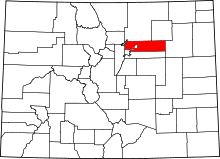 | |
| Towns | ||
| CDPs | ||
| Unincorporated communities | ||
| Footnotes | ‡This populated place also has portions in an adjacent county or counties | |
Municipalities and communities of Jefferson County, Colorado, United States | ||
|---|---|---|
| Cities | 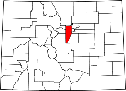 | |
| Towns | ||
| CDPs | ||
| Unincorporated communities | ||
| Ghost town | ||
| Footnotes | ‡This populated place also has portions in an adjacent county or counties | |
Mayors of cities with populations exceeding 100,000 in Colorado | ||
|---|---|---|
| ||
Places adjacent to Westminster, Colorado | ||||||||||
|---|---|---|---|---|---|---|---|---|---|---|
| ||||||||||