Morgantown, Indiana
| Morgantown, Indiana | |
|---|---|
| Town | |
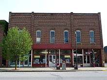
 Morgantown Town Hall | |
| Nickname(s): Motown | |
 Location of Morgantown in Morgan County, Indiana. | |
| Coordinates: 39°22′25″N 86°15′38″W / 39.37361°N 86.26056°WCoordinates: 39°22′25″N 86°15′38″W / 39.37361°N 86.26056°W | |
| Country | United States |
| State | Indiana |
| County | Morgan |
| Township | Jackson |
| Area[1] | |
| • Total | 0.38 sq mi (0.98 km2) |
| • Land | 0.38 sq mi (0.98 km2) |
| • Water | 0.00 sq mi (0.00 km2) |
| Elevation[2] | 679 ft (207 m) |
| Population (2010)[3] | |
| • Total | 986 |
| • Estimate (2016)[4] | 986 |
| • Density | 2,608.47/sq mi (1,007.63/km2) |
| Time zone | UTC-5 (Eastern (EST)) |
| • Summer (DST) | UTC-4 (EDT) |
| ZIP code | 46160 |
| Area code(s) | 765 |
| FIPS code | 18-51102[5] |
| GNIS feature ID | 439438 |
| Website | http://morgantownindiana.org/ |
Morgantown is a town in Jackson Township, Morgan County, in the U.S. state of Indiana.[6] The population was 986 at the 2010 census.
History
Morgantown was founded by Robert Bowles and Samuel Teeters, who first laid out 52 lots in the month of March, 1831.[7] A post office has been in operation at Morgantown since 1833.[8]
The Morgantown Historic District was listed on the National Register of Historic Places in 2006.[9]
Geography
Morgantown is located at 39°22′25″N 86°15′38″W / 39.37361°N 86.26056°W (39.373646, -86.260610).[10]
According to the 2010 census, Morgantown has a total area of 0.38 square miles (0.98 km2), all land.[11]
Demographics
| Historical population | |||
|---|---|---|---|
| Census | Pop. | %± | |
| 1850 | 230 | — | |
| 1880 | 509 | — | |
| 1910 | 667 | — | |
| 1920 | 831 | 24.6% | |
| 1930 | 748 | −10.0% | |
| 1940 | 724 | −3.2% | |
| 1950 | 838 | 15.7% | |
| 1960 | 971 | 15.9% | |
| 1970 | 1,134 | 16.8% | |
| 1980 | 897 | −20.9% | |
| 1990 | 978 | 9.0% | |
| 2000 | 964 | −1.4% | |
| 2010 | 986 | 2.3% | |
| Est. 2016 | 986 | [4] | 0.0% |
| U.S. Decennial Census[12] | |||
2010 census
As of the census[3] of 2010, there were 986 people, 374 households, and 236 families residing in the town. The population density was 2,594.7 inhabitants per square mile (1,001.8/km2). There were 418 housing units at an average density of 1,100.0 per square mile (424.7/km2). The racial makeup of the town was 98.5% White, 0.1% African American, 0.4% Native American, 0.2% Asian, 0.3% from other races, and 0.5% from two or more races. Hispanic or Latino of any race were 0.4% of the population.
There were 374 households of which 36.1% had children under the age of 18 living with them, 43.3% were married couples living together, 15.0% had a female householder with no husband present, 4.8% had a male householder with no wife present, and 36.9% were non-families. 31.0% of all households were made up of individuals and 13.6% had someone living alone who was 65 years of age or older. The average household size was 2.54 and the average family size was 3.18.
The median age in the town was 37.9 years. 26.5% of residents were under the age of 18; 7.7% were between the ages of 18 and 24; 26.3% were from 25 to 44; 23.5% were from 45 to 64; and 16.1% were 65 years of age or older. The gender makeup of the town was 47.6% male and 52.4% female.
2000 census
As of the census[5] of 2000, there were 964 people, 366 households, and 259 families residing in the town. The population density was 2,521.6 people per square mile (979.5/km²). There were 394 housing units at an average density of 1,030.6 per square mile (400.3/km²). The racial makeup of the town was 99.17% White, 0.31% African American, 0.31% Native American, 0.10% from other races, and 0.10% from two or more races. Hispanic or Latino of any race were 0.62% of the population.
There were 366 households out of which 34.4% had children under the age of 18 living with them, 57.4% were married couples living together, 10.9% had a female householder with no husband present, and 29.2% were non-families. 26.2% of all households were made up of individuals and 13.4% had someone living alone who was 65 years of age or older. The average household size was 2.51 and the average family size was 3.05.
In the town, the population was spread out with 25.6% under the age of 18, 7.7% from 18 to 24, 29.1% from 25 to 44, 20.6% from 45 to 64, and 16.9% who were 65 years of age or older. The median age was 35 years. For every 100 females, there were 86.5 males. For every 100 females age 18 and over, there were 80.2 males.
The median income for a household in the town was $33,158, and the median income for a family was $45,385. Males had a median income of $31,066 versus $23,068 for females. The per capita income for the town was $17,504. About 2.2% of families and 8.3% of the population were below the poverty line, including 2.6% of those under age 18 and 31.3% of those age 65 or over.
Education
Morgantown has a public library, a branch of the Morgan County Public Library.[13]
References
- ↑ "2016 U.S. Gazetteer Files". United States Census Bureau. Retrieved Jul 28, 2017.
- ↑ "US Board on Geographic Names". United States Geological Survey. 2007-10-25. Retrieved 2008-01-31.
- 1 2 "American FactFinder". United States Census Bureau. Retrieved 2012-12-11.
- 1 2 "Population and Housing Unit Estimates". Retrieved June 9, 2017.
- 1 2 "American FactFinder". United States Census Bureau. Retrieved 2008-01-31.
- ↑ "Morgantown, Indiana". Geographic Names Information System. United States Geological Survey. Retrieved 2017-05-08.
- ↑ Blanchard, Charles (1884). Counties of Morgan, Monroe and Brown, Indiana: Historical and Biographical. F.A. Battey & Company. p. 115.
- ↑ "Morgan County". Jim Forte Postal History. Retrieved 8 September 2015.
- ↑ National Park Service (2010-07-09). "National Register Information System". National Register of Historic Places. National Park Service.
- ↑ "US Gazetteer files: 2010, 2000, and 1990". United States Census Bureau. 2011-02-12. Retrieved 2011-04-23.
- ↑ "G001 - Geographic Identifiers - 2010 Census Summary File 1". United States Census Bureau. Retrieved 2015-07-17.
- ↑ "Census of Population and Housing". Census.gov. Retrieved June 4, 2015.
- ↑ "Contact". Morgan County Public Library. Retrieved 10 March 2018.
External links
| Wikimedia Commons has media related to Morgantown, Indiana. |
Municipalities and communities of Morgan County, Indiana, United States | ||
|---|---|---|
| City | ||
| Towns | ||
| Townships | ||
| CDP | ||
| Other unincorporated communities |
| |
| Footnotes | ‡This populated place also has portions in an adjacent county or counties | |
.jpg)