Danville, Indiana
| Danville, Indiana | |
|---|---|
| Town | |
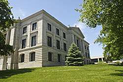 Hendricks County Courthouse in Danville | |
| Motto(s): "A Great Place to Spend an Hour or a Lifetime"[1] | |
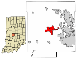 Location of Danville in Hendricks County, Indiana. | |
| Coordinates: 39°45′39″N 86°31′4″W / 39.76083°N 86.51778°WCoordinates: 39°45′39″N 86°31′4″W / 39.76083°N 86.51778°W | |
| Country | United States |
| State | Indiana |
| County | Hendricks |
| Township | Center |
| Area[2] | |
| • Total | 6.98 sq mi (18.07 km2) |
| • Land | 6.93 sq mi (17.95 km2) |
| • Water | 0.05 sq mi (0.12 km2) |
| Elevation | 951 ft (290 m) |
| Population (2010)[3] | |
| • Total | 9,001 |
| • Estimate (2016)[4] | 9,676 |
| • Density | 1,396.25/sq mi (539.09/km2) |
| Time zone | UTC-5 (EST) |
| • Summer (DST) | UTC-4 (EDT) |
| ZIP code | 46122 |
| Area code(s) | 317 |
| FIPS code | 18-16804[5] |
| GNIS feature ID | 0433314[6] |
| Website |
www |
Danville is a town in Center Township, Hendricks County, Indiana, United States. The population was 9,001 at the 2010 census,[7] up from 6,418 at the 2000 census. By 2016 the estimated population was 9,676.[4] The town is the county seat of Hendricks County.[8]
History
Danville was founded in 1824,[1] and its post office one year later.[9] Danville was incorporated as a town in 1835.[10]
The Ora Adams House, Leander Campbell House, Danville Courthouse Square Historic District, Danville Main Street Historic District, Dr. Jeremiah and Ann Jane DePew House, Hendricks County Jail and Sheriff's Residence, Twin Bridges, and Wilson-Courtney House are listed on the National Register of Historic Places.[11][12]
Geography
Danville is located at the center of Hendricks County at 39°45′39″N 86°31′4″W / 39.76083°N 86.51778°W (39.760736, −86.517798).[13] U.S. Route 36 is the town's Main Street, leading east 20 miles (32 km) to downtown Indianapolis and west 131 miles (211 km) to Decatur, Illinois. Indiana State Road 39 joins US-36 briefly in the center of town but leads north 9 miles (14 km) to Lizton and Interstate 74, and south 11 miles (18 km) to Center Valley and Interstate 70.
According to the 2010 census, Danville has a total area of 6.98 square miles (18.08 km2), of which 6.93 square miles (17.95 km2) (or 99.28%) is land and 0.05 square miles (0.13 km2) (or 0.72%) is water.[14] The West Fork of White Lick Creek, a tributary of the White River, flows north-to-south through the eastern side of the town.
Airport
- 2R2 - Hendricks County Airport
Demographics
| Historical population | |||
|---|---|---|---|
| Census | Pop. | %± | |
| 1850 | 386 | — | |
| 1860 | 895 | 131.9% | |
| 1870 | 1,040 | 16.2% | |
| 1880 | 1,598 | 53.7% | |
| 1890 | 1,569 | −1.8% | |
| 1900 | 1,802 | 14.9% | |
| 1910 | 1,640 | −9.0% | |
| 1920 | 1,729 | 5.4% | |
| 1930 | 1,930 | 11.6% | |
| 1940 | 2,093 | 8.4% | |
| 1950 | 2,802 | 33.9% | |
| 1960 | 3,287 | 17.3% | |
| 1970 | 3,771 | 14.7% | |
| 1980 | 4,220 | 11.9% | |
| 1990 | 4,345 | 3.0% | |
| 2000 | 6,418 | 47.7% | |
| 2010 | 9,001 | 40.2% | |
| Est. 2016 | 9,676 | [4] | 7.5% |
| U.S. Decennial Census[15] | |||
2010 census
As of the census[3] of 2010, there were 9,001 people, 3,344 households, and 2,398 families residing in the town. The population density was 1,298.8 inhabitants per square mile (501.5/km2). There were 3,589 housing units at an average density of 517.9 per square mile (200.0/km2). The racial makeup of the town was 96.8% White, 0.8% African American, 0.2% Native American, 0.4% Asian, 0.4% from other races, and 1.4% from two or more races. Hispanic or Latino of any race were 1.8% of the population.
There were 3,344 households of which 41.2% had children under the age of 18 living with them, 55.4% were married couples living together, 11.9% had a female householder with no husband present, 4.3% had a male householder with no wife present, and 28.3% were non-families. 23.0% of all households were made up of individuals and 10.1% had someone living alone who was 65 years of age or older. The average household size was 2.66 and the average family size was 3.14.
The median age in the town was 34.3 years. 29.3% of residents were under the age of 18; 7.6% were between the ages of 18 and 24; 28% were from 25 to 44; 23.3% were from 45 to 64; and 11.6% were 65 years of age or older. The gender makeup of the town was 48.5% male and 51.5% female.
2000 census
As of the census[5] of 2000, there were 8,032 people, 2,350 households, and 1,670 families residing in the town. The population density was 1,047.7 people per square mile (404.2/km²). There were 2,506 housing units at an average density of 409.1 per square mile (157.8/km²). The racial makeup of the town was 98.38% White, 0.34% African American, 0.22% Native American, 0.26% Asian, 0.02% Pacific Islander, 0.11% from other races, and 0.67% from two or more races. Hispanic or Latino of any race were 1.06% of the population.
There were 2,350 households out of which 37.6% had children under the age of 18 living with them, 58.7% were married couples living together, 8.7% had a female householder with no husband present, and 28.9% were non-families. 25.1% of all households were made up of individuals and 12.5% had someone living alone who was 65 years of age or older. The average household size was 2.58 and the average family size was 3.11.
In the town, the population was spread out with 27.6% under the age of 18, 8.4% from 18 to 24, 30.3% from 25 to 44, 20.0% from 45 to 64, and 13.8% who were 65 years of age or older. The median age was 35 years. For every 100 females there were 98.3 males. For every 100 females age 18 and over, there were 95.0 males.
The median income for a household in the town was $54,330, and the median income for a family was $62,813. Males had a median income of $40,724 versus $26,678 for females. The per capita income for the town was $22,209. About 2.1% of families and 2.5% of the population were below the poverty line, including 1.3% of those under age 18 and 7.7% of those age 65 or over.
Arts and culture
Museums and other points of interest
The Hendricks County Historical Museum is located in the former Sheriff's Residence and Jail at 170 South Washington in Danville. The building was erected in 1866 and served as the county jail until 1974. The two-story brick structure, listed on the National Register of Historic Places, is the only surviving example of the Second Empire style of architecture in the county. This style was popular after the American Civil War and has as defining elements a central tower and mansard roof. The Museum's collection includes items relating to domestic life, agriculture, military history, education and other aspects of our county's heritage. It also includes items relating to the history of Indiana Central Normal College (later Canterbury College), which was located in Danville from 1878 until 1951.[16]
Education
Danville Community School Corporation, the school district which serves Danville, operates Danville Community High School, a secondary school (grades 9 through 12) located just off of U.S. Route 36. The mascot of Danville Community Schools is a Warrior in American Indian clothing. The school colors are crimson and gray. Other facilities operated by the school corporation are
- Danville Middle School
- South Elementary School
- North Elementary School
- Opportunity House
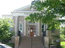
The town has a lending library, the Danville-Center Township Public Library.[17]
Notable people
- Travis Steele - Current head coach of the Xavier Musketeers men's basketball team
- John Cravens, Registrar of Indiana University 1895-1936; raised in Danville and graduated from Central Indiana Normal College in Danville[18][19]
- Bob Snyder, musician known for playing tenor sax, alto sax, clarinet, and flute; born in Danville[20]
- Sam Thompson, 19th Century Major League Baseball player born in Danville[21]
See also
- Holistic Image VIII, public artwork in front of the Town Hall
Neighboring communities
Places adjacent to Danville, Indiana | ||||||||||
|---|---|---|---|---|---|---|---|---|---|---|
| ||||||||||
References
- 1 2 "Town of Danville Indiana". Town of Danville Indiana. Retrieved September 25, 2012.
- ↑ "2016 U.S. Gazetteer Files". United States Census Bureau. Retrieved Jul 28, 2017.
- 1 2 "American FactFinder". United States Census Bureau. Retrieved 2012-12-11.
- 1 2 3 "Population and Housing Unit Estimates". Retrieved June 9, 2017.
- 1 2 "American FactFinder". United States Census Bureau. Archived from the original on September 11, 2013. Retrieved 2008-01-31.
- ↑ "US Board on Geographic Names". United States Geological Survey. 2007-10-25. Retrieved 2008-01-31.
- ↑ "Geographic Identifiers: 2010 Demographic Profile Data (G001): Danville town, Indiana". American Factfinder. U.S. Census Bureau. Retrieved June 20, 2017.
- ↑ "Find a County". National Association of Counties. Archived from the original on May 31, 2011. Retrieved 2011-06-07.
- ↑ "Hendricks County". Jim Forte Postal History. Retrieved January 8, 2017.
- ↑ Hadley, John Vestal (1914). History of Hendricks County, Indiana: Her People, Industries and Institutions. B.F. Bowen. p. 51.
- ↑ National Park Service (2010-07-09). "National Register Information System". National Register of Historic Places. National Park Service.
- ↑ "National Register of Historic Places Listings". Weekly List of Actions Taken on Properties: 12/27/10 through 12/30/10. National Park Service. 2011-01-07.
- ↑ "US Gazetteer files: 2010, 2000, and 1990". United States Census Bureau. 2011-02-12. Retrieved 2011-04-23.
- ↑ "G001 - Geographic Identifiers - 2010 Census Summary File 1". United States Census Bureau. Retrieved 2015-07-16.
- ↑ "Census of Population and Housing". Census.gov. Archived from the original on May 12, 2015. Retrieved June 4, 2015.
- ↑ hendrickscountyhistoricalmuseum.org
- ↑ "Indiana public library directory" (PDF). Indiana State Library. Retrieved 7 March 2018.
- ↑ "Cravens family papers, 1891-1972, bulk 1920-1922". Archives Online at Indiana University. Retrieved September 25, 2012.
- ↑ "John Cravens: A Hoosier Ideal". Collinsites. Retrieved February 28, 2013.
- ↑ "ALUMNI HALL OF FAME INDUCTEES". Danville Community School Corporation. Archived from the original on April 16, 2014. Retrieved September 25, 2012.
- ↑ "Thompson, Sam". National Baseball Hall of Fame. Retrieved September 25, 2012.
External links
| Wikimedia Commons has media related to Danville, Indiana. |
- Town of Danville official website
- Leadership Hendricks County
- Danville Community School Corporation
- Hendricks County Convention and Visitors Bureau
- City-Data.com, statistical data
Municipalities and communities of Hendricks County, Indiana, United States | ||
|---|---|---|
| Towns | ||
| Townships | ||
| Unincorporated communities | ||
| Footnotes | ‡This populated place also has portions in an adjacent county or counties | |
.jpg)