Missouri statistical areas

The statistical areas of the United States of America comprise the metropolitan statistical areas (MSAs),[1] the micropolitan statistical areas (μSAs),[2] and the combined statistical areas (CSAs)[3] currently defined by the United States Office of Management and Budget (OMB).

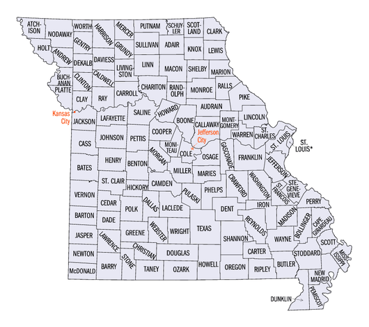
Most recently on December 1, 2009, the Office of Management and Budget defined 1067 statistical areas for the United States,[4] including 3 combined statistical areas, 8 metropolitan statistical areas, and 20 micropolitan statistical areas in the State of Missouri. The table below shows the recent population of these statistical areas, the 114 counties, and the 1 independent city of Missouri.

An enlargeable map of the 114 counties and 1 independent city of the State of Missouri

Table

The table below describes the 31 United States statistical areas, 114 counties, and 1 independent city of the State of Missouri with the following information:[5]

  1. The combined statistical area (CSA) as designated by the OMB.[4]
  2. The CSA population as of July 1, 2016, as estimated by the United States Census Bureau. [6]
  3. The core based statistical area (CBSA)[7] as designated by the OMB.[4]
  4. The CBSA population as of July 1, 2016, as estimated by the United States Census Bureau. [8]
  5. The county or independent city.[9]
  6. The county or independent city population as of July 1, 2016, as estimated by the United States Census Bureau.[9]
The 31 United States statistical areas, 114 counties, and 1 independent city of the State of Missouri

Combined Statistical Area 2016 Population Core Based Statistical Area 2016 Population County 2016 Population
St. Louis-St. Charles-Farmington, MO-IL CSA 2,882,932 St. Louis, MO-IL MSA 2,817,355 St. Louis County, Missouri 998,692
St. Charles County, Missouri 365,151
St. Louis City 318,069
St. Clair County, Illinois 270,259
Madison County, Illinois 268,459
Jefferson County, Missouri 219,480
Franklin County, Missouri 101,938
Lincoln County, Missouri 53,076
Macoupin County, Illinois 47,687
Clinton County, Illinois 37,956
Monroe County, Illinois 33,306
Warren County, Missouri 32,515
Washington County, Missouri 25,076
Jersey County, Illinois 22,916
Bond County, Illinois 17,727
Calhoun County, Illinois 5,048
Farmington, MO μSA 65,577 St. Francois County, Missouri 65,577
Kansas City-Overland Park-Kansas City, MO-KS CSA 2,122,908 Kansas City, MO-KS MSA 2,056,676 Jackson County, Missouri 676,360
Johnson County, Kansas 552,991
Clay County, Missouri 225,161
Wyandotte County, Kansas 158,224
Cass County, Missouri 100,052
Platte County, Missouri 90,903
Leavenworth County, Kansas 77,176
Lafayette County, Missouri 33,209
Miami County, Kansas 32,715
Franklin County, Kansas 25,931
Ray County, Missouri 23,230
Clinton County, Missouri 20,789
Bates County, Missouri 17,008
Linn County, Kansas 9,612
Caldwell County, Missouri 9,315
Warrensburg, MO μSA 53,439 Johnson County, Missouri 53,439
Atchison, KS μSA 16,793 Atchison County, Kansas 16,793
none Fayetteville-Springdale-Rogers, AR-MO MSA 473,830 Benton County, Arkansas 227,556
Washington County, Arkansas 207,521
McDonald County, Missouri 22,977
Madison County, Arkansas `15,776
Springfield, MO MSA 440,142 Greene County, Missouri 277,214
Christian County, Missouri 78,570
Webster County, Missouri 36,439
Polk County, Missouri 31,170
Dallas County, Missouri 16,749
Joplin, MO MSA 176,849 Jasper County, Missouri 118,435
Newton County, Missouri 58,414
Columbia, MO MSA 175,831 Boone County, Missouri 165,627
Howard County, Missouri 10,204
Jefferson City, MO MSA 150,480 Cole County, Missouri 76,448
Callaway County, Missouri 44,420
Moniteau County, Missouri 15,697
Osage County, Missouri 13,915
Cape Girardeau-Sikeston-Jackson, MO-IL CSA 136,160 Cape Girardeau-Jackson, MO-IL μSA 97,024 Cape Girardeau County, Missouri 76,632
Bollinger County, Missouri 12,356
Alexander County, Illinois 8,036
Sikeston, MO μSA 39,136 Scott County, Missouri 39,136
none St. Joseph, MO-KS MSA 127,574 Buchanan County, Missouri 89,666
Andrew County, Missouri 17,196
DeKalb County, Missouri 12,767
Doniphan County, Kansas 7,945
Branson, MO μSA 84,999 Taney County, Missouri 52,736
Stone County, Missouri 32,263
Quincy, IL-MO μSA 77,314 Adams County, Illinois 67,159
Lewis County, Missouri 10,155
Fort Leonard Wood, MO μSA 53,175 Pulaski County, Missouri 53,175
Rolla, MO μSA 45,020 Phelps County, Missouri 45,020
Poplar Bluff, MO μSA 43,082 Butler County, Missouri 43,082
Fort Madison-Keokuk, IA-MO μSA 42,640 Lee County, Iowa 35,621
Clark County, Missouri 7,019
Sedalia, MO μSA 42,178 Pettis County, Missouri 42,178
West Plains, MO μSA 40,665 Howell County, Missouri 40,665
Hannibal, MO μSA 38,998 Marion County, Missouri 28,717
Ralls County, Missouri 10,281
Lebanon, MO μSA 35,636 Laclede County, Missouri 35,636
Kennett, MO μSA 31,974 Dunklin County, Missouri 31,974
Kirksville, MO μSA 29,933 Adair County, Missouri 25,552
Schuyler County, Missouri 4,381
Mexico, MO μSA 25,552 Audrain County, Missouri 25,552
Moberly, MO μSA 25,346 Randolph County, Missouri 25,723
Maryville, MO μSA 23,468 Nodaway County, Missouri 23,468
Marshall, MO μSA 23,280 Saline County, Missouri 23,280
none Camden County, Missouri 43,679
Lawrence County, Missouri 38,660
Barry County, Missouri 35,282
Stoddard County, Missouri 29,807
Miller County, Missouri 24,770
Texas County, Missouri 25,936
Crawford County, Missouri 24,800
Henry County, Missouri 22,219
Vernon County, Missouri 20,963
Morgan County, Missouri 20,502
Benton County, Missouri 19,115
Perry County, Missouri 19,041
New Madrid County, Missouri 18,783
Wright County, Missouri 18,716
Pike County, Missouri 18,572
Pemiscot County, Missouri 18,174
Ste. Genevieve County, Missouri 18,124
Cooper County, Missouri 17,663
Dent County, Missouri 15,676
Macon County, Missouri 15,591
Gasconade County, Missouri 15,168
Livingston County, Missouri 15,074
Mississippi County, Missouri 14,306
Ripley County, Missouri 14,143
Cedar County, Missouri 13,948
Douglas County, Missouri 13,548
Wayne County, Missouri 13,475
Linn County, Missouri 12,566
Barton County, Missouri 12,327
Montgomery County, Missouri 12,270
Madison County, Missouri 12,195
Oregon County, Missouri 11,017
Iron County, Missouri 10,656
Grundy County, Missouri 10,228
St. Clair County, Missouri 9,641
Hickory County, Missouri 9,628
Ozark County, Missouri 9,595
Carroll County, Missouri 9,260
Maries County, Missouri 9,171
Harrison County, Missouri 8,866
Monroe County, Missouri 8,734
Shannon County, Missouri 8,432
Daviess County, Missouri 8,313
Dade County, Missouri 7,807
Chariton County, Missouri 7,734
Gentry County, Missouri 6,786
Sullivan County, Missouri 6,659
Reynolds County, Missouri 6,588
Carter County, Missouri 6,365
Shelby County, Missouri 6,280
Atchison County, Missouri 5,569
Putnam County, Missouri 4,978
Scotland County, Missouri 4,828
Holt County, Missouri 4,814
Knox County, Missouri 4,126
Mercer County, Missouri 3,804
Worth County, Missouri 2,150
State of Missouri

See also

References

  1. The United States Office of Management and Budget (OMB) defines a metropolitan statistical area (MSA) as a core based statistical area having at least one urbanized area of 50,000 or more population, plus adjacent territory that has a high degree of social and economic integration with the core as measured by commuting ties.
  2. The United States Office of Management and Budget (OMB) defines a micropolitan statistical area (μSA) as a core based statistical area having at least one urban cluster of at least 10,000 but less than 50,000 population, plus adjacent territory that has a high degree of social and economic integration with the core as measured by commuting ties.
  3. The United States Office of Management and Budget (OMB) defines a combined statistical area (CSA) as an aggregate of adjacent core based statistical areas that are linked by commuting ties.
  4. 1 2 3 "OMB Bulletin No. 10-02: Update of Statistical Area Definitions and Guidance on Their Uses" (PDF). United States Office of Management and Budget. December 1, 2009. Archived from the original (PDF) on January 15, 2010. Retrieved August 8, 2012.
  5. An out-of-state area and its population are displayed in green. An area that extends into more than one state is displayed in teal. A teal population number over a black population number show the total population versus the in-state population.
  6. "Table 2. Annual Estimates of the Population of Combined Statistical Areas: April 1, 2010 to July 1, 2016" (CSV). 2011 Population Estimates. United States Census Bureau, Population Division. April 2012. Retrieved August 10, 2012.
  7. The United States Office of Management and Budget (OMB) defines a core based statistical area as one or more adjacent counties or county-equivalents having at least one urban cluster of at least 10,000 population, plus adjacent territory that has a high degree of social and economic integration with the core as measured by commuting ties. The core based statistical areas comprise the metropolitan statistical areas and the micropolitan statistical areas.
  8. "Table 1. Annual Estimates of the Population of Metropolitan and Micropolitan Statistical Areas: April 1, 2010 to July 1, 2016" (CSV). 2011 Population Estimates. United States Census Bureau, Population Division. April 2012. Retrieved August 10, 2012.
  9. 1 2 "Annual Estimates of the Resident Population for Counties and County-Equivalents: April 1, 2010 to July 1, 2016" (CSV). 2011 Population Estimates. United States Census Bureau, Population Division. April 2012. Retrieved August 10, 2012.
This article is issued from Wikipedia. The text is licensed under Creative Commons - Attribution - Sharealike. Additional terms may apply for the media files.