Crawford County, Pennsylvania
| Crawford County, Pennsylvania | ||
|---|---|---|
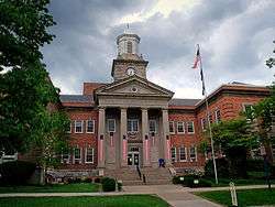 The Crawford County Courthouse in Meadville | ||
| ||
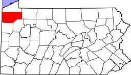 Location in the U.S. state of Pennsylvania | ||
 Pennsylvania's location in the U.S. | ||
| Founded | March 12, 1800 | |
| Named for | William Crawford | |
| Seat | Meadville | |
| Largest city | Meadville | |
| Area | ||
| • Total | 1,038 sq mi (2,688 km2) | |
| • Land | 1,012 sq mi (2,621 km2) | |
| • Water | 25 sq mi (65 km2), 2.4% | |
| Population (est.) | ||
| • (2015) | 86,484 | |
| • Density | 85/sq mi (33/km2) | |
| Congressional district | 3rd | |
| Time zone | Eastern: UTC−5/−4 | |
| Website |
www | |
|
Footnotes: | ||
| Designated | May 12, 1982[1] | |

Crawford County is a county located in the U.S. state of Pennsylvania. As of the 2010 census, the population was 88,765.[2] Its county seat is Meadville.[3] The county was created on March 12, 1800, from part of Allegheny County and named for Colonel William Crawford.[4]
Crawford County comprises the Meadville, PA Micropolitan Statistical Area, which is also included in the Erie-Meadville, PA Combined Statistical Area.
Geography
According to the U.S. Census Bureau, the county has a total area of 1,038 square miles (2,690 km2), of which 1,012 square miles (2,620 km2) is land and 25 square miles (65 km2) (2.4%) is water.[5]
Adjacent Counties
- Erie County (north)
- Warren County (east)
- Venango County (southeast)
- Mercer County (south)
- Trumbull County, Ohio (southwest)
- Ashtabula County, Ohio (west)
National protected area
State protected area
Major highways
Demographics
| Historical population | |||
|---|---|---|---|
| Census | Pop. | %± | |
| 1800 | 2,346 | — | |
| 1810 | 6,178 | 163.3% | |
| 1820 | 9,397 | 52.1% | |
| 1830 | 16,030 | 70.6% | |
| 1840 | 31,724 | 97.9% | |
| 1850 | 37,849 | 19.3% | |
| 1860 | 48,755 | 28.8% | |
| 1870 | 63,832 | 30.9% | |
| 1880 | 68,607 | 7.5% | |
| 1890 | 65,324 | −4.8% | |
| 1900 | 63,643 | −2.6% | |
| 1910 | 61,565 | −3.3% | |
| 1920 | 60,667 | −1.5% | |
| 1930 | 62,980 | 3.8% | |
| 1940 | 71,644 | 13.8% | |
| 1950 | 78,948 | 10.2% | |
| 1960 | 77,956 | −1.3% | |
| 1970 | 81,342 | 4.3% | |
| 1980 | 88,869 | 9.3% | |
| 1990 | 86,169 | −3.0% | |
| 2000 | 90,367 | 4.9% | |
| 2010 | 88,765 | −1.8% | |
| Est. 2016 | 86,257 | [6] | −2.8% |
| U.S. Decennial Census[7] 1790-1960[8] 1900-1990[9] 1990-2000[10] 2010-2013[2] | |||
As of the 2000 census, there were 90,366 people, 34,678 households, and 23,858 families residing in the county.[11] The population density was 89 people per square mile (34/km²). There were 42,416 housing units at an average density of 42 per square mile (16/km²). The racial makeup of the county was 97.00% White, 1.59% Black or African American, 0.20% Native American, 0.28% Asian, 0.03% Pacific Islander, 0.13% from other races, and 0.77% from two or more races. 0.59% of the population were Hispanic or Latino of any race. 26.7% were of German, 11.7% American, 11.3% Irish, 10.8% English, 7.6% Italian and 5.4% Polish ancestry according to Census 2000.
There were 34,678 households out of which 30.40% had children under the age of 18 living with them, 55.60% were married couples living together, 9.20% had a female householder with no husband present, and 31.20% were non-families. 26.20% of all households were made up of individuals and 11.60% had someone living alone who was 65 years of age or older. The average household size was 2.50 and the average family size was 3.01.
In the county, the population was spread out with 24.70% under the age of 18, 9.20% from 18 to 24, 26.60% from 25 to 44, 23.90% from 45 to 64, and 15.60% who were 65 years of age or older. The median age was 38 years. For every 100 females there were 94.80 males. For every 100 females age 18 and over, there were 90.80 males.
Micropolitan Statistical Area
The United States Office of Management and Budget[12] has designated Crawford County as the Meadville, PA Micropolitan Statistical Area (µSA). As of the 2010 U.S. Census[13] the micropolitan area ranked 5th most populous in the State of Pennsylvania and the 52nd most populous in the United States with a population of 88,765. Crawford County is also a part of the Erie-Meadville, PA Combined Statistical Area (CSA), which combines the population of both Crawford County and the Erie County areas. The Combined Statistical Area ranked 7th in the State of Pennsylvania and 102nd most populous in the United States with a population of 369,331.
Government
| Year | Republican | Democratic | Third Parties |
|---|---|---|---|
| 2016 | 66.1% 24,987 | 29.0% 10,971 | 4.9% 1,855 |
| 2012 | 58.8% 20,901 | 39.0% 13,883 | 2.2% 791 |
| 2008 | 54.2% 20,750 | 43.8% 16,780 | 2.0% 777 |
| 2004 | 57.3% 21,965 | 41.8% 16,013 | 0.9% 344 |
| 2000 | 56.6% 18,858 | 39.8% 13,250 | 3.7% 1,220 |
| 1996 | 46.6% 14,659 | 41.2% 12,943 | 12.2% 3,844 |
| 1992 | 40.8% 14,112 | 37.0% 12,813 | 22.3% 7,703 |
| 1988 | 56.3% 17,249 | 42.5% 13,021 | 1.2% 358 |
| 1984 | 60.8% 20,181 | 38.5% 12,792 | 0.7% 222 |
| 1980 | 53.6% 16,552 | 38.1% 11,778 | 8.4% 2,579 |
| 1976 | 50.0% 15,301 | 48.1% 14,712 | 2.0% 597 |
| 1972 | 64.4% 18,393 | 32.8% 9,371 | 2.8% 805 |
| 1968 | 53.1% 14,991 | 40.2% 11,345 | 6.7% 1,890 |
| 1964 | 36.8% 10,664 | 62.8% 18,212 | 0.4% 115 |
| 1960 | 60.7% 18,754 | 39.0% 12,050 | 0.3% 102 |
| 1956 | 66.7% 18,887 | 33.0% 9,346 | 0.4% 104 |
| 1952 | 65.5% 19,079 | 33.9% 9,874 | 0.6% 181 |
| 1948 | 60.7% 14,161 | 39.3% 9,174 | |
| 1944 | 61.8% 15,205 | 37.5% 9,216 | 0.7% 170 |
| 1940 | 60.6% 15,891 | 38.9% 10,197 | 0.5% 125 |
| 1936 | 51.3% 14,463 | 45.4% 12,788 | 3.3% 938 |
| 1932 | 51.7% 10,918 | 44.4% 9,382 | 3.8% 811 |
| 1928 | 71.2% 17,072 | 28.0% 6,718 | 0.8% 199 |
| 1924 | 63.1% 10,918 | 17.2% 2,969 | 19.8% 3,418 |
| 1920 | 62.3% 10,032 | 25.9% 4,175 | 11.8% 1,892 |
| 1916 | 44.2% 5,487 | 46.8% 5,814 | 9.0% 1,119 |
| 1912 | 20.6% 2,497 | 32.2% 3,908 | 47.3% 5,742 |
| 1908 | 52.6% 7,679 | 38.8% 5,668 | 8.6% 1,258 |
| 1904 | 59.0% 7,450 | 28.9% 3,645 | 12.1% 1,525 |
| 1900 | 50.0% 7,705 | 45.4% 7,000 | 4.6% 713 |
| 1896 | 47.3% 7,851 | 50.5% 8,383 | 2.3% 377 |
| 1892 | 47.3% 7,152 | 40.8% 6,166 | 11.9% 1,804 |
| 1888 | 53.6% 8,040 | 39.8% 5,964 | 6.7% 999 |
County Commissioners
Other county officials
- Anthony J. Vardaro, President Judge of the Courts of Common Pleas
- John F. Spataro, Judge of the Courts of Common Pleas
- Mark Stevens, Judge of the Courts of Common Pleas
- Kathleen Roae (R), Auditor
- Diana Perry (R), Auditor
- Christopher Seeley (D), Auditor
- Patricia Wetherbee (R), Clerk of Courts
- Scott Schell (R), Coroner
- Francis Schultz (R), District Attorney
- David Kennedy (R), Jury Commissioner
- Samantha Staab (D), Jury Commissioner
- Emmy Arnett (R), Prothonotary
- Deborah Curry (R), Register of Wills/Recorder of Deeds
- Walter "Nick" Hoke (R), Sheriff
- Christine Krzysiak (R), Treasurer
Pennsylvania Senate
| District | Senator | Party |
|---|---|---|
| 50 | Michele Brooks | Republican |
Pennsylvania House of Representatives
| District | Representative | Party |
|---|---|---|
| 6 | Brad Roae | Republican |
| 17 | Parke Wentling | Republican |
| 65 | Kathy Rapp | Republican |
United States House of Representatives
| District | Representative | Party |
|---|---|---|
| 3 | Mike Kelly | Republican |
United States Senate
| Senator | Party |
|---|---|
| Pat Toomey | Republican |
| Bob Casey | Democrat |
Education
Colleges and universities
- Allegheny College, located in Meadville
- University of Pittsburgh at Titusville, a branch campus of the University of Pittsburgh, located in Titusville
Community, junior and technical colleges
- Precision Manufacturing Institute (PMI)[15]
Laurel Technical Institute (LTI)
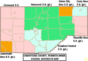
Public school districts
Communities
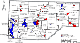
Under Pennsylvania law, there are four types of incorporated municipalities: cities, boroughs, townships, and, in at most two cases, towns. The following cities, boroughs and townships are located in Crawford County:
Cities
- Meadville (county seat)
- Titusville
Boroughs
Townships
- Athens
- Beaver
- Bloomfield
- Cambridge
- Conneaut
- Cussewago
- East Fairfield
- East Fallowfield
- East Mead
- Fairfield
- Greenwood
- Hayfield
- North Shenango
- Oil Creek
- Pine
- Randolph
- Richmond
- Rockdale
- Rome
- Sadsbury
- South Shenango
- Sparta
- Spring
- Steuben
- Summerhill
- Summit
- Troy
- Union
- Venango
- Vernon
- Wayne
- West Fallowfield
- West Mead
- West Shenango
- Woodcock
Census-designated places
Census-designated places are geographical areas designated by the U.S. Census Bureau for the purposes of compiling demographic data. They are not actual jurisdictions under Pennsylvania law.
Unincorporated communities
Population ranking
The population ranking of the following table is based on the 2010 census of Crawford County.[13]
† county seat
| Rank | City/Town/etc. | Municipal type | Population (2010 Census) |
|---|---|---|---|
| 1 | † Meadville | City | 13,388 |
| 2 | Titusville | City | 5,601 |
| 3 | Cambridge Springs | Borough | 2,595 |
| 4 | Conneaut Lakeshore | CDP | 2,395 |
| 5 | Pymatuning Central | CDP | 2,269 |
| 6 | Cochranton | Borough | 1,136 |
| 7 | Linesville | Borough | 1,040 |
| 8 | Saegertown | Borough | 997 |
| 9 | Conneautville | Borough | 774 |
| 10 | Fredericksburg | CDP | 733 |
| 11 | Conneaut Lake | Borough | 653 |
| 12 | Hydetown | Borough | 526 |
| 13 | Canadohta Lake | CDP | 516 |
| 14 | Pymatuning South | CDP | 479 |
| 15 | Springboro | Borough | 477 |
| 16 | Harmonsburg | CDP | 401 |
| 17 | Blooming Valley | Borough | 337 |
| 18 | Townville | Borough | 323 |
| 19 | Pymatuning North | CDP | 311 |
| T-20 | Spartansburg | Borough | 305 |
| T-20 | Kerrtown | CDP | 305 |
| 21 | Venango | Borough | 239 |
| 22 | Centerville | Borough | 218 |
| 23 | Hartstown | CDP | 201 |
| 24 | Woodcock | Borough | 157 |
| 25 | Guys Mills | CDP | 124 |
| 26 | Geneva | CDP | 109 |
| 27 | Lincolnville | CDP | 96 |
| 28 | Atlantic | CDP | 77 |
| 29 | Riceville | CDP | 68 |
| 30 | Adamsville | CDP | 67 |
See also
References
- ↑ "PHMC Historical Markers Search" (Searchable database). Pennsylvania Historical and Museum Commission. Commonwealth of Pennsylvania. Retrieved 2014-01-25.
- 1 2 "State & County QuickFacts". United States Census Bureau. Retrieved November 16, 2013.
- ↑ "Find a County". National Association of Counties. Archived from the original on 2011-05-31. Retrieved 2011-06-07.
- ↑ Gannett, Henry (1905). The Origin of Certain Place Names in the United States. Govt. Print. Off. p. 95.
- ↑ "2010 Census Gazetteer Files". United States Census Bureau. August 22, 2012. Retrieved March 6, 2015.
- ↑ "Population and Housing Unit Estimates". Retrieved June 9, 2017.
- ↑ "U.S. Decennial Census". United States Census Bureau. Archived from the original on May 12, 2015. Retrieved March 6, 2015.
- ↑ "Historical Census Browser". University of Virginia Library. Retrieved March 6, 2015.
- ↑ Forstall, Richard L., ed. (March 24, 1995). "Population of Counties by Decennial Census: 1900 to 1990". United States Census Bureau. Retrieved March 6, 2015.
- ↑ "Census 2000 PHC-T-4. Ranking Tables for Counties: 1990 and 2000" (PDF). United States Census Bureau. April 2, 2001. Retrieved March 6, 2015.
- ↑ "American FactFinder". United States Census Bureau. Archived from the original on 2013-09-11. Retrieved 2008-01-31.
- ↑ "Office of Management and Budget". whitehouse.gov.
- 1 2 "Archived copy". Archived from the original on 2013-12-21. Retrieved 2015-12-29.
- ↑ Leip, David. "Dave Leip's Atlas of U.S. Presidential Elections". uselectionatlas.org.
- ↑ "Precision Manufacturing Institute (PMI)". Retrieved 2007-04-07.
External links
| Wikimedia Commons has media related to Crawford County, Pennsylvania. |
- Crawford County Official Website
- Crawford County Historical Society
- History of Townships in Crawford County, PA
- Crawford County's Historic Bridges
- Crawford County Convention and Visitors Bureau