Baao, Camarines Sur
| Baao | |
|---|---|
| Municipality | |
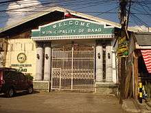
| Municipality of Baao | |
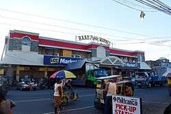 Baao Centro | |
 Map of Camarines Sur with Baao highlighted | |
.svg.png) Baao Location within the Philippines | |
| Coordinates: 13°27′22″N 123°21′50″E / 13.4561°N 123.3639°ECoordinates: 13°27′22″N 123°21′50″E / 13.4561°N 123.3639°E | |
| Country |
|
| Region | Bicol Region (Region V) |
| Province | Camarines Sur |
| District | 5th District |
| Founded | 1590 |
| Barangays | 30 (see Barangays) |
| Government [1] | |
| • Type | Sangguniang Bayan |
| • Mayor | Jeffrey Sinfuego Besinio |
| • Electorate | 28,239 voters (2016) |
| Area [2] | |
| • Total | 106.63 km2 (41.17 sq mi) |
| Population (2015 census)[3] | |
| • Total | 58,849 |
| • Density | 550/km2 (1,400/sq mi) |
| Time zone | UTC+8 (PST) |
| ZIP code | 4432 |
| PSGC | 051701000 |
| IDD : area code | +63 (0)54 |
| Climate type | Tropical rainforest climate |
| Income class | 3rd municipal income class |
| Revenue (₱) | 125,728,789.60 (2016)[4] |
| Poverty incidence | 26.83 (2012)[5] |
| Native languages |
Rinconada Bikol Central Bikol Tagalog |
Baao, (Rinconada Bikol: Banwāan ka Baao; Tagalog: Bayan ng Baao), officially the Municipality of Baao, is a 3rd class municipality in the province of Camarines Sur, Philippines. According to the 2015 census, it has a population of 58,849 people.[3]
The municipality of Baao is within the 5th Congressional District of the province of Camarines Sur. The town is bounded on the north by the municipalities of Pili and Ocampo, on the east by the city of Iriga, on the west by Bula and south by the municipality Nabua. The town is approximately 480 kilometres (300 mi) south-east of Metro Manila, 30 kilometres (19 mi) south of Naga City, 7.5 kilometres (4.7 mi) west of Iriga City, and 70 kilometres (43 mi) north of Legazpi City.
Barangays
Baao is politically subdivided into 30 barangays.
- Agdangan Pob. (San Cayetano)
- Antipolo
- Bagumbayan
- Cristo Rey
- Del Pilar
- Del Rosario (Poblacion)
- Iyagan
- La Medalla
- Caranday (La Purisima)
- Lourdes
- Nababarera
- Sagrada
- Salvacion
- San Antonio (Buluang)
- San Francisco (Poblacion)
- San Isidro (Oras)
- San Jose (Poblacion)
- San Juan
- San Nicolas (Poblacion)
- San Rafael (Ikpan)
- Pugay (San Rafael/San Jose)
- San Ramon (Poblacion)
- San Roque (Poblacion)
- San Vicente
- Santa Cruz (Poblacion)
- Santa Eulalia
- Santa Isabel
- Santa Teresa (Vega)
- Santa Teresita (Tara-tara)
- Tapol
Demographics
| Population census of Baao | ||
|---|---|---|
| Year | Pop. | ±% p.a. |
| 1903 | 7,871 | — |
| 1918 | 8,727 | +0.69% |
| 1939 | 11,950 | +1.51% |
| 1948 | 16,485 | +3.64% |
| 1960 | 22,724 | +2.71% |
| 1970 | 28,285 | +2.21% |
| 1975 | 30,219 | +1.34% |
| 1980 | 33,896 | +2.32% |
| 1990 | 39,040 | +1.42% |
| 1995 | 41,366 | +1.09% |
| 2000 | 46,693 | +2.63% |
| 2007 | 52,466 | +1.62% |
| 2010 | 54,971 | +1.71% |
| 2015 | 58,849 | +1.31% |
| Source: Philippine Statistics Authority[3] [6] [7] [8] | ||
In the 2015 census, the population of Baao, Camarines Sur, was 58,849 people,[3] with a density of 550 inhabitants per square kilometre or 1,400 inhabitants per square mile.
Language
Rinconada Bikol is the main language of the population. Baaoeños used the Baao variant, a lowland dialect (sinaranəw) of Rinconada Bikol which is different of that in Iriga.
Tagalog and English are also spoken in formal gatherings and occasions. The latter is widely used in schools as well as in business transactions.
Religion
As one of the historical towns of Catholicism in the Bicol region, Baao has a majority of Roman Catholic adherents. Iglesia Ni Cristo on the other hand is the second largest group with a very fast phase of growing membership. Islam has already set off in the town and they are composed of Muslim merchants/immigrants from Mindanao. Various Protestants religions are also present.
Climate
| Climate data for Baao, Camarines Sur | |||||||||||||
|---|---|---|---|---|---|---|---|---|---|---|---|---|---|
| Month | Jan | Feb | Mar | Apr | May | Jun | Jul | Aug | Sep | Oct | Nov | Dec | Year |
| Average high °C (°F) | 33 (91) |
32 (90) |
35 (95) |
37 (99) |
37 (99) |
36 (97) |
35 (95) |
33 (91) |
35 (95) |
34 (93) |
33 (91) |
32 (90) |
34 (94) |
| Average low °C (°F) | 26 (79) |
26 (79) |
28 (82) |
30 (86) |
31 (88) |
31 (88) |
29 (84) |
28 (82) |
29 (84) |
28 (82) |
28 (82) |
27 (81) |
28 (83) |
| Average precipitation mm (inches) | 51.03 (2.0091) |
78.13 (3.076) |
55.3 (2.177) |
83.07 (3.2705) |
159.34 (6.2732) |
239.88 (9.4441) |
385.80 (15.189) |
391.75 (15.4232) |
293.65 (11.561) |
401.33 (15.8004) |
108.2 (4.26) |
334.9 (13.185) |
2,582.38 (101.6685) |
| Average rainy days | 21 | 24 | 19 | 20 | 25 | 29 | 31 | 29 | 29 | 29 | 27 | 30 | 313 |
| Source: World Weather Online[9] | |||||||||||||
Economy
Transportation
Accessible only by land transportation, it is along the main route of the Maharlika Highway and the Philippine National Railways. Commuter rail services are provided by PNR serving from Naga City as its terminus and stops at Baao Station up to Ligao City in Albay then back again northward to Naga. Yet rail service to Manila is currently suspended due severe damages brought by Typhoon Reming in 2006. However, this is overtaken by bus companies that serve daily intercity trips. From Naga City, the easiest way to go to Baao is to ride a bus going to Iriga City from the Naga City Central Bus Terminal and disembark at Baao bus stop.
Fiestas and festivals
The town fiesta (Feast of St. Bartolomew) or "Pintakasi" of Baao is celebrated from August 23 to 25. The only festival at Baao is the Barlin Festival; it commemorates the birthday of the First Filipino Bishop, Jorge I. Barlin. It is celebrated annually during the month of April.
Education
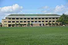
Baao Community College the lone state school offering tertiary courses for college students.
St. Monica Academy is a private catholic school run by Augustinian sisters. It offers both elementary and secondary quality education with the purpose of creating graduates not only of high caliber but also with hearts that are "in one" with the poor.
Rosary School Inc. (formerly Rosary Learning Center) is a private educational institution offering complete preschool, elementary and secondary courses.
Ave Maria Early Childhood Impressions Center is a private catholic school for toddlers and pre-schoolers ages 2 yrs. old and above.
Other schools include:
- Agdangan High School
- Baao Central School
- Baao High School
- Baao West Central School
- Eusebia Paz Arroyo Memorial High School
- Nonito Paz Arroyo Memorial High School
Notable people
- Jorge Barlin y Imperial (1850-1909), First native Filipino bishop.
- Fr. Joaquin G. Bernas, S.J., J.S.D. Lawyer, Jesuit priest, constitutional law scholar, writer and newspaper columnist.
- Luis Dato writer, poet and educator
- Joker P. Arroyo, Filipino lawyer, politician and Senator of the Republic of the Philippines.
- Beatriz Saw, Pinoy Big Brother Season 2 Big Winner, actress
References
- ↑ "Municipality". Quezon City, Philippines: Department of the Interior and Local Government. Retrieved 31 May 2013.
- ↑ "Province: Camarines Sur". PSGC Interactive. Quezon City, Philippines: Philippine Statistics Authority. Retrieved 12 November 2016.
- 1 2 3 4 Census of Population (2015). "Region V (Bicol Region)". Total Population by Province, City, Municipality and Barangay. PSA. Retrieved 20 June 2016.
- ↑ "Camarines Sur : Cities and Municipalities Competitiveness Index". Makati City, Philippines: National Competitiveness Council (Philippines). Retrieved 29 October 2017.
- ↑ "PSA Releases the 2012 Municipal and City Level Poverty Estimates". Quezon City, Philippines: Philippine Statistics Authority. Archived from the original on 28 January 2017. Retrieved 28 January 2017.
- ↑ Census of Population and Housing (2010). "Region V (Bicol Region)". Total Population by Province, City, Municipality and Barangay. NSO. Retrieved 29 June 2016.
- ↑ Censuses of Population (1903–2007). "Region V (Bicol Region)". Table 1. Population Enumerated in Various Censuses by Province/Highly Urbanized City: 1903 to 2007. NSO.
- ↑ "Province of Camarines Sur". Municipality Population Data. Local Water Utilities Administration Research Division. Retrieved 17 December 2016.
- ↑ "Baao, Camarines Sur: Average Temperatures and Rainfall". World Weather Online. Retrieved 29 October 2017.
External links
| Wikimedia Commons has media related to Baao, Camarines Sur. |
Pili (capital) | |
| Municipalities | |
| Component city | |
| Independent component city |
|