Oas, Albay
| Oas | |
|---|---|
| Municipality | |
| Municipality of Oas | |
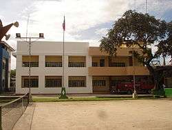 Municipal Hall | |
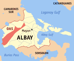 Map of Albay with Oas highlighted | |
.svg.png) Oas Location within the Philippines | |
| Coordinates: 13°15′32″N 123°29′43″E / 13.2589°N 123.4953°ECoordinates: 13°15′32″N 123°29′43″E / 13.2589°N 123.4953°E | |
| Country |
|
| Region | Bicol Region (Region V) |
| Province | Albay |
| District | 3rd district |
| Barangays | 53 (see Barangays) |
| Government [1] | |
| • Type | Sangguniang Bayan |
| • Mayor | Domingo Red Escoto Jr. |
| • Electorate | 35,027 voters (2016) |
| Area [2] | |
| • Total | 263.61 km2 (101.78 sq mi) |
| Population (2015 census)[3] | |
| • Total | 67,960 |
| • Density | 260/km2 (670/sq mi) |
| Time zone | UTC+8 (PST) |
| ZIP code | 4504 |
| PSGC | 050512000 |
| IDD : area code | +63 (0)52 |
| Climate type | Tropical rainforest climate |
| Income class | 1st municipal income class |
| Revenue (₱) | 153,032,324.79 (2016) |
| Native languages |
Albay Bikol language Tagalog |
| Website |
elgu2 |
Oas, officially the Municipality of Oas, (Central Bicolano: Banwaan kan Oas; Filipino: Bayan ng Oas), is a 1st class municipality in the province of Albay, Philippines. According to the 2015 census, it has a population of 67,960 people.[3]
History
Oas was founded during the early Spanish colonization of the Bicol Peninsula. In 1605, Father Baltazar de los Reyes converted 12 leading natives of the area to Christianity in one day, forming the foundation of the community now known as Oas.
There are three stories that tell the origin of the name of Oas:
- There is a dam across the narrowest portion of a local river. This dam solely irrigates the vast fields of the place including those of the nearby town of Libon and results in a good harvest. People are wary of any cracks or leaks on the dam walls during months of heavy rains. A crier would shout "nawaswas" giving the call to the people (in times of this kind of emergency) for immediate action in groups. From then on, the natives coined this name to the place and later shortened it to present form.
- Early Spanish Colonizers reaching this particular section of the Bicol Peninsula asked the name of the place from the about 600 natives living there, "Como se llama este sitio?" with gesture of their hands. The natives mistakenly thought the question to be "Onan kading lugar kadi, maiwas?" (What place is this, it's very big?) in their native dialect. In response, the natives answered, "Si, señores. Labi nikading iwas. Labi nikading iwas." (Yes, sirs, this is grand and spacious). From then on the early Spanish colonizers adopted in their official census the existence of "a rich fertile valley with verdant fields of grain" which is the little town of Oas in Bicol.
Geography
Oas is located at 13°15′32″N 123°29′43″E / 13.2589°N 123.4953°E.
According to the Philippine Statistics Authority, the municipality has a land area of 263.61 square kilometres (101.78 sq mi) [2] constituting 10.23% of the 2,575.77-square-kilometre- (994.51 sq mi) total area of Albay.
Barangays
Oas is politically subdivided into 53 barangays.[4]
| PSGC | Barangay | Population | ±% p.a. | |||
|---|---|---|---|---|---|---|
| 2015[3] | 2010[5] | |||||
| 050512001 | Badbad | 0.9% | 602 | 583 | 0.61% | |
| 050512002 | Badian | 3.9% | 2,681 | 2,348 | 2.56% | |
| 050512003 | Bagsa | 1.3% | 862 | 764 | 2.32% | |
| 050512004 | Bagumbayan | 1.3% | 879 | 1,018 | −2.76% | |
| 050512005 | Balogo | 6.2% | 4,236 | 3,897 | 1.60% | |
| 050512008 | Banao | 0.7% | 470 | 562 | −3.35% | |
| 050512009 | Bangiawon | 1.3% | 910 | 785 | 2.85% | |
| 050512011 | Bogtong | 0.5% | 367 | 351 | 0.85% | |
| 050512010 | Bongoran | 2.7% | 1,816 | 1,741 | 0.81% | |
| 050512012 | Busac | 3.1% | 2,079 | 1,939 | 1.34% | |
| 050512013 | Cadawag | 0.7% | 485 | 427 | 2.45% | |
| 050512014 | Cagmanaba | 4.9% | 3,305 | 3,039 | 1.61% | |
| 050512015 | Calaguimit | 1.3% | 867 | 865 | 0.04% | |
| 050512016 | Calpi | 2.0% | 1,335 | 1,224 | 1.67% | |
| 050512017 | Calzada | 1.3% | 911 | 1,029 | −2.29% | |
| 050512018 | Camagong | 1.7% | 1,167 | 1,146 | 0.35% | |
| 050512019 | Casinagan | 0.9% | 617 | 530 | 2.94% | |
| 050512020 | Centro Poblacion | 0.3% | 225 | 277 | −3.88% | |
| 050512021 | Coliat | 1.1% | 723 | 717 | 0.16% | |
| 050512022 | Del Rosario | 1.1% | 733 | 624 | 3.11% | |
| 050512023 | Gumabao | 1.2% | 793 | 865 | −1.64% | |
| 050512024 | Ilaor Norte | 2.2% | 1,495 | 1,525 | −0.38% | |
| 050512025 | Ilaor Sur | 3.2% | 2,202 | 2,275 | −0.62% | |
| 050512026 | Iraya Norte | 2.9% | 1,982 | 1,909 | 0.72% | |
| 050512027 | Iraya Sur | 1.1% | 774 | 711 | 1.63% | |
| 050512028 | Manga | 3.4% | 2,322 | 2,146 | 1.51% | |
| 050512029 | Maporong | 1.7% | 1,184 | 1,107 | 1.29% | |
| 050512030 | Maramba | 4.9% | 3,301 | 3,114 | 1.12% | |
| 050512032 | Matambo | 0.7% | 489 | 435 | 2.25% | |
| 050512033 | Mayag | 0.7% | 452 | 507 | −2.16% | |
| 050512034 | Mayao | 2.4% | 1,618 | 1,514 | 1.27% | |
| 050512031 | Moroponros | 0.5% | 357 | 283 | 4.52% | |
| 050512035 | Nagas | 2.4% | 1,631 | 1,665 | −0.39% | |
| 050512037 | Obaliw-Rinas | 2.2% | 1,504 | 1,401 | 1.36% | |
| 050512038 | Pistola | 1.7% | 1,135 | 1,101 | 0.58% | |
| 050512039 | Ramay | 1.1% | 734 | 724 | 0.26% | |
| 050512040 | Rizal | 1.3% | 864 | 892 | −0.61% | |
| 050512041 | Saban | 2.8% | 1,908 | 1,875 | 0.33% | |
| 050512042 | San Agustin | 1.9% | 1,285 | 1,240 | 0.68% | |
| 050512043 | San Antonio | 1.4% | 939 | 938 | 0.02% | |
| 050512044 | San Isidro | 2.2% | 1,529 | 1,400 | 1.69% | |
| 050512045 | San Jose | 1.1% | 744 | 759 | −0.38% | |
| 050512046 | San Juan | 2.2% | 1,503 | 1,390 | 1.50% | |
| 050512047 | San Miguel | 1.1% | 772 | 792 | −0.49% | |
| 050512036 | San Pascual (Nale) | 1.2% | 841 | 743 | 2.39% | |
| 050512049 | San Ramon | 2.5% | 1,710 | 1,657 | 0.60% | |
| 050512050 | San Vicente (Suca) | 1.4% | 938 | 1,046 | −2.05% | |
| 050512056 | Tablon | 1.4% | 940 | 903 | 0.77% | |
| 050512051 | Talisay | 1.1% | 779 | 693 | 2.25% | |
| 050512052 | Talongog | 1.8% | 1,192 | 1,144 | 0.79% | |
| 050512053 | Tapel | 2.7% | 1,813 | 1,371 | 5.46% | |
| 050512054 | Tobgon | 2.4% | 1,648 | 1,517 | 1.59% | |
| 050512055 | Tobog | 1.9% | 1,312 | 1,277 | 0.52% | |
| Total | 67,960 | 64,785 | 0.92% | |||
Demographics
| Population census of Oas | ||
|---|---|---|
| Year | Pop. | ±% p.a. |
| 1903 | 11,393 | — |
| 1918 | 16,488 | +2.49% |
| 1939 | 23,131 | +1.63% |
| 1948 | 27,824 | +2.07% |
| 1960 | 36,095 | +2.19% |
| 1970 | 47,952 | +2.88% |
| 1975 | 50,293 | +0.96% |
| 1980 | 52,269 | +0.77% |
| 1990 | 53,061 | +0.15% |
| 1995 | 56,536 | +1.20% |
| 2000 | 62,063 | +2.02% |
| 2007 | 63,888 | +0.40% |
| 2010 | 64,785 | +0.51% |
| 2015 | 67,960 | +0.92% |
| Source: Philippine Statistics Authority[3][5][6][7] | ||
In the 2015 census, Oas had a population of 67,960.[3] The population density was 260 inhabitants per square kilometre (670/sq mi).
Government
Sangguniang Bayan
- Vice Mayor: Antonio B. Yuchongco
- Members Councilor
- Renee R. Raro
- Gader B. Rellama
- Robert N. Arevalo
- Cholita R. Redillas
- Leopoldo R. Zaragoza
- Gregorio P. Comboy
- Delbert Butch R. Vicera
- Raymundo T. Raquid
- Jose Gregorio R. Ricarte (Liga ng Barangay President)
References
- ↑ "Municipality". Quezon City, Philippines: Department of the Interior and Local Government. Retrieved 31 May 2013.
- 1 2 "Province: Albay". PSGC Interactive. Quezon City, Philippines: Philippine Statistics Authority. Retrieved 12 November 2016.
- 1 2 3 4 5 Census of Population (2015). "Region V (Bicol Region)". Total Population by Province, City, Municipality and Barangay. PSA. Retrieved 20 June 2016.
- ↑ "Municipal: Oas, Albay". PSGC Interactive. Quezon City, Philippines: Philippine Statistics Authority. Retrieved 8 January 2016.
- 1 2 Census of Population and Housing (2010). "Region V (Bicol Region)". Total Population by Province, City, Municipality and Barangay. NSO. Retrieved 29 June 2016.
- ↑ Censuses of Population (1903–2007). "Region V (Bicol Region)". Table 1. Population Enumerated in Various Censuses by Province/Highly Urbanized City: 1903 to 2007. NSO.
- ↑ "Province of Albay". Municipality Population Data. Local Water Utilities Administration Research Division. Retrieved 17 December 2016.
External links
Places adjacent to Oas, Albay | ||||||||||
|---|---|---|---|---|---|---|---|---|---|---|
| ||||||||||