Batuan, Masbate
| Batuan | |
|---|---|
| Municipality | |
| Municipality of Batuan | |
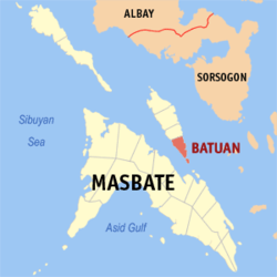 Map of Masbate with Batuan highlighted | |
.svg.png) Batuan Location within the Philippines | |
| Coordinates: 12°25′N 123°46′E / 12.42°N 123.77°ECoordinates: 12°25′N 123°46′E / 12.42°N 123.77°E | |
| Country |
|
| Region | Bicol Region (Region V) |
| Province | Masbate |
| District | 1st district |
| Founded | 1951 |
| Barangays | 14 (see Barangays) |
| Government [1] | |
| • Type | Sangguniang Bayan |
| • Mayor | Charlie D. Yuson III |
| • Electorate | 8,388 voters (2016) |
| Area [2] | |
| • Total | 56.28 km2 (21.73 sq mi) |
| Population (2015 census)[3] | |
| • Total | 15,086 |
| • Density | 270/km2 (690/sq mi) |
| Time zone | UTC+8 (PST) |
| ZIP code | 5415 |
| PSGC | 054104000 |
| IDD : area code | +63 (0)56 |
| Climate type | Tropical rainforest climate |
| Income class | 5th municipal income class |
| Revenue (₱) | 51,686,651.84 (2016) |
| Native languages |
Masbateño language Tagalog |
Batuan, officially the Municipality of Batuan, is a 5th class municipality in the province of Masbate, Philippines. According to the 2015 census, it has a population of 15,086 people.[3]
It is located at the southern point of Ticao Island. It is the smallest municipality in Masbate, both in land area and population.
In 1951, the barrios of Batuan, Burgos, Gibraltar, Costa Rica, Panisihan, and Matabao were separated from San Fernando to form the Municipality of Batuan.[4]
The municipality is home to the Bongsanglay Natural Park.
Barangays
Batuan is politically subdivided into 14 barangays. [2]
- Burgos
- Cañares
- Canvañez
- Costa Rica
- Danao
- Gibraltar
- Mabuhay
- Matabao
- Nasandig
- Panisihan
- Poblacion
- Rizal
- Royroy
- Sawang
Demographics
| Population census of Batuan | |||||||||||||||||||||||||||||||||||||
|---|---|---|---|---|---|---|---|---|---|---|---|---|---|---|---|---|---|---|---|---|---|---|---|---|---|---|---|---|---|---|---|---|---|---|---|---|---|
|
| ||||||||||||||||||||||||||||||||||||
| Source: Philippine Statistics Authority[3] [5] [6] [7] | |||||||||||||||||||||||||||||||||||||
In the 2015 census, the population of Batuan, Masbate, was 15,086 people,[3] with a density of 270 inhabitants per square kilometre or 700 inhabitants per square mile.
Archaeological and Ecological Landscape and Seascape of Ticao
The municipality is part of Ticao island, which is known as an archaeological landscape, possessing thousands of pre-colonial artifacts such as the Baybayin-inscribed Rizal Stone, Ticao gold spike teeth, Burial jars of varrying designs and sizes, jade beads, human face rock statues, and the Ticao petrographs.Much of the homes in Ticao island use these archaeological finds to design their interiors. The island is also an ecological frontier for the conservation of manta rays. The island also possesses a 'rare subspecies' of Visayan warty pig, that is almost near extinction.
References
- ↑ "Municipality". Quezon City, Philippines: Department of the Interior and Local Government. Retrieved 31 May 2013.
- 1 2 "Province: Masbate". PSGC Interactive. Quezon City, Philippines: Philippine Statistics Authority. Retrieved 12 November 2016.
- 1 2 3 4 Census of Population (2015). "Region V (Bicol Region)". Total Population by Province, City, Municipality and Barangay. PSA. Retrieved 20 June 2016.
- ↑ "An Act Creating the Municipality of Batuan in the Province of Masbate". LawPH.com. Retrieved 2011-04-09.
- ↑ Census of Population and Housing (2010). "Region V (Bicol Region)". Total Population by Province, City, Municipality and Barangay. NSO. Retrieved 29 June 2016.
- ↑ Censuses of Population (1903–2007). "Region V (Bicol Region)". Table 1. Population Enumerated in Various Censuses by Province/Highly Urbanized City: 1903 to 2007. NSO.
- ↑ "Province of Masbate". Municipality Population Data. Local Water Utilities Administration Research Division. Retrieved 17 December 2016.
External links
- Philippine Standard Geographic Code
- Philippine Census Information
- Local Governance Performance Management System
Places adjacent to Batuan, Masbate | ||||||||||
|---|---|---|---|---|---|---|---|---|---|---|
| ||||||||||
Masbate City (capital) | |
| Municipalities | |
| Component city | |