Lupi, Camarines Sur
| Lupi | ||
|---|---|---|
| Municipality | ||
| Municipality of Lupi | ||
| ||
 Map of Camarines Sur with Lupi highlighted | ||
.svg.png) Lupi Location within the Philippines | ||
| Coordinates: 13°49′N 122°54′E / 13.82°N 122.9°ECoordinates: 13°49′N 122°54′E / 13.82°N 122.9°E | ||
| Country |
| |
| Region | Bicol Region (Region V) | |
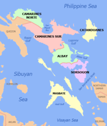
| Province | Camarines Sur | |
| District | 1st district | |
| Founded | 1726 | |
| Barangays | 38 (see Barangays) | |
| Government [1] | ||
| • Type | Sangguniang Bayan | |
| • Mayor | Bobby Matamorosa | |
| • Vice Mayor | Josie Acero | |
| • Electorate | 16,653 voters (2016) | |
| Area [2] | ||
| • Total | 199.12 km2 (76.88 sq mi) | |
| Population (2015 census)[3] | ||
| • Total | 32,167 | |
| • Density | 160/km2 (420/sq mi) | |
| Time zone | UTC+8 (PST) | |
| ZIP code | 4409 | |
| PSGC | 051719000 | |
| IDD : area code | +63 (0)54 | |
| Climate type | Tropical rainforest climate | |
| Income class | 3rd municipal income class | |
| Revenue (₱) | 96,679,570.13 (2016) | |
| Poverty incidence | 36.97 (2012)[4] | |
| Native languages |
Central Bikol Manide Tagalog | |

Lupi, officially the Municipality of Lupi, is a 3rd class municipality in the province of Camarines Sur, Philippines. According to the 2015 census, it has a population of 32,167 people.[3]
History
Lupi, in the first district of the province, was branded as a "travelling poblacion" as it had been transferred several times when it was a small settlement during Spanish rule. On 17 October 1726, however, the Spanish government under the administration of Governor General Marquéz de Torrecampo who was also the titular head of the Diocese of Caceres, issued a decree making Lupi a separate town.
Barangays
Lupi is politically subdivided into 38 barangays.
- Alleomar
- Bagangan Sr.
- Bagong Sikat
- Bel-Cruz
- Bangon
- Barrera Jr.
- Barrera Sr.
- Belwang
- Buenasuerte
- Bulawan Jr.
- Bulawan Sr.
- Cabutagan
- Casay
- Colacling (Del Rosario)
- Cristo Rey
- Del Carmen
- Haguimit
- Halubán (Pigbasagan)
- Kaibigan
- La Purísima
- Lourdes
- Mangcawayan
- Napolidan
- Población
- Polantuna
- Sagrada
- Salvación
- San Isidro
- San José
- San Pedro
- San Rafael Norte
- San Rafael Sur
- San Ramon
- San Vicente
- Sooc
- Tanawán
- Tible
- Tapi (Lupi Nuevo)
Demographics
| Population census of Lupi | ||
|---|---|---|
| Year | Pop. | ±% p.a. |
| 1903 | 1,307 | — |
| 1918 | 1,515 | +0.99% |
| 1939 | 3,455 | +4.00% |
| 1948 | 6,513 | +7.30% |
| 1960 | 16,981 | +8.31% |
| 1970 | 18,419 | +0.82% |
| 1975 | 19,682 | +1.34% |
| 1980 | 21,216 | +1.51% |
| 1990 | 24,809 | +1.58% |
| 1995 | 25,390 | +0.43% |
| 2000 | 26,148 | +0.63% |
| 2007 | 27,630 | +0.76% |
| 2010 | 30,118 | +3.19% |
| 2015 | 32,167 | +1.26% |
| Source: Philippine Statistics Authority[3][5][6][7] | ||
In the 2015 census, the population of Lupi, Camarines Sur, was 32,167 people,[3] with a density of 160 inhabitants per square kilometre or 410 inhabitants per square mile.
Climate
| Climate data for Lupi, Camarines Sur | |||||||||||||
|---|---|---|---|---|---|---|---|---|---|---|---|---|---|
| Month | Jan | Feb | Mar | Apr | May | Jun | Jul | Aug | Sep | Oct | Nov | Dec | Year |
| Average high °C (°F) | 33 (91) |
32 (90) |
35 (95) |
37 (99) |
38 (100) |
36 (97) |
35 (95) |
33 (91) |
35 (95) |
34 (93) |
33 (91) |
32 (90) |
34 (94) |
| Average low °C (°F) | 27 (81) |
27 (81) |
29 (84) |
31 (88) |
32 (90) |
32 (90) |
31 (88) |
29 (84) |
30 (86) |
29 (84) |
28 (82) |
28 (82) |
29 (85) |
| Average precipitation mm (inches) | 36.66 (1.4433) |
58.6 (2.307) |
37.91 (1.4925) |
76.31 (3.0043) |
98.34 (3.8717) |
151.99 (5.9839) |
288.39 (11.3539) |
291.41 (11.4728) |
186.77 (7.3531) |
363.21 (14.2996) |
97.5 (3.839) |
292.1 (11.5) |
1,979.19 (77.9211) |
| Average rainy days | 18 | 23 | 16 | 17 | 25 | 28 | 31 | 26 | 27 | 29 | 24 | 29 | 293 |
| Source: World Weather Online[8] | |||||||||||||
References
- ↑ "Municipality". Quezon City, Philippines: Department of the Interior and Local Government. Retrieved 31 May 2013.
- ↑ "Province: Camarines Sur". PSGC Interactive. Quezon City, Philippines: Philippine Statistics Authority. Retrieved 12 November 2016.
- 1 2 3 4 Census of Population (2015). "Region V (Bicol Region)". Total Population by Province, City, Municipality and Barangay. PSA. Retrieved 20 June 2016.
- ↑ "PSA Releases the 2012 Municipal and City Level Poverty Estimates". Quezon City, Philippines: Philippine Statistics Authority. Archived from the original on 28 January 2017. Retrieved 28 January 2017.
- ↑ Census of Population and Housing (2010). "Region V (Bicol Region)". Total Population by Province, City, Municipality and Barangay. NSO. Retrieved 29 June 2016.
- ↑ Censuses of Population (1903–2007). "Region V (Bicol Region)". Table 1. Population Enumerated in Various Censuses by Province/Highly Urbanized City: 1903 to 2007. NSO.
- ↑ "Province of Camarines Sur". Municipality Population Data. Local Water Utilities Administration Research Division. Retrieved 17 December 2016.
- ↑ "Lupi, Camarines Sur: Average Temperatures and Rainfall". World Weather Online. Retrieved 29 October 2017.
External links
- Philippine Standard Geographic Code
- Official Site of the Province of Camarines Sur
- Philippine Census Information
Places adjacent to Lupi, Camarines Sur | |
|---|---|
Pili (capital) | |
| Municipalities | |
| Component city | |
| Independent component city |
|