Bacacay, Albay
| Bacacay | |
|---|---|
| Municipality | |
| Municipality of Bacacay | |
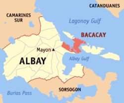 Map of Albay with Bacacay highlighted | |
.svg.png) Bacacay Location within the Philippines | |
| Coordinates: 13°18′N 123°48′E / 13.3°N 123.8°ECoordinates: 13°18′N 123°48′E / 13.3°N 123.8°E | |
| Country |
|
| Region | Bicol Region (Region V) |
| Province | Albay |
| District | 1st district |
| Barangays | 56 (see Barangays) |
| Government [1] | |
| • Type | Sangguniang Bayan |
| • Mayor | Dinky Romano |
| • Electorate | 43,625 voters (2016) |
| Area [2] | |
| • Total | 122.13 km2 (47.15 sq mi) |
| Population (2015 census)[3] | |
| • Total | 68,906 |
| • Density | 560/km2 (1,500/sq mi) |
| Time zone | UTC+8 (PST) |
| ZIP code | 4509 |
| PSGC | 050501000 |
| IDD : area code | +63 (0)52 |
| Climate type | Tropical rainforest climate |
| Income class | 2nd municipal income class |
| Revenue (₱) | 137,356,689.17 (2016) |
| Native languages |
Central Bikol Albay Bikol language Tagalog |
Bacacay, officially the Municipality of Bacacay, (Central Bicolano: Banwaan kan Bacacay; Filipino: Bayan ng Bacacay), is a 2nd class municipality in the province of Albay, Philippines. According to the 2015 census, it has a population of 68,906 people.[3]
Geography
Bacacay is located at 13°18′N 123°48′E / 13.3°N 123.8°E.
According to the Philippine Statistics Authority, the municipality has a land area of 122.13 square kilometres (47.15 sq mi) [2] constituting 4.74% of the 2,575.77-square-kilometre- (994.51 sq mi) total area of Albay.
Barangays
Bacacay is politically subdivided into 56 barangays.[4]
| PSGC | Barangay | Population | ±% p.a. | |||
|---|---|---|---|---|---|---|
| 2015[3] | 2010[5] | |||||
| 050501001 | Baclayon | 3.9% | 2,703 | 2,397 | 2.31% | |
| 050501002 | Banao | 2.2% | 1,491 | 1,379 | 1.50% | |
| 050501032 | Barangay 1 (Poblacion) | 1.9% | 1,308 | 1,078 | 3.75% | |
| 050501038 | Barangay 2 (Poblacion) | 0.4% | 285 | 282 | 0.20% | |
| 050501039 | Barangay 3 (Poblacion) | 0.8% | 545 | 543 | 0.07% | |
| 050501040 | Barangay 4 (Poblacion) | 0.4% | 274 | 277 | −0.21% | |
| 050501041 | Barangay 5 (Poblacion) | 0.4% | 276 | 279 | −0.21% | |
| 050501042 | Barangay 6 (Poblacion) | 0.4% | 248 | 266 | −1.33% | |
| 050501043 | Barangay 7 (Poblacion) | 0.4% | 267 | 262 | 0.36% | |
| 050501044 | Barangay 8 (Poblacion) | 0.2% | 147 | 122 | 3.61% | |
| 050501045 | Barangay 9 (Poblacion) | 0.9% | 646 | 631 | 0.45% | |
| 050501033 | Barangay 10 (Poblacion) | 1.1% | 773 | 652 | 3.29% | |
| 050501034 | Barangay 11 (Poblacion) | 0.3% | 197 | 194 | 0.29% | |
| 050501035 | Barangay 12 (Poblacion) | 0.4% | 298 | 305 | −0.44% | |
| 050501036 | Barangay 13 (Poblacion) | 1.9% | 1,315 | 1,249 | 0.99% | |
| 050501037 | Barangay 14 (Poblacion) | 1.8% | 1,237 | 1,176 | 0.97% | |
| 050501003 | Bariw | 0.9% | 625 | 601 | 0.75% | |
| 050501004 | Basud | 2.5% | 1,746 | 1,523 | 2.64% | |
| 050501005 | Bayandong | 2.4% | 1,650 | 1,615 | 0.41% | |
| 050501006 | Bonga (Upper) | 11.1% | 7,649 | 7,468 | 0.46% | |
| 050501008 | Buang | 1.9% | 1,337 | 1,267 | 1.03% | |
| 050501048 | Busdac (San Jose) | 1.7% | 1,182 | 1,082 | 1.70% | |
| 050501009 | Cabasan | 2.9% | 2,028 | 2,004 | 0.23% | |
| 050501010 | Cagbulacao | 1.3% | 862 | 842 | 0.45% | |
| 050501011 | Cagraray | 1.0% | 703 | 767 | −1.65% | |
| 050501012 | Cajogutan | 1.6% | 1,130 | 1,090 | 0.69% | |
| 050501013 | Cawayan | 1.8% | 1,247 | 1,116 | 2.14% | |
| 050501014 | Damacan | 0.6% | 431 | 466 | −1.48% | |
| 050501015 | Gubat Ilawod | 1.6% | 1,080 | 1,043 | 0.67% | |
| 050501016 | Gubat Iraya | 1.7% | 1,159 | 1,138 | 0.35% | |
| 050501017 | Hindi | 5.5% | 3,800 | 3,458 | 1.81% | |
| 050501018 | Igang | 3.4% | 2,332 | 2,128 | 1.76% | |
| 050501019 | Langaton | 1.1% | 765 | 757 | 0.20% | |
| 050501020 | Manaet | 1.2% | 836 | 764 | 1.73% | |
| 050501021 | Mapulang Daga | 0.7% | 453 | 529 | −2.91% | |
| 050501022 | Mataas | 0.8% | 518 | 478 | 1.54% | |
| 050501023 | Misibis | 1.5% | 1,007 | 934 | 1.44% | |
| 050501024 | Nahapunan | 0.6% | 402 | 406 | −0.19% | |
| 050501025 | Namanday | 2.2% | 1,482 | 1,440 | 0.55% | |
| 050501026 | Namantao | 1.1% | 778 | 901 | −2.76% | |
| 050501027 | Napao | 2.7% | 1,883 | 1,690 | 2.08% | |
| 050501028 | Panarayon | 2.7% | 1,848 | 1,658 | 2.09% | |
| 050501029 | Pigcobohan | 1.2% | 817 | 838 | −0.48% | |
| 050501030 | Pili Ilawod | 2.2% | 1,522 | 1,284 | 3.29% | |
| 050501031 | Pili Iraya | 1.4% | 997 | 924 | 1.46% | |
| 050501046 | Pongco (Lower Bonga) | 1.5% | 1,022 | 960 | 1.20% | |
| 050501049 | San Pablo | 1.8% | 1,274 | 1,240 | 0.52% | |
| 050501050 | San Pedro | 2.3% | 1,605 | 1,516 | 1.09% | |
| 050501051 | Sogod | 6.6% | 4,552 | 4,433 | 0.51% | |
| 050501052 | Sula | 1.3% | 873 | 960 | −1.79% | |
| 050501053 | Tambilagao (Tambognon) | 1.3% | 906 | 920 | −0.29% | |
| 050501054 | Tambongon (Tambilagao) | 1.2% | 795 | 748 | 1.17% | |
| 050501055 | Tanagan | 2.0% | 1,388 | 1,486 | −1.29% | |
| 050501056 | Uson | 0.9% | 644 | 625 | 0.57% | |
| 050501057 | Vinisitahan-Basud (Mainland) | 0.9% | 621 | 607 | 0.44% | |
| 050501058 | Vinisitahan-Napao (Island) | 1.4% | 947 | 926 | 0.43% | |
| Total | 68,906 | 65,724 | 0.90% | |||
Demographics
| Population census of Bacacay | ||
|---|---|---|
| Year | Pop. | ±% p.a. |
| 1903 | 14,214 | — |
| 1918 | 20,211 | +2.37% |
| 1939 | 23,863 | +0.79% |
| 1948 | 26,504 | +1.17% |
| 1960 | 29,181 | +0.80% |
| 1970 | 37,737 | +2.60% |
| 1975 | 40,130 | +1.24% |
| 1980 | 44,433 | +2.06% |
| 1990 | 49,202 | +1.02% |
| 1995 | 56,295 | +2.56% |
| 2000 | 58,357 | +0.77% |
| 2007 | 61,574 | +0.74% |
| 2010 | 65,724 | +2.40% |
| 2015 | 68,906 | +0.90% |
| Source: Philippine Statistics Authority[3] [5] [6] [7] | ||
In the 2015 census, Bacacay had a population of 68,906.[3] The population density was 560 inhabitants per square kilometre (1,500/sq mi).
Government
Mayors
- Dinky Romano (2016 – present)
- Tobias Betito (2010 – 2016)
- Gloria Berango (2001 – 2010)
- Eligio Berango (1992 – 2001)
- Berting Lawenko (1988 – 1992)
Tourism
Bacacay features caves and beaches, and is visited especially at summer. Beach resorts within the town include the Kuron-Kuron Beach Resort, Viento de Mar Beach Resort, VRT (Tanchuling) Beach Resort, Michaelangelus Beach Resort, and the Misibis Bay Resort.[9]
Education
Bacacay has 41 elementary schools and 7 secondary schools directly supervised by Department of Education-Division of Albay.[10]
Primary schools
- Bacacay East Central School
- Banao Elementary School
- Bariw Elementary School
- Basud Elementary School
- Bayandong Elementary School
- Bogna Elementary School
- Buang Elementary School
- Busdac Elementary School
- Cabasan Elementary School
- Cagbulacao Elementary School
- Cagraray Elementary School
- Cajugotan Elementary School
- Cawayan Elementary School
- Damacan Elementary School
- Gubat Elementary School
- Hindi Elementary School
- Igang Elementary School
- Langaton Elementary School
- Lower Bonga Elementary School
- Manaet Elementary School
- Mapulang Daga Elementary School
- Mataas Elementary School
- Misibis Elementary School
- Nahapunan Elementary School
- Namanday Elementary School
- Namantao Elementary School
- Napao Elementary School
- Panarayon Elementary School
- Pigcobuhan Elementary School
- Pili Elementary School
- San Pablo Elementary School
- San Pedro Elementary School
- Sogod Elementary School
- Sula Elementary School
- Tambilagao Elementary School
- Tambongon Elementary School
- Tanagan Elementary School
- Upper Bonga Elementary School
- Uson Elementary School
- Vinisitahan East Elementary School
- Vinisitahan South Elementary School
Secondary schools
- Bonga National High School
- Cabasan National High School
- Cawayan National High School
- Pili National High School
- San Pablo High School
- Sogod National High School
- Vinisitahan National High School
Colleges
References
- ↑ "Municipality". Quezon City, Philippines: Department of the Interior and Local Government. Retrieved 31 May 2013.
- 1 2 "Province: Albay". PSGC Interactive. Quezon City, Philippines: Philippine Statistics Authority. Retrieved 12 November 2016.
- 1 2 3 4 5 Census of Population (2015). "Region V (Bicol Region)". Total Population by Province, City, Municipality and Barangay. PSA. Retrieved 20 June 2016.
- ↑ "Municipal: Bacacay, Albay". PSGC Interactive. Quezon City, Philippines: Philippine Statistics Authority. Retrieved 8 January 2016.
- 1 2 Census of Population and Housing (2010). "Region V (Bicol Region)". Total Population by Province, City, Municipality and Barangay. NSO. Retrieved 29 June 2016.
- ↑ Censuses of Population (1903–2007). "Region V (Bicol Region)". Table 1. Population Enumerated in Various Censuses by Province/Highly Urbanized City: 1903 to 2007. NSO.
- ↑ "Province of Albay". Municipality Population Data. Local Water Utilities Administration Research Division. Retrieved 17 December 2016.
- ↑ http://www.deped.gov.ph
- ↑ http://www.misibisbay.com/
- ↑ "Checklist". Department of Education - Division of Albay. DepEd Albay ICT Team. 2011. Archived from the original on 2 November 2014. Retrieved 5 December 2016.
- ↑ "Zamora Memorial College - Educational Institutions"
External links
| Wikivoyage has a travel guide for Bacacay. |
Places adjacent to Bacacay, Albay | |
|---|---|