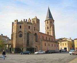
L'Isle-en-Dodon
| L'Isle-en-Dodon | ||
|---|---|---|
| Commune | ||
 | ||
| ||
 L'Isle-en-Dodon Location within Occitanie region  L'Isle-en-Dodon | ||
| Coordinates: 43°22′56″N 0°50′10″E / 43.3822°N 0.8361°ECoordinates: 43°22′56″N 0°50′10″E / 43.3822°N 0.8361°E | ||
| Country | France | |
| Region | Occitanie | |
| Department | Haute-Garonne | |
| Arrondissement | Saint-Gaudens | |
| Canton | Cazères | |
| Intercommunality | Portes du Comminges | |
| Government | ||
| • Mayor (2008–2014) | Jean-Louis Brousse | |
| Area1 | 22.58 km2 (8.72 sq mi) | |
| Population (2008)2 | 2,084 | |
| • Density | 92/km2 (240/sq mi) | |
| Time zone | UTC+1 (CET) | |
| • Summer (DST) | UTC+2 (CEST) | |
| INSEE/Postal code | 31239 /31230 | |
| Elevation |
187–326 m (614–1,070 ft) (avg. 200 m or 660 ft) | |
|
1 French Land Register data, which excludes lakes, ponds, glaciers > 1 km2 (0.386 sq mi or 247 acres) and river estuaries. 2 Population without double counting: residents of multiple communes (e.g., students and military personnel) only counted once. | ||
.svg.png)
L'Isle-en-Dodon is a commune in the Haute-Garonne department in southwestern France
Geography
L'Isle-en-Dodon is located on the Save river, at the northern end of the plate of Lannemezan. The slopes which surround the city point out the nearby gersois country.
Population
| Historical population | ||
|---|---|---|
| Year | Pop. | ±% |
| 1962 | 1,779 | — |
| 1968 | 2,046 | +15.0% |
| 1975 | 2,022 | −1.2% |
| 1982 | 2,039 | +0.8% |
| 1990 | 2,037 | −0.1% |
| 1999 | 1,905 | −6.5% |
| 2008 | 2,084 | +9.4% |
Transportation
L'Isle-en-Dodon is 60 kilometres from Toulouse by road, a journey which takes approximately an hour. A regular bus service runs three times a day to Toulouse. At Saint-Gaudens, 45 km (28 mi) to the south in the valley of the Garonne, the A64 autoroute and the SNCF train line pass.
See also
References
| Wikimedia Commons has media related to L'Isle-en-Dodon. |
This article is issued from
Wikipedia.
The text is licensed under Creative Commons - Attribution - Sharealike.
Additional terms may apply for the media files.