List of state highway spurs in Kansas
| Kansas state highway spurs | |
|---|---|
   Highway markers for K-22, K-131, and K-368 | |
| Highway names | |
| Interstates | Interstate nn (I-nn) |
| US Highways | U.S. Highway nn (US-nn) |
| State | K-nn |
| System links | |
| |
The Kansas state highway system includes and has included many state highway spurs that connect through highways with places that are not along a through highway. The Kansas Department of Transportation and its predecessor agencies have established most of these highways to serve small cities. In most cases, the spur highway connecting a through route with a city ends at the city limit of the city. The spur highways also serve unincorporated villages, state institutions like psychiatric hospitals, state parks and other Kansas Department of Wildlife, Parks and Tourism–administered facilities, and historic sites.
K-22
| |
|---|---|
| Location | Haddam |
| Length | 3.087 mi[1] (4.968 km) |
| Existed | 1941– |
K-22 is a 3.087-mile-long (4.968 km) spur route that serves the city of Haddam in west central Washington County.[1][2]
K-30
| |
|---|---|
| Location | Maple Hill |
| Length | 1.950 mi[1] (3.138 km) |
| Existed | 1950– |
K-30 is a 1.950-mile-long (3.138 km) spur route that serves the city of Maple Hill in northeastern Wabaunsee County.[1][2]
K-41
| |
|---|---|
| Location | Delphos |
| Length | 4.960 mi[1] (7.982 km) |
| Existed | 1938– |
K-41 is a 4.960-mile-long (7.982 km) spur route that serves the city of Delphos in north central Ottawa County.[1][2]
K-46
| |
|---|---|
| Location | Little River |
| Length | 1.315 mi[1] (2.116 km) |
| Existed | 1937–2013 |
K-46 was a 1.315-mile (2.116 km) north–south spur of US-56 that served the town of Little River. K-46 first appeared on the 1937 Kansas highway map.[3] It was removed from the highway system on June 3, 2013.[4]
K-67
| |
|---|---|
| Location | Norton |
| Length | 0.972 mi[1] (1.564 km) |
| Existed | 1938– |
K-67 is a 0.972-mile-long (1.564 km) spur route that serves the Kansas Department of Corrections Norton Correctional Facility east of Norton in central Norton County.[1][2] The highway begins at US-36 and K-383, which run concurrently east–west, and immediately has a grade crossing of the Kyle Railroad. K-67 passes along the east side of the state prison and crosses Prairie Dog Creek before reaching its northern terminus at the next section line road.[2] K-67 has existed since at least January 1938.[5] Before K-67 provided access to Norton Correctional Facility, the highway served Norton State Hospital on the same site. The state hospital closed in 1988.[6]
K-71
| |
|---|---|
| Location | Bern |
| Length | 4.581 mi[1] (7.372 km) |
K-71 is a 4.581-mile-long (7.372 km) spur route that serves the city of Bern in north central Nemaha County.[1][2] The route begins at an intersection with K-63 and heads east to Bern, where it ends at an intersection with 216th Road and Matthews Avenue.
K-76
| |
|---|---|
| Location | Williamstown |
| Length | 0.325 mi[7] (0.523 km) |
| Existed | c. 1951–2014 |
K-76 was a 0.325-mile-long (0.523 km) spur route that served the unincorporated village of Williamstown in southeastern Jefferson County. The highway began at Railroad Avenue just north of the Union Pacific Railroad. K-76 headed north along Oak Street to a four-way intersection with US-24 and US-59. From that intersection, US-24 headed west toward Perry, US-59 headed north toward Oskaloosa, and the two U.S. Highways headed southeast concurrently toward Lawrence.[7][8] K-76 has existed since before 1951, when the Kansas State Highway Department approved a relocation of US-24 on the north side of Williamstown through a May 23, 1951, resolution. This project moved the US-24–US-59–K-76 intersection south, and US-59 took over the northern part of K-76's course.[9] The Kansas Department of Transportation removed K-76 from the state highway system through a January 3, 2014, resolution.[7]
K-78
| |
|---|---|
| Location | Miller |
| Length | 1.057 mi[1] (1.701 km) |
| Existed | c. 1938– |
K-78 is a 1.057-mile-long (1.701 km) spur route that serves the unincorporated village of Miller in northeastern Lyon County.[1][2] The highway begins at a junction of section line roads on the northern edge of the village. K-78 heads north to its end at US-56 between Admire and Osage City.[2] A spur to Miller has been part of the state highway system since at 1936.[10] K-78 was assigned to the Miller spur by January 1938 at the latest.[11]
K-79
| |
|---|---|
| Location | Circleville |
| Length | 3.561 mi[1] (5.731 km) |
K-79 is a 3.561-mile-long (5.731 km) spur route that serves the city of Circleville in north central Jackson County.[1][2] The route begins at an intersection with K-16 and heads north to Circleville, where it ends at an intersection with 254th Road and K Road.
K-80
| |
|---|---|
| Location | Morganville |
| Length | 3.816 mi[1] (6.141 km) |
K-80 is a 3.816-mile-long (6.141 km) spur route that serves the city of Morganville in north central Clay County.[1][2] The route begins at an intersection with Jayhawk Road and Allen Street, where it heads east and ends at an intersection with K-15.
K-84
| |
|---|---|
| Location | Penokee |
| Length | 0.881 mi[1] (1.418 km) |
| Existed | c. 1938– |
K-84 is a 0.881-mile-long (1.418 km) spur route that serves the unincorporated village of Penokee in west central Graham County.[1][2] The highway begins just north of Railroad Avenue in the village, from which the road continues south as 4th Street. K-84 crosses the South Fork Solomon River on its way to its northern terminus at US-24 between Hoxie and Hill City.[2] The main east–west highway of Graham County crossed the South Fork Solomon River at Penokee on its course between Morland and Hill City in 1918.[12] However, by 1932, that highway followed US-24's present course, and a spur route may have been in place south to Penokee.[13] K-84 was assigned to the Penokee spur by January 1938 at the latest.[11]
K-85
| |
|---|---|
| Location | Morland |
| Length | 0.800 mi[1] (1.287 km) |
| Existed | c. 1938– |
K-85 is a 0.800-mile-long (1.287 km) spur route that serves the city of Morland in west central Graham County.[1][2] The highway begins at the north city limit north of Solomon Street; the road continues as 5th Street. K-85 crosses the South Fork Solomon River on its way to its northern terminus at US-24 between Hoxie and Hill City.[14] The main east–west highway of Graham County followed the south side of the South Fork Solomon River at Morland on its course between Hoxie and the village of Penokee in 1918.[12] However, by 1932, that highway followed US-24's present course, and a spur route may have been in place south to Morland.[13] K-85 was assigned to the Morland spur by January 1938 at the latest.[11]
K-89
| |
|---|---|
| Location | Halstead |
| Length | 1.514 mi[1] (2.437 km) |
| Existed | 1932– |
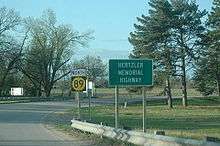
K-89 is a 1.514-mile-long (2.437 km) spur route that serves the city of Halstead in central Harvey County.[1][2] The highway begins at a flood gate at the south end of the highway's bridge across the Little Arkansas River at the north city limit.[15] The road continues south as Main Street, which contains a variety of historic sites, including its post office, museum and former railroad station, a pair of historic homes, and the Bernhard Warkentin Homestead, which is a National Historic Landmark. K-89 heads north by Riverside Park—the site of the Old Settlers Picnic and of filming for the 1955 movie Picnic[16]—along Hertzler Memorial Highway, which honors "Horse and Buggy Doctor" Arthur E. Hertzler.[17] The highway passes through an S-curve to veer east onto a section line road, which the highway follows to its end at US-50 between Burrton and Newton.[18] The Kansas State Highway Commission approved a purchase order for right of way to construct K-89 on September 13, 1932.[19] The highway was built in the second half of 1934 as an improved dirt road that was partially funded by national recovery grants.[20] However, before the state had paved the highway, the commission decided to eliminate several sharp curves in the highway's planned course and return the unused land to the former property owners in a November 15, 1935, resolution.[19] K-89 was paved on its present course by 1936.[10]
K-114
| |
|---|---|
| Location | Ogden |
| Length | 0.90 mi[21] (1.4 km) |
| Existed | 1977– |
K-114 is a 0.9-mile-long (1.4 km) spur route that serves the city of Ogden in southwestern Riley County.[21] The highway begins at the east city limit of Ogden; the road continues southwest as Riley Street. The highway curves southeast as a four-lane divided highway, crosses a Union Pacific rail line, and reaches its eastern terminus at a partial cloverleaf interchange with K-18, a four-lane freeway that heads northeast toward Manhattan and southwest toward I-70 and Junction City.[21][22][2] K-114 was proposed as part of a May 9, 1973, Kansas State Highway Commission resolution to remove K-18 from its course through Fort Riley in favor of a route around the military base between Ogden and Junction City to separate military traffic and regular highway traffic. K-18 would be placed on its present corridor from just east of Ogden south to I-70, and the piece of K-18 between the city of Ogden and the new portion of K-18 would become K-114.[23] The junction of K-18 and K-114 would be a partial interchange featuring a flyover ramp for westbound K-18 and no access from K-114 to westbound K-18 or from eastbound K-18 to K-114.[22][23] K-114 was established when construction on the K-18 link between Ogden and I-70 was completed between 1975 and 1977.[24][25] Between 2010 and 2013, K-18 and K-114 were relocated and their present interchange was constructed.[26][27]
K-114 (1950–1966)
| |
|---|---|
| Location | Everest |
| Length | 0.376 mi[28] (0.605 km) |
| Existed | 1950–1966 |
K-114 was a 0.376-mile-long (0.605 km) spur route that served the city of Everest in southeastern Brown County.[28][29] The highway began at US-73 and K-20, which ran concurrently east–west, between Horton to the west and Huron and Denton to the east. K-114 headed north to the south city limit of Everest, from which the road continued north as Fifth Street.[29][30] The Kansas State Highway Commission accepted K-114 into the state highway system through a July 12, 1950, resolution.[28] The commission authorized relocations of US-73 and K-20 in and around Everest through an August 12, 1964, resolution. The eastern end of K-20's concurrency with US-73 had been southeast of Everest. The state-numbered highway would be relocated to pass through Everest, assume the course of K-114, and reach its new US-73 junction at what was K-114's southern terminus.[31] K-114 was replaced by K-20 when the relocations were completed in 1966.[32][33]
K-115
| |
|---|---|
| Location | Palmer |
| Length | 0.650 mi[1] (1.046 km) |
| Existed | 1946– |
K-115 is a 0.650-mile-long (1.046 km) spur route that serves the city of Palmer in south central Washington County.[1][2] The highway begins at Pennsylvania Avenue just west of the east city limit at Peats Creek. K-115 heads east along Palmer Avenue to K-9 and K-15, which run concurrently north–south, between Clay Center and Linn.[34] The Kansas State Highway Commission accepted K-115 into the state highway system from Washington County through an April 10, 1946, resolution.[35]
K-119
| |
|---|---|
| Location | Greenleaf |
| Length | 0.761 mi[1] (1.225 km) |
| Existed | 1947– |
K-119 is a 0.761-mile-long (1.225 km) spur route that serves the city of Greenleaf in east central Washington County.[1][2] The highway begins at K-9 and K-148, which run concurrently east–west, between Linn and Barnes. K-119 heads north to the south city limit of Greenleaf at 8th Street, from which the road continues north as Main Street.[36] The Kansas State Highway Commission accepted K-119 into the state highway system from Washington County through an October 8, 1947, resolution.[37]
K-131
| |
|---|---|
| Location | Lebo |
| Length | 0.521 mi[1] (0.838 km) |
| Existed | 1949– |
K-131 is a 0.521-mile-long (0.838 km) spur route that serves the city of Lebo in northwestern Coffey County.[1][2] The highway begins at the north city limit between Sixth and Seventh streets, from which the road continues south as Ogden Street. K-131 heads north to a diamond interchange with I-35 and US-50, which run concurrently east–west, between Emporia and Ottawa.[38] The Kansas State Highway Commission accepted K-131 into the state highway system from Coffey County through an August 24, 1949, resolution.[39] The section of highway began at US-50S south of the city and went north 0.560 miles (0.901 km) to Sac and Fox Street and Ogden Street at the south city limit of Lebo.[39][40] This highway is now named Old Highway 131.[38] On November 14, 1968, the Kansas State Highway Commission approved a lengthy resolution adding and removing several designations in Lyon, Coffey, Osage, and Franklin counties as part of plans to construct I-35 between Emporia and Ottawa. The resolution removed US-50 from its old course and placed it on I-35, and it also changed K-131's route from its southern approach to Lebo to its current northern approach.[40] The change in routing in K-131 and the other highways went into effect in 1973 when I-35 was completed from east of Emporia to Ottawa.[41][42]
K-138
| |
|---|---|
| Location | Paxico |
| Length | 1.086 mi[1] (1.748 km) |
| Existed | 1952– |
K-138 is a 1.086-mile-long (1.748 km) spur route that serves the city of Paxico in central Wabaunsee County.[1][2] The highway begins at a partial cloverleaf interchange with I-70 and US-40, which run concurrently east–west, between Alma and Maple Hill. K-138 heads east and gradually approaches a Union Pacific Railroad line and then closely parallels the line to the west city limit of Paxico at Newbury Avenue.[43] The Kansas State Highway Commission authorized K-10, which at the time extended west of Lawrence, to be relocated to a new two-lane road between K-99 north of Alma and Maple Hill through an October 29, 1940, resolution.[44] This new highway bypassed K-10's old course west from Paxico when it was completed between 1941 and 1945.[44][45][46] The commission accepted K-138 into the state highway system from Wabaunsee County through a October 8, 1952, resolution. [47] K-138 followed K-10's old course for 1.259 miles (2.026 km) between an oblique intersection on a tangent with the contemporary course of K-10 and the city limit of Paxico.[44][47] K-10 near Paxico was replaced by US-40 between 1953 and 1956.[48][49] K-138 was put on its present course when it was relocated at its west end to tie into the I-70 interchange when US-40 was upgraded to the Interstate Highway in 1961.[50][51]
K-157
| |
|---|---|
| Location | Lyon Township |
| Length | 3.866 mi[1] (6.222 km) |
| Existed | 1950– |
K-157 is a 3.866-mile-long (6.222 km) spur route in Lyon Township in southwestern Geary County that serves Rock Springs 4-H Center, a 4-H camp that lies in both Geary and Dickinson counties.[1][2] The highway begins at the main entrance of Rock Springs 4-H Center just north of the Geary–Dickinson county line. K-157 heads north to the next section line road, then the route curves east and follows the section line road to its eastern terminus at US-77 between Junction City and Herington.[2] The Kansas State Highway Commission proposed a state highway connection between US-77 and Rock Springs 4-H Camp in a May 24, 1950, resolution, and the commission confirmed their decision in a November 14, 1950, resolution. The highway used the north–south segment of modern K-157, but instead of heading east toward modern US-77 north of the camp, the highway headed west to the contemporary course of US-77.[52] The Kansas State Highway Commission approved a relocation of US-77 between Herington and Junction City in a January 6, 1960, resolution. The resolution included designation of a new course for K-157 from north of the 4-H facility to connect with the new course of US-77 and to remove the connection to old US-77.[53] K-157 was assigned to its present course after US-77's relocation was completed in 1961.[50][51]
K-167
| |
|---|---|
| Location | Marienthal |
| Length | 0.506 mi[1] (0.814 km) |
| Existed | 1958– |
K-167 is a 0.506-mile-long (0.814 km) spur route that serves the unincorporated village of Marienthal in east central Wichita County.[1][2] The highway begins at K-96 between Leoti and Scott City. K-167 heads north through a grade crossing of the Kansas and Oklahoma Railroad and terminates at the north end of the village at a county highway equidistant between K-96 and the section line road to the north.[2] The Kansas State Highway Commission accepted K-167 into the state highway system from Wichita County through an August 27, 1958, certification of an September 25, 1957, resolution.[54]
K-168
| |
|---|---|
| Location | Lehigh |
| Length | 0.527 mi[1] (0.848 km) |
| Existed | 1970– |
K-168 is a 0.527-mile-long (0.848 km) spur route that serves the city of Lehigh in west central Marion County.[1][2] The highway begins at US-56 and K-15, which run concurrently east–west, between Canton and Hillsboro. K-168 heads north to the south city limit of Lehigh at Main Street, from which the road continues north as Old K56 Road.[55] K-168 was constructed as part of US-56, which in 1969 passed along the west city limit of Lehigh and intersected K-15 at what is now K-168's southern terminus.[56] The Kansas State Highway Commission authorized a relocation of US-56 to its current course near Lehigh in a March 26, 1969, resolution. As part of the resolution, the portion of bypassed US-56 south of Main Street in Lehigh would be redesignated K-168.[57] The US-56 relocation was completed and K-168 was assigned to its present course in 1970.[58][59]
K-173
| |
|---|---|
| Location | Densmore |
| Length | 0.650 mi[1] (1.046 km) |
| Existed | 1956– |
K-173 is a 0.650-mile-long (1.046 km) spur route that serves the unincorporated village of Densmore in southeastern Norton County.[1][2] The highway begins at an intersection of section line roads in the village. K-173 heads north to its end at K-9 between Edmond and Logan.[2] The village of Densmore had been served directly by K-9 until that highway was relocated to its present course between Edmond and Logan between 1946 and 1948.[60][61] The Kansas State Highway Commission accepted K-173 into the state highway system from Norton County through a May 23, 1956, certification of March 13, 1956, resolution that recognized the need to restore state highway access to the village of Densmore.[62]
K-175
| |
|---|---|
| Location | Marquette |
| Length | 0.500 mi[63] (0.805 km) |
| Existed | 1956–2013 |
K-175 was a 0.500-mile-long (0.805 km) spur route that served the city of Marquette in northwestern McPherson County.[63][64] The highway began at an abandoned railroad grade at the north city limit of Marquette. The road continued south as Swedonia Street into the city, which contains the Hans Hanson House and the Kansas Motorcycle Museum. K-175 headed north from the city limit to its end at K-4 between Geneseo and Lindsborg.[65] The Kansas State Highway Commission established the highway through a June 13, 1956, resolution to restore state highway access to Marquette removed when K-4 was relocated to bypass the city between 1953 and 1956.[66][67] The Kansas Department of Transportation acted to remove K-175 from the state highway system in a September 9, 2009, resolution that mainly concerned relocating several segments of K-61.[63] The removal was effective at the conclusion of "turnback work" to resurface the highway in 2013.[68]
K-182
| |
|---|---|
| Location | Bellaire |
| Length | 0.914 mi[1] (1.471 km) |
| Existed | 1955– |
K-182 is a 0.914-mile-long (1.471 km) spur route that serves the unincorporated village of Bellaire in east central Smith County.[1][2] The highway begins at US-36 between Smith Center and Lebanon. K-182 heads north and ends at the grade crossing with the Kyle Railroad in the village of Bellaire.[2] The Kansas State Highway Commission accepted K-182 into the state highway system from Smith County through a November 23, 1955, resolution.[69]
K-185
| |
|---|---|
| Location | McFarland |
| Length | 0.650 mi[1] (1.046 km) |
| Existed | 1955– |
K-185 is a 0.650-mile-long (1.046 km) spur route that serves the city of McFarland in north central Wabaunsee County.[1][2] The highway begins at a section line road within an S-curve at the north city limit, from which the road continues southeast as Main Street. K-185 heads north to its end at a partial cloverleaf interchange with I-70 and US-40, which run concurrently east–west, between Alma and Maple Hill.[70] The Kansas State Highway Commission accepted K-185 into the state highway system from Wabaunsee County through a May 25, 1955, resolution. K-185's northern terminus was originally at K-10, which at the time extended west of Lawrence.[71] The commission had authorized K-10 to be relocated to a new two-lane road between K-99 north of Alma and Maple Hill through an October 29, 1940, resolution.[44] This new highway bypassed K-10's old course through McFarland when it was completed between 1941 and 1945.[44][45][46] K-10 near McFarland was replaced by US-40 in 1956.[71][49] The highway was then upgraded to I-70 in 1961.[50][51]
K-189
| |
|---|---|
| Location | Miltonvale |
| Length | 0.915 mi[1] (1.473 km) |
K-189 is a 0.915-mile-long (1.473 km) spur route that serves the city of Miltonvale in southeastern Cloud County.[1][2] The highway begins at the south end of East 3rd Street, which forms the east city limit. The road curves west into the city and becomes east–west Ash Avenue. K-189 heads north to its end at US-24 between Glasco and Clay Center.[72] The Kansas State Highway Commission approved a relocation of US-24 from east of US-81 to Miltonvale through a November 24, 1954, resolution. The old routing of US-24 west of Miltonvale would be transferred to county control, and the portion of US-24 from Miltonvale north to the junction of the old and new courses would remain in the state highway system.[73] The US-24 relocation was completed and K-189 was assigned to the connector from US-24 to Miltonvale by 1956.[49]
K-191
| |
|---|---|
| Location | Lebanon |
| Length | 0.999 mi[1] (1.608 km) |
| Existed | 1954– |
K-191 is a 0.999-mile-long (1.608 km) spur route that serves the geographic center of the contiguous United States near Lebanon in east central Smith County.[1][2] The highway begins at a park with a monument to the site's geographic distinction at the junction of two section line roads. K-191 heads east to its end at US-281 1 mile (1.6 km) north of the north city limit of Lebanon.[74] The Kansas State Highway Commission accepted K-191 into the state highway system from Smith County through a November 24, 1954, certification of an April 14, 1954, resolution to provide state resources to the ordinary section line road burdened with serving traffic to the geographic site.[75]
K-193
| |
|---|---|
| Location | Asherville |
| Length | 0.467 mi[1] (0.752 km) |
| Existed | 1954– |
K-193 is a 0.467-mile-long (0.752 km) spur route that serves the unincorporated village of Asherville in east central Mitchell County.[1][2] The highway begins at an intersection of section line roads in the village. K-193 heads north to its end at US-24 between Beloit and Glasco.[2] The village of Densmore had been served directly by US-24 until that highway was relocated to its present course from west of Asherville to the Mitchell–Cloud county line between 1952 and 1954.[76] The Kansas State Highway Commission approved retaining a section of bypassed US-24 as a new spur route designated K-193 to retain state highway access to the village through a March 24, 1954, resolution.[77]
K-194
| |
|---|---|
| Location | Simpson |
| Length | 1.580 mi[1] (2.543 km) |
| Existed | 1954– |
K-194 is a 1.580-mile-long (2.543 km) spur route that serves the city of Simpson, which lies in east central Mitchell County on the west side of the Mitchell–Cloud county line.[1][2] The highway begins at the north city limit at the Kyle Railroad and Front Street, from which the road continues south as Mill Street. K-194 heads north along the county line to its end at US-24 between Beloit and Glasco.[78] The Kansas State Highway Commission approved a relocation of US-24 from the Mitchell–Cloud county line east to Glasco through a June 25, 1952, resolution. The portion of US-24 through Simpson, which followed the length of the road along the county line between US-24 and the railroad, would be removed from the state highway system.[79] After the US-24 relocation was completed by early 1954, the commission decided to restore state highway access to Simpson along the former course of US-24 through a March 24, 1954, resolution.[80] The spur to Simpson was designated K-194 between then and 1956.[80][49]
K-198
| |
|---|---|
| Location | Collyer |
| Length | 0.811 mi[1] (1.305 km) |
| Existed | 1960– |
K-198 is a 0.811-mile-long (1.305 km) spur route that serves the city of Collyer in northwestern Trego County.[1][2] The highway begins at a diamond interchange with I-70 and US-40, which run concurrently east–west, between Quinter and WaKeeney. K-198 heads north to the next section line road, then the route turns west to its end at Ainslie Street at the south city limit of Collyer, from which the road continues west as Eighth Street.[81] The Kansas State Highway Commission authorized the construction of I-70, the relocation of US-40 onto I-70, and the removal of old US-40 from the state highway system between Collyer and Ogallah via WaKeeney in a February 26, 1958, resolution. That resolution retained the portion of US-40 at Collyer along what is now K-198 and added a north–south connector from old US-40 to I-70.[82] I-70 was completed between Collyer and Ogallah and K-198 was applied to I-70's connector to Collyer by 1960.[83]
K-199
| |
|---|---|
| Location | Courtland |
| Length | 0.832 mi[1] (1.339 km) |
| Existed | 1962– |
K-199 is a 0.832-mile-long (1.339 km) spur route that serves the city of Courtland in west central Republic County.[1][2] The highway begins at the north city limit, from which the road continues south as Main Street. K-199 heads north to its end at US-36 between Mankato and Scandia.[84] The Kansas State Highway Commission approved a US-36 bypass from west of Formoso in Jewell County east to US-36's present junction with K-199 through a March 28, 1958, resolution. US-36 from the Courtland north city limit to K-199's present northern terminus would be retained as a state highway.[85] K-199 was assigned to the spur route to Courtland after the US-36 project was completed in 1962.[51][86]
K-209
| |
|---|---|
| Location | Woodbine |
| Length | 2.455 mi[1] (3.951 km) |
| Existed | 1961– |
K-209 is a 2.455-mile-long (3.951 km) spur route that serves the city of Woodbine, which lies in east central Dickinson County on the west side of the Dickinson–Morris county line.[1][2] The highway begins at the northwest corner of the city at the intersection of Western Avenue and Eighth Street, which is also an intersection of orthogonal section line roads. K-209 follows the north city limit through a grade crossing with the heritage Abilene and Smoky Valley Railroad to the northeast corner of the city at Gillett Road. The highway crosses Lyon Creek, intersects Wolf Road, and curves away from and back to the east–west section line the route followed from Woodbine. At the east end of the curve, K-209 crosses the Dickinson–Morris county line, east of which the highway curves southeast to an orthogonal intersection with US-77 between Junction City and Herington.[87] The Kansas State Highway Commission approved a relocation of US-77 between Herington and Junction City in a January 6, 1960, resolution. The old course of US-77 passed along the west and north sides of Woodbine, crossed Lyon Creek, and turned north onto Wolf Road toward Junction City. The resolution stated the old course of US-77 from the northwest corner of Woodbine to Wolf Road would remain in the state highway system, and a new road would be constructed east from Wolf Road to the new course of US-77.[53] Those two segments together became K-209 after US-77's relocation was completed in 1961.[50][51][53]
K-215
| |
|---|---|
| Location | Goessel |
| Length | 0.488 mi[1] (0.785 km) |
| Existed | 1951– |
K-215 is a 0.488-mile-long (0.785 km) spur route that serves the city of Goessel in southwestern Marion County.[1][2] The highway begins at the east city limit at Elm Street, from which the road continues west as Main Street. K-215 passes to the south of the Mennonite Heritage Museum as it heads east to K-15 between Lehigh and Newton.[88] The Kansas State Highway Commission accepted K-215 into the state highway system from Marion County through an September 14, 1951, resolution. The highway originally extended west 1 mile (1.6 km) from K-15 through the then-unincorporated village to the next section line road.[89] On May 28, 1952, the commission passed another resolution in response to the village incorporating since the previous resolution. Since Kansas law stated a state highway could only extend to the city limit of a municipality, the new resolution removed from the state highway system the portion of the highway within the new city limits of Goessel.[90]
K-216
| |
|---|---|
| Location | Grinnell |
| Length | 0.585 mi[1] (0.941 km) |
| Existed | 1962– |
K-216 is a 0.585-mile-long (0.941 km) spur route that serves the city of Grinnell in northwestern Gove County.[1][2] The highway begins at a diamond interchange with I-70 and US-40, which run concurrently east–west, between Colby and Grainfield. K-216 heads north to South 6th Street, onto which the highway turns west and ends at the south city limit of Grinnell just east of Adams Street.[91] The Kansas State Highway Commission established K-216 to retain state highway access to Grinnell as part of a September 12, 1962, resolution that authorized the construction of I-70 and the relocation of US-40 onto I-70 from US-40 east of Oakley to Grainfield.[92] I-70 between Oakley and Grainfield was constructed between 1962 and 1965, although K-216 may have been marked as early as 1963.[86][93]
K-218
| |
|---|---|
| Location | Herington |
| Length | 1.773 mi[1] (2.853 km) |
| Existed | 1964– |
K-218 is a 1.773-mile-long (2.853 km) spur route that serves the city of Herington in southeastern Dickinson County.[1][2] The highway begins at the west city limit just north of Walnut Street, which heads east toward downtown Herington. K-218 intersects a Union Pacific Railroad line and continues north to its end at K-4 between Hope and Latimer.[94] The Kansas State Highway Commission approved a relocation of US-77 between Herington and Junction City in a January 6, 1960, resolution.[53] The old course of US-77 entered Herington from the south along what is now US-56 Business; turned east onto Trapp Street, north onto Broadway Street, and west onto Walnut Street; and left town by turning north onto what is now K-218.[53][94] The course of K-218 remained in the state highway system after US-77's relocation was completed in 1961.[50][51][53] K-218 was assigned to the old piece of US-77 between 1963 and 1965.[86][93]
K-234
| |
|---|---|
| Location | Hanover |
| Length | 0.347 mi[1] (0.558 km) |
| Existed | 1962– |
K-234 is a 0.347-mile-long (0.558 km) spur route that serves the city of Hanover in northeastern Washington County.[1][2] The highway begins at the east city limit at Highland Street, where the road continues west as North Street. K-234 heads east to K-148 between Barnes and the Nebraska state line.[95] K-234's course was constructed as part of a relocation of K-15E (now K-148) south of Hanover that the Kansas State Highway Commission approved November 18, 1940. K-15E would be removed from Zenith Road from US-36 to Hanover and instead placed on K-148's present course south of what is now K-234 and on K-234's course to enter Hanover from the east instead of the south.[96] This relocation was completed by 1945.[46] The Kansas State Highway Commission authorized a relocation of K-15E north from Hanover on March 8, 1961. This relocation would move K-15E from K-234's present course and Shady Boulevard north from Hanover to K-148's present course.[97] K-234 was established after the K-15E relocation was completed in 1962.[51][86]
K-238
| |
|---|---|
| Location | Elwood |
| Length | 1.433 mi[1] (2.306 km) |
| Existed | 1962– |
K-238 is a 1.433-mile-long (2.306 km) spur route in Elwood in east central Doniphan County.[1][2] The highway serves Rosecrans Memorial Airport, the joint civilian–military airport for St. Joseph, Missouri, which lies on the opposite side of the Missouri River from Elwood. The airport lies west of the river but is in the state of Missouri; the Kansas–Missouri border follows a chain of oxbow lakes. Traffic from St. Joseph must pass through Kansas and use K-238 to reach the city's airport. K-238 begins at a diamond interchange with US-36 in the city of Elwood between St. Joseph and Wathena. The highway heads north through an S-curve and intersects Roseport Road. K-238 continues north along the west city limit to its end at the Browning Bridge, which crosses the eponymous oxbow lake into Missouri at the south end of the airport.[98] The Missouri River and the state line followed the same meander path prior to the Missouri River basin floods of 1952, before which St. Joseph was connected to its airport on land via Missouri Supplemental Route OO.[99][100] The 1952 floods created a meander cutoff east of the airport, cutting St. Joseph off from its airport. By 1955, the U.S. Army Corps of Engineers constructed a permanent cutoff channel east of the one caused by the floods.[99] In order to improve access to the airport, the Kansas State Highway Commission approved the designation and construction of K-238 from US-36, which then followed Roseport Road, north to the Browning Bridge at the state line in a July 12, 1961, resolution.[101] The highway was constructed and marked as K-238 in 1962.[51][86] US-36 was authorized to be moved to its present freeway in a July 31, 1980, resolution. The resolution also extended K-238 east from its southern terminus along old US-36 through Elwood to its partial cloverleaf interchange with the freeway just west of the U.S. Highway's bridge to St. Joseph.[102] K-238 was authorized to be placed on its present course and removed from Roseport Road through a March 25, 1993, resolution.[103] The diamond interchange at K-238's southern terminus was completed between 1995 and 1997.[104][105]
K-243
| |
|---|---|
| Location | Hollenberg Pony Express Station |
| Length | 0.942 mi[1] (1.516 km) |
| Existed | 1962– |
K-243 is a 0.942-mile-long (1.516 km) spur route that serves the Hollenberg Pony Express Station near Hanover in northeastern Washington County.[1][2] The highway begins at K-148 between Barnes and the Nebraska state line. K-243 heads east to Big Bear Road, a section line road that provides access to the Hollenberg Pony Express Station property, also known as the Cottonwood Pony Express Station and Hollenberg Ranch State Park.[95] The Kansas State Highway Commission accepted K-243 into the state highway system from Washington County through a June 13, 1962, certification of an August 23, 1961, resolution. The commission based its actions on a law the Kansas Legislature passed in 1961 that permitted the commission to improve roads to historical sites.[106]
K-247
| |
|---|---|
| Location | Ellis |
| Length | 0.123 mi[1] (0.198 km) |
| Existed | 1964– |
K-247 is a 0.123-mile-long (0.198 km) spur route that serves the city of Ellis in western Ellis County.[1][2] The highway begins at the north city limit of Ellis at 3rd Street, from which the road continues south as Washington Street. K-247 heads north to its end at a diamond interchange with I-70 and US-40, which run concurrently east–west, between WaKeeney and Hays.[107] The Kansas State Highway Commission authorized the construction of I-70, the relocation of US-40 onto I-70, and the removal of old US-40 from the state highway system between Ogallah to the west in Trego County and Hays in an August 14, 1963, resolution. That resolution included a connector with the proposed designation of K-247 between I-70 and Ellis to retain state access to the city that would be removed with the removal of the old route of US-40 from the state highway system.[108] I-70 was completed between Ogallah and Hays and Ogallah and K-247 was applied to I-70's connector to Ellis in 1964.[86][93]
K-248
| |
|---|---|
| Location | Kensington |
| Length | 0.997 mi[1] (1.605 km) |
| Existed | 1962– |
K-248 is a 0.997-mile-long (1.605 km) spur route that serves the city of Kensington in west central Smith County.[1][2] The highway begins at 180 Road, a section line road, a little east of that road's bridge over Cedar Creek as the west leg of a wye intersection between east–west 180 Road and the north–south road that is named Main Street within Kensington, whose city limits are a little to the north of the wye. K-248 intersects a Kyle Railroad–operated rail line in the center of town. The highway follows Main Street to its northern terminus at US-36 at the north city limits of Kensington. US-36 heads west toward Agra and east toward Athol.[109] The Kansas State Highway Commission approved a relocation of US-36 from east of Agra in far eastern Phillips County to Kensington through a March 7, 1962, resolution. All of the bypassed routing of US-36, which included the present route of K-248 through Kensington, was planned to returned to local control.[110] However, on October 24, 1962, the commission passed a resolution retaining the portion of old US-36 north of 180 Road.[111] K-248 was assigned to its course after the US-36 relocation was completed in 1962.[51][86]
K-252
| |
|---|---|
| Location | Beverly |
| Length | 0.453 mi[1] (0.729 km) |
| Existed | 1964– |
K-252 is a 0.453-mile-long (0.729 km) spur route that serves the city of Beverly in east central Lincoln County.[1][2] The highway begins at the north city limit of Beverly north of 3rd Street, from which the road continues south as Main Street. K-252 heads north to its end at K-18 between Lincoln and Tescott.[112] The Kansas State Highway Commission accepted K-252 into the state highway system from Lincoln County through a May 13, 1964, resolution.[113] The designation restored state highway access to Beverly after K-18 had been removed from Beverly after that highway was relocated between Lincoln and Beverly between 1958 and 1960.[83][114]
K-253
| |
|---|---|
| Location | Edson |
| Length | 0.674 mi[1] (1.085 km) |
| Existed | 1968– |
K-253 is a 0.674-mile-long (1.085 km) spur route that serves the unincorporated village of Edson in east central Sherman County.[1][2] The highway begins at a diamond interchange with I-70 and US-24, which run concurrently east–west, between Goodland and Brewster. K-253 heads north to Old U.S. Highway 24, where the highway ends east of the center of Edson.[2] The Kansas State Highway Commission established K-253 to retain state highway access to Edson in an August 10, 1966, resolution.[115] This access was not originally part of plans for the portion of I-70 between the Colorado state line and Levant in Thomas County, as US-24 would have been moved onto I-70 and the old course of US-24 would be removed from the state highway system; these plans had been approved in a June 7, 1966, resolution.[116] K-253 was marked after I-70 was completed from Goodland to Levant in 1968.[117][56]
K-255
| |
|---|---|
| Location | Victoria |
| Length | 1.195 mi[1] (1.923 km) |
| Existed | 1964– |
K-255 is a 1.195-mile-long (1.923 km) spur route that serves the city of Victoria in eastern Ellis County.[1][2] The highway begins at the north city limit of Victoria just north of 13th Street, from which the road continues south as Cathedral Street. K-255 heads north to its end at a diamond interchange with I-70 and US-40, which run concurrently east–west, between Hays and Topeka.
K-257
| |
|---|---|
| Location | Gorham |
| Length | 0.932 mi[118] (1.500 km) |
| Existed | 1966–2006 |
K-257 was a 0.932-mile-long (1.500 km) spur route that served the city of Gorham in west central Russell County.[118][119] The highway began at a diamond interchange with I-70 and US-40, which run concurrently east–west, between Hays and Russell. K-257 headed north its end at Carrie Street at the south city limit of Gorham, from which the road continued north as Clifford Street.[119][120] The Kansas State Highway Commission authorized the construction of I-70, the relocation of US-40 onto I-70, and the removal of old US-40 from the state highway system from Hays to east of Russell in an May 13, 1964, resolution. That resolution included a connector between I-70 and Gorham to retain state access to the city that would be removed with the removal of the old route of US-40 from the state highway system.[118] K-257 was assigned to the Gorham connector after I-70 was completed through Russell County in 1966.[32][33] The Kansas Department of Transportation removed K-257 from the state highway system through an August 24, 2006, resolution.[121]
K-264
| |
|---|---|
| Location | Larned |
| Length | 1.033 mi[1] (1.662 km) |
| Existed | c. 1965– |
K-264 is a 1.033-mile-long (1.662 km) spur route that serves Larned State Hospital west of Larned in central Pawnee County.[1][2] The highway begins at a T-intersection northwest of the psychiatric hospital within the state complex, which also includes the Larned Correctional Mental Health Facility and the Larned Juvenile Correctional Facility of the Kansas Department of Corrections. K-264 heads north out of the state reservation through an S-curve to its north end at K-156 between Larned and Burdett.[2] The Kansas State Highway Commission authorized constructing K-264 through an August 11, 1965, resolution. Because the route served a state institution, the spur highway was exempt from the 10,000-mile (16,093 km) state highway system limitation.[122] K-264 was completed between 1965 and 1968.[122][123]
K-267
| |
|---|---|
| Location | Kanorado |
| Length | 0.837 mi[1] (1.347 km) |
| Existed | 1969– |
K-267 is a 0.837-mile-long (1.347 km) spur route that serves the city of Kanorado in west central Sherman County near the Colorado state line.[1][2] The highway begins at a diamond interchange with I-70 and US-24, which run concurrently east–west, between Goodland and Burlington, Colorado. K-267 heads north to Old U.S. Highway 24, onto which the highway turns west to parallel the Kyle Railroad line. The highway ends at Eastern Avenue at the east city limit of Kanorado, from which Old U.S. Highway 24 continues west through a corner of Kanorado to the Colorado state line.[124] The Kansas State Highway Commission approved plans for the portion of I-70 between the Colorado state line and Levant in Thomas County through a June 7, 1966, resolution. As part of these plans, US-24 would have been moved onto I-70 and almost all of the old course of US-24 would be removed from the state highway system. However, the portion of old US-24 from Eastern Avenue to the next section line road joined the portion of that road between old US-24 and I-70 as part of the new K-267.[116] K-267 was marked when I-70 was completed from Goodland to the Colorado state line in late 1969.[56][58]
K-279
| |
|---|---|
| Location | Osawatomie |
| Length | 0.489 mi[1] (0.787 km) |
| Existed | 1972– |
K-279 is a 0.489-mile-long (0.787 km) spur route that serves Osawatomie State Hospital in the city of Osawatomie in southwestern Miami County.[1][2] The highway begins at Osawatomie Road at the eastern entrance to the psychiatric hospital grounds. K-279 heads east, passing out of and back into the Osawatomie city limits, to a diamond interchange with US-169 and K-7, which run concurrently along the freeway bypass of Osawatomie, between Paola and Garnett.[125] K-279 was established as the route number for a new connector between the US-169 bypass and Osawatomie State Hospital in the same July 19, 1972, resolution in which the Kansas State Highway Commission approved constructing the bypass. The highway was constructed to retain state highway access to the state hospital after US-169 was removed from Old Kansas City Road. Because the route served a state institution, K-279 was exempt from the 10,000-mile (16,093 km) state highway system limitation.[126] The US-169 bypass, K-279, and their interchange opened between 1975 and 1977.[24][25]
K-284
| |
|---|---|
| Location | Barnard |
| Length | 5.618 mi[1] (9.041 km) |
| Existed | 1973– |
K-284 is a 5.618-mile-long (9.041 km) spur route that serves the city of Barnard in north central Lincoln County.[1][2]
K-285
| |
|---|---|
| Location | De Soto |
| Length | 0.218 mi[127][128] (0.351 km) |
| Existed | 1977–c. 1999 |
K-285 was a 0.218-mile-long (0.351 km) spur route that served the city of De Soto in northwestern Johnson County.[127][128] The highway began at a partial cloverleaf interchange with K-10 between Shawnee and Eudora. K-285 headed north to the south city limit of De Soto, from which the highway continued north along Lexington Avenue.[129][130] The Kansas State Highway Commission authorized the relocation of K-10 onto its freeway between De Soto and K-7 and the removal of old K-10 from the state highway system in a June 15, 1972, resolution. The 0.607-mile-long (0.977 km) portion of old K-10 from the freeway to the south city limit of De Soto would be retained and designated K-285.[127] K-285 replaced the piece of K-10 north of the freeway when the K-10 freeway was completed between 1975 and 1977.[24][25] In 1977, the city of De Soto expanded its limits southward; thus, the Kansas Department of Transportation removed the 0.389-mile-long (0.626 km) portion of K-285 between the old and new south city limit from the state highway system in a January 26, 1977, resolution. The resolution also stated any further annexation of the land under K-285 would automatically result in the relevant length of road being transferred to local control.[128] The city of De Soto activated this provision of the resolution, thus removing K-285 from the state highway system, when the city annexed the remainder of the land under K-285 between 1997 and 1999.[105][131]
K-368
| |
|---|---|
| Location | Vassar |
| Length | 1.000 mi[1] (1.609 km) |
| Existed | 1972– |
K-368 is a 1.000-mile-long (1.609 km) spur route that serves Pomona State Park near Vassar in east central Osage County.[1][2] The highway begins at K-268 between Lyndon and Quenemo. K-368 heads north and intersects the Flint Hills Nature Trail, a rail trail along a former Missouri Pacific Railroad line, before reaching its north end at the entrance to Pomona State Park.[2][132] The U.S. Army Corps of Engineers began to construct Pomona Dam and its associated reservoir in the early 1960s. The federal agency agreed to relocate several county highways that would be displaced by the reservoir, and the Kansas State Highway Commission requested a pair of those highways–an east–west highway between US-75 and K-68 and an access road to the recreational land around the reservoir—be constructed to state highway standards. The commission designated those highways K-268 and K-368, respectively, in a November 14, 1962, resolution.[133] K-268 and K-368 were constructed and added to the state highway system and Pomona Reservoir was completed between 1963 and 1965.[86][93]
References
- 1 2 3 4 5 6 7 8 9 10 11 12 13 14 15 16 17 18 19 20 21 22 23 24 25 26 27 28 29 30 31 32 33 34 35 36 37 38 39 40 41 42 43 44 45 46 47 48 49 50 51 52 53 54 55 56 57 58 59 60 61 62 63 64 65 66 67 68 69 70 71 72 73 74 75 76 77 78 79 80 81 82 83 84 85 86 87 88 89 Staff (2016). "Pavement Management Information System". Kansas Department of Transportation. Retrieved April 19, 2017.
- 1 2 3 4 5 6 7 8 9 10 11 12 13 14 15 16 17 18 19 20 21 22 23 24 25 26 27 28 29 30 31 32 33 34 35 36 37 38 39 40 41 42 43 44 45 46 47 48 49 50 51 52 53 54 55 56 Bureau of Transportation Planning (April 2017). General County Highway Maps (half inch) (PDF) (Map). 1:125,000. Topeka, KS: Kansas Department of Transportation. Retrieved April 30, 2017.
- Cloud County (K-189, K-194)
- Coffey County (K-131)
- Dickinson County (K-209, K-218)
- Doniphan County (K-238)
- Ellis County (K-247)
- Geary County (K-157)
- Gove County (K-216)
- Graham County (K-84, K-85)
- Harvey County (K-89)
- Jefferson County (K-76)
- Lincoln County (K-252)
- Lyon County (K-78)
- Marion County (K-168, K-215)
- Miami County (K-279)
- Mitchell County (K-193)
- Morris County (K-209)
- Norton County (K-67, K-173)
- Osage County (K-368)
- Pawnee County (K-264)
- Republic County (K-199)
- Riley County (K-114)
- Sherman County (K-253, K-267)
- Smith County (K-182, K-191, K-248)
- Trego County (K-198)
- Wabaunsee County (K-138, K-185)
- Washington County (K-115, K-119, K-234, K-243)
- Wichita County (K-167)
- ↑ Official State Transportation Map (PDF) (Map) (1937 ed.). Kansas Department of Transportation. Retrieved 2008-05-14.
- ↑ "K-46 removal". KDOT.
- ↑ Kansas State Highway System (PDF) (Map) (January 1938 ed.). Kansas State Highway Commission. § A5. Retrieved April 19, 2017.
- ↑ Grenz, Chris (September 23, 2003). "Legislative committee considers hospital closures". Topeka Capital–Journal. Topeka, KS: Morris Communications. Retrieved April 19, 2017.
- 1 2 3 Office of the Secretary of Transportation (January 3, 2014). "Resolution to Withdraw Highways in Jefferson County". Kansas Department of Transportation. Retrieved April 29, 2017.
- ↑ Bureau of Transportation Planning (August 2010). General Highway Map: Jefferson County (PDF) (Map). 1:125,000. Topeka, KS: Kansas Department of Transportation. Williamstown inset. Retrieved April 29, 2017.
- ↑ Kansas State Highway Commission (May 23, 1951). "Resolution for Relocation and Redesignation of Road in Jefferson County". Kansas Department of Transportation. Retrieved April 29, 2017.
- 1 2 Kansas State Highway System (PDF) (Map) (1936 ed.). Kansas State Highway Commission. Retrieved April 30, 2017.
- 1 2 3 Kansas State Highway System (PDF) (Map) (January 1938 ed.). Kansas State Highway Commission. §§ B4, D12. Retrieved April 23, 2017.
- 1 2 Official Map: Kansas State Roads (PDF) (Map). Kansas State Highway Commission. August 7, 1918. Retrieved April 23, 2017.
- 1 2 Kansas State Highway System (PDF) (Map) (1932 ed.). Kansas State Highway Commission. Retrieved April 23, 2017.
- ↑ Bureau of Transportation Planning (June 2005). City of Morland (PDF) (Map). KDOT City Maps. Topeka, KS: Kansas Department of Transportation. Retrieved April 23, 2017.
- ↑ Frey, Chad (August 7, 2013). "Halstead closes flood gates". The Newton Kansan. Newton, KS: GateHouse Media. Retrieved April 30, 2017.
- ↑ "Parks, Trails & Other Recreation". City of Halstead. Retrieved April 30, 2017.
- ↑ "Arthur Emanual Hertzler". Kansapedia. Topeka, KS: Kansas Historical Society. January 2013. Retrieved April 30, 2017.
- ↑ Bureau of Transportation Planning (September 2007). City of Halstead (PDF) (Map). KDOT City Maps. Topeka, KS: Kansas Department of Transportation. Retrieved April 30, 2017.
- 1 2 Kansas State Highway Commission (December 5, 1935). "Memorandum to Mr. Ireland". Kansas Department of Transportation. Retrieved April 30, 2017.
- ↑ "Tenth Biennial Report of the State Highway Commission State of Kansas" (1934–1936 ed.). Topeka, KS: Kansas State Highway Commission. June 30, 1936: 11. Retrieved April 30, 2017.
- 1 2 3 "Overview of K-114". Google Maps. Google, Inc. Retrieved April 21, 2017.
- 1 2 Bureau of Transportation Planning (October 1999). City of Ogden (PDF) (Map). KDOT City Maps. Topeka, KS: Kansas Department of Transportation. Retrieved April 21, 2017.
- 1 2 Kansas State Highway Commission (May 9, 1973). "Resolution for Relocation and Redesignation of Road in Geary County and Riley County". Kansas Department of Transportation. Retrieved April 22, 2017.
- 1 2 3 Official Kansas Highway Map (PDF) (Map) (1975–1976 ed.). Kansas Department of Transportation. §§ C9, C12, D12. Retrieved April 20, 2017.
- 1 2 3 Kansas Transportation Map (PDF) (Map) (1977 ed.). Kansas Department of Transportation. §§ C9, C12, D12. Retrieved April 20, 2017.
- ↑ Kansas Department of Transportation (November 19, 2010). "Kansas Map Changes: 2010 Annual Report" (PDF). Kansas Department of Transportation. Retrieved April 22, 2017.
- ↑ Kansas Official State Transportation Map (PDF) (Map) (2013–2014 ed.). Kansas Department of Transportation. § C9. Retrieved April 22, 2017.
- 1 2 3 Kansas State Highway Commission (July 12, 1950). "Resolution to Add Road in Brown County to the State Highway System: Spur from US 73 to Everest". Kansas Department of Transportation. Retrieved April 29, 2017.
- 1 2 Highway Planning Department. General Highway Map: Brown County (PDF) (Map) (1954 ed.). 1:125,000. Topeka, KS: Kansas State Highway Commission. Retrieved April 29, 2017.
- ↑ Bureau of Transportation Planning (May 2004). City of Everest (PDF) (Map). KDOT City Maps. Topeka, KS: Kansas Department of Transportation. Retrieved April 19, 2017.
- ↑ Kansas State Highway Commission (August 12, 1964). "Resolution for Relocation and Redesignation of Road in Brown County and Atchison County". Kansas Department of Transportation. Retrieved April 29, 2017.
- 1 2 Official Kansas Highway Map (PDF) (Map) (1966 ed.). Kansas State Highway Commission. §§ B11, C9. Retrieved April 29, 2017.
- 1 2 Official Kansas Highway Map (PDF) (Map) (1967 ed.). Kansas State Highway Commission. §§ B11, C9. Retrieved April 29, 2017.
- ↑ Bureau of Transportation Planning (May 2007). City of Palmer (PDF) (Map). KDOT City Maps. Topeka, KS: Kansas Department of Transportation. Retrieved April 19, 2017.
- ↑ Kansas State Highway Commission (April 10, 1946). "Resolution for Addition of Road in Washington County". Kansas Department of Transportation. Retrieved April 19, 2017.
- ↑ Bureau of Transportation Planning (May 2007). City of Greenleaf (PDF) (Map). KDOT City Maps. Topeka, KS: Kansas Department of Transportation. Retrieved April 19, 2017.
- ↑ Kansas State Highway Commission (October 8, 1947). "Resolution for Addition of Road in Washington County to the State Highway System". Kansas Department of Transportation. Retrieved April 19, 2017.
- 1 2 Bureau of Transportation Planning (August 2006). City of Lebo (PDF) (Map). KDOT City Maps. Topeka, KS: Kansas Department of Transportation. Retrieved April 20, 2017.
- 1 2 Kansas State Highway Commission (August 24, 1949). "Resolution to Add Road in Coffey County to the State Highway System: Lebo Spur". Kansas Department of Transportation. Retrieved April 20, 2017.
- 1 2 Kansas State Highway Commission (November 14, 1968). "Resolution for Location, Relocation, and Redesignation of Roads Using State-wide Funds as Follows (Lyon County, Coffey County, Osage County, Franklin County)". Kansas Department of Transportation. Retrieved April 20, 2017.
- ↑ Official Kansas Highway Map (PDF) (Map) (1973 ed.). Kansas State Highway Commission. § D11. Retrieved April 19, 2017.
- ↑ Official Kansas Highway Map (PDF) (Map) (1974 ed.). Kansas State Highway Commission. § D11. Retrieved April 19, 2017.
- ↑ Bureau of Transportation Planning (November 1999). City of Paxico (PDF) (Map). KDOT City Maps. Topeka, KS: Kansas Department of Transportation. Retrieved May 1, 2017.
- 1 2 3 4 5 Kansas State Highway Commission (October 29, 1940). "Resolution for Relocation and Redesignation of Road in Wabaunsee County". Kansas Department of Transportation. Retrieved May 1, 2017.
- 1 2 Kansas State Highway System (PDF) (Map) (1941 ed.). Kansas State Highway Commission. § C11. Retrieved May 1, 2017.
- 1 2 3 Kansas State Highway System (PDF) (Map) (1945 ed.). Kansas State Highway Commission. §§ A10, C11. Retrieved May 1, 2017.
- 1 2 Kansas State Highway Commission (May 25, 1955). "Resolution to Add Road in Wabaunsee County to the State Highway System: Paxico Spur". Kansas Department of Transportation. Retrieved May 1, 2017.
- ↑ Official Kansas Highway Map (PDF) (Map) (1953 ed.). Kansas State Highway Commission. §§ C11. Retrieved May 1, 2017.
- 1 2 3 4 Official Kansas Highway Map (PDF) (Map) (1956 ed.). Kansas State Highway Commission. §§ B8, C11. Retrieved April 21, 2017.
- 1 2 3 4 5 Official Kansas Highway Map (PDF) (Map) (1961 ed.). Kansas State Highway Commission. §§ C9, C11. Retrieved April 30, 2017.
- 1 2 3 4 5 6 7 8 9 Official Kansas Highway Map (PDF) (Map) (1962 ed.). Kansas State Highway Commission. § A10, B6, B8, B12, C9, C11. Retrieved April 19, 2017.
- ↑ Kansas State Highway Commission (November 14, 1950). "Resolution to Add Road in Geary County to the State Highway System: Spur from US-77 to Rock Springs 4-H Camp". Kansas Department of Transportation. Retrieved April 30, 2017.
- 1 2 3 4 5 6 Kansas State Highway Commission (January 6, 1960). "Resolution for Relocation and Redesignation of Road in Dickinson County, Morris County, and Geary County". Kansas Department of Transportation. Retrieved April 30, 2017.
- ↑ Kansas State Highway Commission (August 27, 1958). "Certification by State Highway Engineer Covering Addition of Road in Wichita County to the State Highway System: Marienthal Spur". Kansas Department of Transportation. Retrieved April 21, 2017.
- ↑ Bureau of Transportation Planning (January 2007). City of Lehigh (PDF) (Map). KDOT City Maps. Topeka, KS: Kansas Department of Transportation. Retrieved April 19, 2017.
- 1 2 3 Official Kansas Highway Map (PDF) (Map) (1969 ed.). Kansas State Highway Commission. §§ C2, D9. Retrieved April 20, 2017.
- ↑ Kansas State Highway Commission (March 26, 1969). "Resolution for Relocation and Redesignation of Road in McPherson County and Marion County". Kansas Department of Transportation. Retrieved April 19, 2017.
- 1 2 Official Kansas Highway Map (PDF) (Map) (1970 ed.). Kansas State Highway Commission. §§ C2, D9. Retrieved April 23, 2017.
- ↑ Official Kansas Highway Map (PDF) (Map) (1971 ed.). Kansas State Highway Commission. § D9. Retrieved April 19, 2017.
- ↑ Kansas State Highway Commission (August 28, 1946). "Resolution for Relocation and Redesignation of Road in Norton and Phillips Counties". Kansas Department of Transportation. Retrieved April 19, 2017.
- ↑ Kansas State Highway System (PDF) (Map) (1948 ed.). Kansas State Highway Commission. § A5. Retrieved April 19, 2017.
- ↑ Kansas State Highway Commission (May 23, 1956). "Certification by State Highway Engineer for Addition of Road in Norton County to the State Highway System: Densmore Spur". Kansas Department of Transportation. Retrieved April 19, 2017.
- 1 2 3 Office of the Secretary of Transportation (September 9, 2009). "Rural Resolution to Re-align a Portion of K-61 on the State Highway System in Reno and McPherson County". Kansas Department of Transportation. Retrieved April 29, 2017.
- ↑ Bureau of Transportation Planning (November 2007). General Highway Map: McPherson County (PDF) (Map). 1:125,000. Topeka, KS: Kansas Department of Transportation. Retrieved April 29, 2017.
- ↑ Bureau of Transportation Planning (April 2011). City of Marquette (PDF) (Map). KDOT City Maps. Topeka, KS: Kansas Department of Transportation. Retrieved April 29, 2017.
- ↑ Kansas State Highway Commission (May 23, 1951). "Resolution for Addition of Road in McPherson County to the State Highway System: Marquette Spur". Kansas Department of Transportation. Retrieved April 29, 2017.
- ↑ Kansas State Highway Commission (June 24, 1953). "Resolution for Relocation and Redesignation of Road in Ellsworth and McPherson Counties". Kansas Department of Transportation. Retrieved April 29, 2017.
- ↑ Office of the Secretary of Transportation (January 9, 2013). "KDOT Announces Approved December Bids" (PDF). Kansas Department of Transportation. Retrieved April 29, 2017.
- ↑ Kansas State Highway Commission (November 23, 1955). "Resolution for Addition to State Highway System: Bellaire Spur". Kansas Department of Transportation. Retrieved April 20, 2017.
- ↑ Bureau of Transportation Planning (November 1993). City of McFarland (PDF) (Map). KDOT City Maps. Topeka, KS: Kansas Department of Transportation. Retrieved April 21, 2017.
- 1 2 Kansas State Highway Commission (May 25, 1955). "Resolution for Addition to State Highway System in Wabaunsee County". Kansas Department of Transportation. Retrieved April 21, 2017.
- ↑ Bureau of Transportation Planning (March 2000). City of Miltonvale (PDF) (Map). KDOT City Maps. Topeka, KS: Kansas Department of Transportation. Retrieved April 21, 2017.
- ↑ Kansas State Highway Commission (November 24, 1954). "Resolution for Relocation and Redesignation of Road in Cloud County". Kansas Department of Transportation. Retrieved April 21, 2017.
- ↑ Bureau of Transportation Planning (January 2011). City of Lebanon (PDF) (Map). KDOT City Maps. Topeka, KS: Kansas Department of Transportation. Retrieved April 23, 2017.
- ↑ Kansas State Highway Commission (November 24, 1954). "Certification by State Highway Engineer in Compliance with Resolution Adopted by the Commission April 14, 1954: State Highway 191, Smith County". Kansas Department of Transportation. Retrieved April 23, 2017.
- ↑ Kansas State Highway Commission (May 28, 1952). "Resolution for Relocation and Redesignation of Road in Mitchell County". Kansas Department of Transportation. Retrieved April 20, 2017.
- ↑ Kansas State Highway Commission (March 24, 1954). "Resolution for Addition to State Highway System in Mitchell County: Asherville Spur". Kansas Department of Transportation. Retrieved April 20, 2017.
- ↑ Bureau of Transportation Planning (September 1999). City of Simpson (PDF) (Map). KDOT City Maps. Topeka, KS: Kansas Department of Transportation. Retrieved April 20, 2017.
- ↑ Kansas State Highway Commission (June 25, 1952). "Resolution for Relocation and Redesignation of Road in Cloud County". Kansas Department of Transportation. Retrieved April 30, 2017.
- 1 2 Kansas State Highway Commission (March 24, 1954). "Resolution for Addition to State Highway System in Mitchell and Cloud Counties: Simpson Spur". Kansas Department of Transportation. Retrieved April 30, 2017.
- ↑ Bureau of Transportation Planning (March 2007). City of Collyer (PDF) (Map). KDOT City Maps. Topeka, KS: Kansas Department of Transportation. Retrieved April 20, 2017.
- ↑ Kansas State Highway Commission (February 26, 1958). "Resolution for Relocation and Redesignation of Road in Trego County". Kansas Department of Transportation. Retrieved April 21, 2017.
- 1 2 Official Kansas Highway Map (PDF) (Map) (1960 ed.). Kansas State Highway Commission. §§ C5, C8. Retrieved April 23, 2017.
- ↑ Bureau of Transportation Planning (September 2007). City of Courtland (PDF) (Map). KDOT City Maps. Topeka, KS: Kansas Department of Transportation. Retrieved April 20, 2017.
- ↑ Kansas State Highway Commission (March 28, 1958). "Resolution for Relocation and Redesignation of Road in Jewell County and Republic County". Kansas Department of Transportation. Retrieved April 20, 2017.
- 1 2 3 4 5 6 7 8 Official Kansas Highway Map (PDF) (Map) (1963–1964 ed.). Kansas State Highway Commission. §§ A10, B6, B8, B12, C4, C5, D9, D11. Retrieved May 2, 2017.
- ↑ Bureau of Transportation Planning (March 1998). City of Woodbine (PDF) (Map). KDOT City Maps. Topeka, KS: Kansas Department of Transportation. Retrieved May 2, 2017.
- ↑ Bureau of Transportation Planning (January 2007). City of Goessel (PDF) (Map). KDOT City Maps. Topeka, KS: Kansas Department of Transportation. Retrieved April 19, 2017.
- ↑ Kansas State Highway Commission (September 14, 1951). "Resolution to Add Road in Marion County to the State Highway System". Kansas Department of Transportation. Retrieved April 19, 2017.
- ↑ Kansas State Highway Commission (May 28, 1952). "Resolution to Delete a Portion of a Road in Marion County from the State Highway System: Revision of Goessel Spur". Kansas Department of Transportation. Retrieved April 19, 2017.
- ↑ Bureau of Transportation Planning (July 2005). City of Grinnell (PDF) (Map). KDOT City Maps. Topeka, KS: Kansas Department of Transportation. Retrieved April 20, 2017.
- ↑ Kansas State Highway Commission (September 12, 1962). "Resolution for Relocation and Redesignation of Road in Gove County". Kansas Department of Transportation. Retrieved April 20, 2017.
- 1 2 3 4 Official Kansas Highway Map (PDF) (Map) (1965 ed.). Kansas State Highway Commission. § C4, C5, D9, D11. Retrieved May 2, 2017.
- 1 2 Bureau of Transportation Planning (July 2007). City of Herington (PDF) (Map). KDOT City Maps. Topeka, KS: Kansas Department of Transportation. Retrieved May 2, 2017.
- 1 2 Bureau of Transportation Planning (July 2010). City of Hanover (PDF) (Map). KDOT City Maps. Topeka, KS: Kansas Department of Transportation. Retrieved April 19, 2017.
- ↑ Kansas State Highway Commission (November 18, 1940). "Resolution for Relocation and Redesignation of Road in Washington County". Kansas Department of Transportation. Retrieved April 19, 2017.
- ↑ Kansas State Highway Commission (March 8, 1961). "Resolution for Relocation and Redesignation of Road in Washington County". Kansas Department of Transportation. Retrieved April 19, 2017.
- ↑ Bureau of Transportation Planning (March 2007). City of Elwood and Wathena (PDF) (Map). KDOT City Maps. Topeka, KS: Kansas Department of Transportation. Retrieved May 3, 2017.
- 1 2 Wells, J. V. B. (1955). Floods of April 1952 in the Missouri River Basin (PDF). Washington: United States Geological Survey. pp. 70–71. Retrieved May 3, 2017.
- ↑ State Highways of Missouri (PDF) (Map) (1948–1949 ed.). Cartography by Missouri State Highway Department. Missouri State Highway Department. St. Joseph inset. Retrieved May 3, 2017.
- ↑ Kansas State Highway Commission (July 12, 1961). "Resolution for Location and Designation of Road in Doniphan County". Kansas Department of Transportation. Retrieved May 3, 2017.
- ↑ Office of the Secretary of Transportation (July 31, 1980). "Resolution for Relocation and Redesignation of Roads in Doniphan County". Kansas Department of Transportation. Retrieved May 3, 2017.
- ↑ Office of the Secretary of Transportation (March 25, 1993). "Resolution to Relocate a Segment of Highway in Doniphan County". Kansas Department of Transportation. Retrieved May 3, 2017.
- ↑ Kansas Official State Transportation Map (PDF) (Map) (1995–1996 ed.). Kansas Department of Transportation. § B12. Retrieved May 3, 2017.
- 1 2 Kansas Official State Transportation Map (PDF) (Map) (1997–1998 ed.). Kansas Department of Transportation. §§ B12, C12. Retrieved May 3, 2017.
- ↑ Kansas State Highway Commission (June 13, 1962). "Certification by State Highway Engineer Covering Addition of Road in Washington County to the State Highway System: Spur to Pony Express Station". Kansas Department of Transportation. Retrieved April 19, 2017.
- ↑ Bureau of Transportation Planning (June 2007). City of Ellis (PDF) (Map). KDOT City Maps. Topeka, KS: Kansas Department of Transportation. Retrieved April 20, 2017.
- ↑ Kansas State Highway Commission (August 14, 1963). "Resolution for Relocation and Redesignation of Road in Trego County and Ellis County". Kansas Department of Transportation. Retrieved April 23, 2017.
- ↑ Bureau of Transportation Planning (February 2011). City of Kensington (PDF) (Map). KDOT City Maps. Topeka, KS: Kansas Department of Transportation. Retrieved April 20, 2017.
- ↑ Kansas State Highway Commission (March 7, 1962). "Resolution for Relocation and Redesignation of Road in Phillips County and Smith County". Kansas Department of Transportation. Retrieved April 20, 2017.
- ↑ Kansas State Highway Commission (October 24, 1962). "Resolution for Addition to State Highway System in Smith County". Kansas Department of Transportation. Retrieved April 20, 2017.
- ↑ Bureau of Transportation Planning (March 2003). City of Beverly (PDF) (Map). KDOT City Maps. Topeka, KS: Kansas Department of Transportation. Retrieved April 23, 2017.
- ↑ Kansas State Highway Commission (May 13, 1964). "Resolution for Location and Designation of Road in Lincoln County". Kansas Department of Transportation. Retrieved April 23, 2017.
- ↑ Kansas State Highway Commission (May 9, 1958). "Resolution for Relocation and Redesignation of Road in Lincoln County". Kansas Department of Transportation. Retrieved April 23, 2017.
- ↑ Kansas State Highway Commission (August 10, 1966). "Resolution for Location and Designation of a Road in Sherman County". Kansas Department of Transportation. Retrieved April 20, 2017.
- 1 2 Kansas State Highway Commission (June 7, 1966). "Resolution for Location, Relocation, and Designation of Roads to Be Financed with State-wide Funds in Sherman County and Thomas County". Kansas Department of Transportation. Retrieved April 20, 2017.
- ↑ Official Kansas Highway Map (PDF) (Map) (1968 ed.). Kansas State Highway Commission. § C2. Retrieved April 20, 2017.
- 1 2 3 Kansas State Highway Commission (May 13, 1964). "Resolution for Relocation and Redesignation of Road in Ellis County and Russell County". Kansas Department of Transportation. Retrieved April 29, 2017.
- 1 2 Bureau of Transportation Planning. General Highway Map: Russell County (PDF) (Map) (2000 ed.). 1:125,000. Topeka, KS: Kansas Department of Transportation. Retrieved April 29, 2017.
- ↑ Bureau of Transportation Planning (December 2006). City of Gorham (PDF) (Map). KDOT City Maps. Topeka, KS: Kansas Department of Transportation. Retrieved April 29, 2017.
- ↑ Kansas Department of Transportation (January 22, 2008). "Kansas Map Changes: 2006 Annual Report" (PDF). Kansas Department of Transportation. p. 15. Retrieved April 29, 2017.
- 1 2 Kansas State Highway Commission (August 11, 1965). "Resolution for Location and Designation of Road in Pawnee County". Kansas Department of Transportation. Retrieved May 6, 2017.
- ↑ Kansas State Highway Commission. General Highway Map: Pawnee County (PDF) (Map) (1984 ed.). 1:125,000. Topeka, KS: Kansas Department of Transportation. Retrieved May 6, 2017.
- ↑ Bureau of Transportation Planning (March 2005). City of Kanorado (PDF) (Map). KDOT City Maps. Topeka, KS: Kansas Department of Transportation. Retrieved April 23, 2017.
- ↑ Bureau of Transportation Planning (June 2010). City of Osawatomie (PDF) (Map). KDOT City Maps. Topeka, KS: Kansas Department of Transportation. Retrieved April 20, 2017.
- ↑ Kansas State Highway Commission (July 19, 1972). "Resolution for Relocation and Redesignation of Roads in Miami County". Kansas Department of Transportation. Retrieved April 20, 2017.
- 1 2 3 Kansas State Highway Commission (June 15, 1972). "Resolution for Relocation and Redesignation of Road in Johnson County". Kansas Department of Transportation. Retrieved April 29, 2017.
- 1 2 3 Office of the Secretary of Transportation (January 22, 1977). "Resolution to Withdraw a Segment of State Highway in Johnson County". Kansas Department of Transportation. Retrieved April 29, 2017.
- ↑ Bureau of Transportation Planning. General Highway Map: Johnson County (PDF) (Map) (1982 ed.). 1:125,000. Topeka, KS: Kansas Department of Transportation. Retrieved April 29, 2017.
- ↑ Bureau of Transportation Planning (May 2006). City of De Soto (PDF) (Map). KDOT City Maps. Topeka, KS: Kansas Department of Transportation. Retrieved April 29, 2017.
- ↑ Kansas Official State Transportation Map (PDF) (Map) (1999–2000 ed.). Kansas Department of Transportation. § C12. Retrieved April 29, 2017.
- ↑ "Flint Hills Nature Trail". Kanza Rail-Trails Conservancy. Retrieved April 30, 2017.
- ↑ Kansas State Highway Commission (November 14, 1962). "Resolution for Addition of Roads to State Highway System in Osage County". Kansas Department of Transportation. Retrieved April 30, 2017.
External links
- Kansas Highways Routelog
- Kansas Highway Maps: Current, Historic, KDOT