Simpson, Kansas
| Simpson, Kansas | |
|---|---|
| City | |
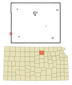 Location within Cloud County and Kansas | |
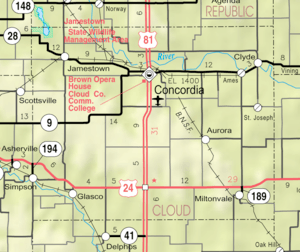 KDOT map of Cloud County (legend) | |
| Coordinates: 39°23′4″N 97°55′56″W / 39.38444°N 97.93222°WCoordinates: 39°23′4″N 97°55′56″W / 39.38444°N 97.93222°W | |
| Country | United States |
| State | Kansas |
| Counties | Mitchell, Cloud |
| Government | |
| • Type | Mayor–Council |
| Area[1] | |
| • Total | 0.25 sq mi (0.65 km2) |
| • Land | 0.25 sq mi (0.65 km2) |
| • Water | 0 sq mi (0 km2) |
| Elevation | 1,332 ft (406 m) |
| Population (2010)[2] | |
| • Total | 86 |
| • Estimate (2016)[3] | 84 |
| • Density | 340/sq mi (130/km2) |
| Time zone | UTC-6 (Central (CST)) |
| • Summer (DST) | UTC-5 (CDT) |
| ZIP code | 67478 |
| Area code | 785 |
| FIPS code | 20-65650 [4] |
| GNIS ID | 0475977 [5] |
Simpson is a city in Cloud and Mitchell counties in Kansas, United States. As of the 2010 census, the city population was 86.[6]
History
Simpson was originally called Brittsville, and under the latter name had its start in 1871 when a mill opened at the site.[7] The present name was adopted in 1882 in honor of Alfred Simpson, an original landowner.[8][9]
The first post office at Brittsville, established in June 1874, was renamed Simpson in April 1882.[10]
Geography
Simpson is located at 39°23′04″N 97°55′56″W / 39.384460°N 97.932291°W (39.384460, -97.932291).[11] According to the United States Census Bureau, the city has a total area of 0.25 square miles (0.65 km2), all of it land.[1]
Demographics
| Historical population | |||
|---|---|---|---|
| Census | Pop. | %± | |
| 1910 | 211 | — | |
| 1920 | 295 | 39.8% | |
| 1930 | 273 | −7.5% | |
| 1940 | 235 | −13.9% | |
| 1950 | 234 | −0.4% | |
| 1960 | 154 | −34.2% | |
| 1970 | 131 | −14.9% | |
| 1980 | 123 | −6.1% | |
| 1990 | 107 | −13.0% | |
| 2000 | 114 | 6.5% | |
| 2010 | 86 | −24.6% | |
| Est. 2016 | 84 | [3] | −2.3% |
| U.S. Decennial Census | |||
2010 census
As of the census[2] of 2010, there were 86 people, 36 households, and 26 families residing in the city. The population density was 344.0 inhabitants per square mile (132.8/km2). There were 61 housing units at an average density of 244.0 per square mile (94.2/km2). The racial makeup of the city was 98.8% White and 1.2% from two or more races.
There were 36 households of which 27.8% had children under the age of 18 living with them, 63.9% were married couples living together, 2.8% had a female householder with no husband present, 5.6% had a male householder with no wife present, and 27.8% were non-families. 22.2% of all households were made up of individuals and 13.9% had someone living alone who was 65 years of age or older. The average household size was 2.39 and the average family size was 2.69.
The median age in the city was 45.5 years. 20.9% of residents were under the age of 18; 5.9% were between the ages of 18 and 24; 23.3% were from 25 to 44; 36.1% were from 45 to 64; and 14% were 65 years of age or older. The gender makeup of the city was 52.3% male and 47.7% female.
2000 census
As of the census[4] of 2000, there were 114 people, 46 households, and 33 families residing in the city. The population density was 475.3 people per square mile (183.4/km2). There were 58 housing units at an average density of 241.8 per square mile (93.3/km2). The racial makeup of the city was 100.00% White.
There were 46 households out of which 34.8% had children under the age of 18 living with them, 65.2% were married couples living together, 4.3% had a female householder with no husband present, and 26.1% were non-families. 23.9% of all households were made up of individuals and 10.9% had someone living alone who was 65 years of age or older. The average household size was 2.48 and the average family size was 2.94.
In the city, the population was spread out with 27.2% under the age of 18, 7.0% from 18 to 24, 28.1% from 25 to 44, 15.8% from 45 to 64, and 21.9% who were 65 years of age or older. The median age was 38 years. For every 100 females, there were 93.2 males. For every 100 females age 18 and over, there were 107.5 males.
The median income for a household in the city was $25,938, and the median income for a family was $29,375. Males had a median income of $26,607 versus $12,917 for females. The per capita income for the city was $12,868. There were 15.2% of families and 18.8% of the population living below the poverty line, including 50.0% of under eighteens and 10.5% of those over 64.
Education
Simpson is served by USD 273 Beloit.[12]
Simpson schools were closed through school unification. The Simpson High School mascot was Simpson Coyotes.[13]
References
- 1 2 "US Gazetteer files 2010". United States Census Bureau. Archived from the original on 2012-01-24. Retrieved 2012-07-06.
- 1 2 "American FactFinder". United States Census Bureau. Retrieved 2012-07-06.
- 1 2 "Population and Housing Unit Estimates". Retrieved June 9, 2017.
- 1 2 "American FactFinder". United States Census Bureau. Retrieved 2008-01-31.
- ↑ "US Board on Geographic Names". United States Geological Survey. 2007-10-25. Retrieved 2008-01-31.
- ↑ "2010 City Population and Housing Occupancy Status". U.S. Census Bureau. Retrieved July 31, 2011.
- ↑ "Origin of Town Names" (PDF). Solomon Valley Highway 24 Heritage Alliance. p. 1. Retrieved 9 April 2018.
- ↑ Kansas State Historical Society (1916). Biennial Report of the Board of Directors of the Kansas State Historical Society. Kansas State Printing Plant. p. 241.
- ↑ Blackmar, Frank Wilson (1912). Kansas: A Cyclopedia of State History, Volume 2. Standard Publishing Company. p. 697.
- ↑ "Kansas Post Offices, 1828-1961 (archived)". Kansas Historical Society. Archived from the original on October 9, 2013. Retrieved 15 June 2014.
- ↑ "US Gazetteer files: 2010, 2000, and 1990". United States Census Bureau. 2011-02-12. Retrieved 2011-04-23.
- ↑ "USD 273 Beloit". USD 273. Retrieved 8 January 2017.
- ↑ "Simpson Gets Past Ada", The Salina Journal, 7 March 1954, p.20.
External links
| Wikimedia Commons has media related to Simpson, Kansas. |
- City
- Historical
- Historic Images - Wichita State University Libraries
- Schools
- USD 273, local school district
- Maps
- Simpson City Map, KDOT
Municipalities and communities of Cloud County, Kansas, United States | ||
|---|---|---|
| Cities |  | |
| Unincorporated communities | ||
| Townships | ||
| Footnotes | ‡This populated place also has portions in an adjacent county or counties | |
Municipalities and communities of Mitchell County, Kansas, United States | ||
|---|---|---|
| Cities |  | |
| CDP | ||
| Unincorporated community | ||
| Ghost towns | ||
| Townships |
| |
| Footnotes | ‡This populated place also has portions in an adjacent county or counties | |