Morland, Kansas
| Morland, Kansas | |
|---|---|
| City | |
.jpg) Morland Community Foundation Inc building (2017) | |
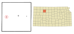 Location within Graham County and Kansas | |
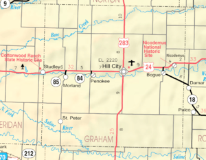 KDOT map of Graham County (legend) | |
| Coordinates: 39°20′56″N 100°4′29″W / 39.34889°N 100.07472°WCoordinates: 39°20′56″N 100°4′29″W / 39.34889°N 100.07472°W | |
| Country | United States |
| State | Kansas |
| County | Graham |
| Area[1] | |
| • Total | 0.47 sq mi (1.22 km2) |
| • Land | 0.47 sq mi (1.22 km2) |
| • Water | 0 sq mi (0 km2) |
| Elevation | 2,303 ft (702 m) |
| Population (2010)[2] | |
| • Total | 154 |
| • Estimate (2016)[3] | 152 |
| • Density | 330/sq mi (130/km2) |
| Time zone | UTC-6 (Central (CST)) |
| • Summer (DST) | UTC-5 (CDT) |
| ZIP code | 67650 |
| Area code(s) | 785 |
| FIPS code | 20-48275 [4] |
| GNIS feature ID | 0471296 [5] |
Morland is a city in Graham County, Kansas, in the United States. As of the 2010 census, the city population was 154.[6] Morland was named for a railroad employee.[7]
History
Morland was originally called Fremont, and under the latter name was founded in 1884, and named after John C. Fremont.[8] In order to avoid repetition with another Kansas community named "Fremont", the name was changed to "Kalula" in 1888, and was changed yet again to "Morland" in 1892.[8]
Geography
Morland is located at 39°20′56″N 100°4′29″W / 39.34889°N 100.07472°W (39.348828, -100.074821).[9] According to the United States Census Bureau, the city has a total area of 0.47 square miles (1.22 km2), all of it land.[1]
Demographics
| Historical population | |||
|---|---|---|---|
| Census | Pop. | %± | |
| 1910 | 237 | — | |
| 1920 | 296 | 24.9% | |
| 1930 | 385 | 30.1% | |
| 1940 | 356 | −7.5% | |
| 1950 | 287 | −19.4% | |
| 1960 | 317 | 10.5% | |
| 1970 | 300 | −5.4% | |
| 1980 | 223 | −25.7% | |
| 1990 | 234 | 4.9% | |
| 2000 | 164 | −29.9% | |
| 2010 | 154 | −6.1% | |
| Est. 2016 | 152 | [3] | −1.3% |
| U.S. Decennial Census | |||
2010 census
As of the census[2] of 2010, there were 154 people, 77 households, and 47 families residing in the city. The population density was 327.7 inhabitants per square mile (126.5/km2). There were 89 housing units at an average density of 189.4 per square mile (73.1/km2). The racial makeup of the city was 95.5% White, 1.9% Native American, and 2.6% from two or more races.
There were 77 households of which 20.8% had children under the age of 18 living with them, 51.9% were married couples living together, 6.5% had a female householder with no husband present, 2.6% had a male householder with no wife present, and 39.0% were non-families. 32.5% of all households were made up of individuals and 11.7% had someone living alone who was 65 years of age or older. The average household size was 2.00 and the average family size was 2.49.
The median age in the city was 51 years. 14.9% of residents were under the age of 18; 6.4% were between the ages of 18 and 24; 13.5% were from 25 to 44; 38.2% were from 45 to 64; and 26.6% were 65 years of age or older. The gender makeup of the city was 47.4% male and 52.6% female.
2000 census
As of the census[4] of 2000, there were 164 people, 70 households, and 48 families residing in the city. The population density was 347.4 people per square mile (134.7/km²). There were 94 housing units at an average density of 199.1 per square mile (77.2/km²). The racial makeup of the city was 98.17% White, 1.22% Native American and 0.61% Asian.
There were 70 households out of which 25.7% had children under the age of 18 living with them, 62.9% were married couples living together, 5.7% had a female householder with no husband present, and 31.4% were non-families. 27.1% of all households were made up of individuals and 15.7% had someone living alone who was 65 years of age or older. The average household size was 2.34 and the average family size was 2.81.
In the city, the population was spread out with 24.4% under the age of 18, 3.0% from 18 to 24, 28.7% from 25 to 44, 26.2% from 45 to 64, and 17.7% who were 65 years of age or older. The median age was 41 years. For every 100 females, there were 97.6 males. For every 100 females age 18 and over, there were 100.0 males.
The median income for a household in the city was $32,917, and the median income for a family was $41,250. Males had a median income of $17,250 versus $21,250 for females. The per capita income for the city was $17,060. About 10.2% of families and 11.4% of the population were below the poverty line, including 19.4% of those under the age of eighteen and none of those sixty five or over.
Education
Morland is a part of USD 281 Graham County.[10]
Morland schools were closed through school unification. The Morland High School mascot was Morland Tigers.[11] The Morland Tigers won the Kansas State High School class 1A volleyball championship in 1974 and 1975.[12]
References
- 1 2 "US Gazetteer files 2010". United States Census Bureau. Archived from the original on 2012-01-24. Retrieved 2012-07-06.
- 1 2 "American FactFinder". United States Census Bureau. Retrieved 2012-07-06.
- 1 2 "Population and Housing Unit Estimates". Retrieved June 9, 2017.
- 1 2 "American FactFinder". United States Census Bureau. Retrieved 2008-01-31.
- ↑ "US Board on Geographic Names". United States Geological Survey. 2007-10-25. Retrieved 2008-01-31.
- ↑ "2010 City Population and Housing Occupancy Status". U.S. Census Bureau. Retrieved September 14, 2011.
- ↑ "Profile for Morland, Kansas". ePodunk. Retrieved 10 June 2014.
- 1 2 "Origin of Town Names" (PDF). Solomon Valley Highway 24 Heritage Alliance. p. 5. Retrieved 9 April 2018.
- ↑ "US Gazetteer files: 2010, 2000, and 1990". United States Census Bureau. 2011-02-12. Retrieved 2011-04-23.
- ↑ "Graham County USD 281". USD 281. Retrieved 6 January 2017.
- ↑ "Morland Tigers", Hays Daily News, 11 September 1975, p.15.
- ↑ "Volleyball". KSHSAA. Retrieved 3 January 2017.
External links
| Wikimedia Commons has media related to Morland, Kansas. |
- City
- Historical Images
- Historic Images - Wichita State University Libraries
- Schools
- USD 281, local school district
- Maps
- Morland City Map, KDOT
Municipalities and communities of Graham County, Kansas, United States | ||
|---|---|---|
| Cities | 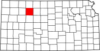 | |
| Unincorporated communities | ||
| Ghost towns | ||
| Townships | ||