Little River, Kansas
| Little River, Kansas | |
|---|---|
| City | |
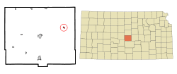 Location within Rice County and Kansas | |
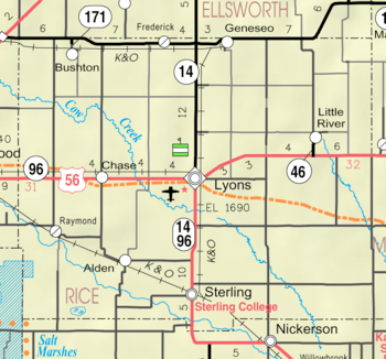 KDOT map of Rice County (legend) | |
| Coordinates: 38°23′50″N 98°0′41″W / 38.39722°N 98.01139°WCoordinates: 38°23′50″N 98°0′41″W / 38.39722°N 98.01139°W | |
| Country | United States |
| State | Kansas |
| County | Rice |
| Township | Union |
| Area[1] | |
| • Total | 0.44 sq mi (1.14 km2) |
| • Land | 0.44 sq mi (1.14 km2) |
| • Water | 0 sq mi (0 km2) |
| Elevation | 1,608 ft (490 m) |
| Population (2010)[2] | |
| • Total | 557 |
| • Estimate (2016)[3] | 536 |
| • Density | 1,300/sq mi (490/km2) |
| Time zone | UTC-6 (Central (CST)) |
| • Summer (DST) | UTC-5 (CDT) |
| ZIP code | 67457 |
| Area code | 620 |
| FIPS code | 20-41575 [4] |
| GNIS feature ID | 0475684 [5] |
Little River is a city in Rice County, Kansas, United States. As of the 2010 census, the city population was 557.[6]
History
For millennia, the land now known as Kansas was inhabited by Native Americans. In 1803, most of modern Kansas was secured by the United States as part of the Louisiana Purchase. In 1854, the Kansas Territory was organized, then in 1861 Kansas became the 34th U.S. state. In 1867, Rice County was founded.
Little River was founded in 1880.[7] The town was named from its situation upon the Little Arkansas River.[8]
In 1878, Atchison, Topeka and Santa Fe Railway and parties from Marion and McPherson counties chartered the Marion and McPherson Railway Company.[9] In 1879, a branch line was built from Florence to McPherson; in 1880 it was extended to Lyons and in 1881 it was extended to Ellinwood.[10] The line was leased and operated by the Atchison, Topeka and Santa Fe Railway. The line from Florence to Marion, was abandoned in 1968.[11] In 1992, the line from Marion to McPherson was sold to Central Kansas Railway. In 1993, after heavy flood damage, the line from Marion to McPherson was abandoned. The original branch line connected Florence, Marion, Canada, Hillsboro, Lehigh, Canton, Galva, McPherson, Conway, Windom, Little River, Mitchell, Lyons, Chase and Ellinwood.
Geography
Little River is located at 38°23′50″N 98°0′41″W / 38.39722°N 98.01139°W (38.397217, -98.011489).[12] According to the United States Census Bureau, the city has a total area of 0.44 square miles (1.14 km2), all land.[1]
Demographics
| Historical population | |||
|---|---|---|---|
| Census | Pop. | %± | |
| 1890 | 340 | — | |
| 1900 | 457 | 34.4% | |
| 1910 | 661 | 44.6% | |
| 1920 | 749 | 13.3% | |
| 1930 | 618 | −17.5% | |
| 1940 | 603 | −2.4% | |
| 1950 | 635 | 5.3% | |
| 1960 | 552 | −13.1% | |
| 1970 | 493 | −10.7% | |
| 1980 | 529 | 7.3% | |
| 1990 | 496 | −6.2% | |
| 2000 | 536 | 8.1% | |
| 2010 | 557 | 3.9% | |
| Est. 2016 | 536 | [3] | −3.8% |
| U.S. Decennial Census | |||
2010 census
As of the census[2] of 2010, there were 557 people, 207 households, and 136 families residing in the city. The population density was 1,265.9 inhabitants per square mile (488.8/km2). There were 246 housing units at an average density of 559.1 per square mile (215.9/km2). The racial makeup of the city was 98.2% White, 0.7% Native American, 0.4% from other races, and 0.7% from two or more races. Hispanic or Latino of any race were 1.6% of the population.
There were 207 households of which 35.3% had children under the age of 18 living with them, 50.7% were married couples living together, 9.2% had a female householder with no husband present, 5.8% had a male householder with no wife present, and 34.3% were non-families. 31.4% of all households were made up of individuals and 15% had someone living alone who was 65 years of age or older. The average household size was 2.53 and the average family size was 3.20.
The median age in the city was 37.2 years. 28.9% of residents were under the age of 18; 5.3% were between the ages of 18 and 24; 25.9% were from 25 to 44; 19.5% were from 45 to 64; and 20.5% were 65 years of age or older. The gender makeup of the city was 47.9% male and 52.1% female.
2000 census
As of the census[4] of 2000, there were 536 people, 202 households, and 131 families residing in the city. The population density was 1,648.0 people per square mile (627.1/km²). There were 234 housing units at an average density of 719.5 per square mile (273.8/km²). The racial makeup of the city was 97.39% White, 0.37% from other races, and 2.24% from two or more races. Hispanic or Latino of any race were 1.31% of the population.
There were 202 households out of which 31.2% had children under the age of 18 living with them, 54.0% were married couples living together, 7.9% had a female householder with no husband present, and 35.1% were non-families. 33.2% of all households were made up of individuals and 20.3% had someone living alone who was 65 years of age or older. The average household size was 2.40 and the average family size was 3.02.
In the city, the population was spread out with 25.9% under the age of 18, 6.5% from 18 to 24, 24.3% from 25 to 44, 17.0% from 45 to 64, and 26.3% who were 65 years of age or older. The median age was 40 years. For every 100 females, there were 81.7 males. For every 100 females age 18 and over, there were 73.4 males.
The median income for a household in the city was $30,066, and the median income for a family was $33,125. Males had a median income of $26,000 versus $20,833 for females. The per capita income for the city was $13,619. About 16.0% of families and 16.8% of the population were below the poverty line, including 24.6% of those under age 18 and 8.1% of those age 65 or over.
Education
Little River is served by USD 444 Little River-Windom.[13]
Sports
The Little River Redskins have won the following Kansas State High School championships:
- 1970 Football - Class 1A [14]
- 1971 Football - Class 1A [14]
- 1974 Boys Basketball - Class 1A [15]
- 1976 Girls Track & Field - Class 1A [16]
- 1976 Girls Track & Field (Indoor) - Class 1A [16]
- 1977 Girls Track & Field - Class 1A [16]
- 1978 Girls Track & Field (Indoor) - Class 1A [16]
- 1979 Girls Track & Field - Class 1A [16]
- 1981 Football - Class 1A [14]
- 1984 Girls Volleyball - Class 2A [17]
- 1995 Girls Basketball - Class 1A [15]
- 1996 Football - Class 8-Man DI [14]
- 1996 Girls Basketball - Class 1A [15]
- 1997 Girls Basketball - Class 1A [15]
- 1998 Girls Basketball - Class 1A [15]
- 1999 Football - Class 8-Man DI [14]
See also
References
- 1 2 "US Gazetteer files 2010". United States Census Bureau. Archived from the original on 2012-07-14. Retrieved 2012-07-06.
- 1 2 "American FactFinder". United States Census Bureau. Retrieved 2012-07-06.
- 1 2 "Population and Housing Unit Estimates". Retrieved June 9, 2017.
- 1 2 "American FactFinder". United States Census Bureau. Retrieved 2008-01-31.
- ↑ "US Board on Geographic Names". United States Geological Survey. 2007-10-25. Retrieved 2008-01-31.
- ↑ "2010 City Population and Housing Occupancy Status". U.S. Census Bureau. Archived from the original on July 21, 2011. Retrieved September 26, 2011.
- ↑ Blackmar, Frank Wilson (1912). Kansas: A Cyclopedia of State History, Volume 2. Standard Publishing Company. p. 177.
- ↑ Kansas State Historical Society (1916). Biennial Report of the Board of Directors of the Kansas State Historical Society. Kansas State Printing Plant. p. 273.
- ↑ Marion County Kansas : Past and Present; Sondra Van Meter; MB Publishing House; LCCN 72-92041; 344 pages; 1972.
- ↑ Fourth Annual Report of the Board of Railroad Commissioners for the Year Ending December 1, 1886 in State of Kansas; Kansas Publishing House; 1886.
- ↑ Railway Abandonment 1968
- ↑ "US Gazetteer files: 2010, 2000, and 1990". United States Census Bureau. 2011-02-12. Retrieved 2011-04-23.
- ↑ "http://usd444.ss5.sharpschool.com/". USD 444. Retrieved 7 January 2017. External link in
|title=(help) - 1 2 3 4 5 "Football". KSHSAA. Retrieved 3 January 2017.
- 1 2 3 4 5 "Basketball". KSHSAA. Retrieved 3 January 2017.
- 1 2 3 4 5 "Track & Field". KSHSAA. Retrieved 6 January 2017.
- ↑ "Volleyball". KSHSAA. Retrieved 3 January 2017.
Further reading
External links
| Wikimedia Commons has media related to Little River, Kansas. |
- City
- Schools
- USD 444, local school district
- Maps
- Little River City Map, KDOT
Municipalities and communities of Rice County, Kansas, United States | ||
|---|---|---|
| Cities | 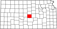 | |
| Unincorporated communities | ||
| Townships | ||