Vassar, Kansas
| Vassar, Kansas | |
|---|---|
| Unincorporated community | |
 KDOT map of Osage County (legend) | |
 Vassar  Vassar | |
| Coordinates: 38°38′50″N 95°37′21″W / 38.64722°N 95.62250°WCoordinates: 38°38′50″N 95°37′21″W / 38.64722°N 95.62250°W[1] | |
| Country | United States |
| State | Kansas |
| County | Osage |
| Elevation[1] | 1,106 ft (337 m) |
| Time zone | UTC-6 (CST) |
| • Summer (DST) | UTC-5 (CDT) |
| ZIP code | 66543 |
| Area code | 785 |
| FIPS code | 20-73450 [1] |
| GNIS ID | 479316 [1] |
Vassar is an unincorporated community and census-designated place (CDP) in Osage County, Kansas, United States.[1] It is located along a former railroad 4 miles (6.4 km) northeast of Lyndon, also about 1 mile south of Pomona Lake.
History
A post office was opened in La Mont's Hill (an extinct town) in 1871, but it was moved to Vassar in 1887.[2] Vassar still has a post office with ZIP code 66543.[3]
Climate
The climate in this area is characterized by hot, humid summers and generally mild to cool winters. According to the Köppen Climate Classification system, Vassar has a humid subtropical climate, abbreviated "Cfa" on climate maps.[4]
See also
References
- 1 2 3 4 5 Geographic Names Information System (GNIS) details for Vassar, Kansas; United States Geological Survey (USGS); October 13, 1978.
- ↑ "Kansas Post Offices, 1828-1961". Kansas Historical Society. Archived from the original on October 9, 2013. Retrieved 22 June 2014.
- ↑ ZIP Code Lookup
- ↑ Climate Summary for Vassar, Kansas
External links
Municipalities and communities of Osage County, Kansas, United States | ||
|---|---|---|
| Cities | 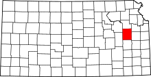 | |
| CDP | ||
| Unincorporated communities | ||
| Townships |
| |
This article is issued from
Wikipedia.
The text is licensed under Creative Commons - Attribution - Sharealike.
Additional terms may apply for the media files.