Jaipur district
| Jaipur district जयपुर जिला | |
|---|---|
| District of Rajasthan | |
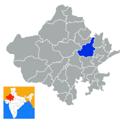 Location of Jaipur district in Rajasthan | |
| Country | India |
| State | Rajasthan |
| Administrative division | Jaipur Division |
| Headquarters | Jaipur |
| Tehsils | 16[1] |
| Government | |
| • District collector | Siddharth Mahajan |
| • Assembly seats | [2] |
| Area | |
| • Total | 11,152 km2 (4,306 sq mi) |
| Population (2011) | |
| • Total | 6,663,971[3] |
| Demographics | |
| • Literacy | 76% |
| • Sex ratio | 910 |
| Major highways | National Highway 11 (NH-11), National Highway 8 (NH-8) |
| Coordinates | 26°55′34″N 75°49′25″E / 26.926°N 75.8235°ECoordinates: 26°55′34″N 75°49′25″E / 26.926°N 75.8235°E |
| Average annual precipitation | 459.8 mm |
| Website | Official website |
Jaipur District is a district of the state of Rajasthan in Northern India. The city of Jaipur, which is Rajasthan's capital and largest city, is the district headquarters. It is the tenth most populous district in India (out of 640).[4]
Divisions
Being the state capital, Jaipur has a Legislative Assembly. There 13 Sub-divisions in district are:
- Jaipur
- Amber
- Bassi
- Chaksu
- Chomu
- Mauzmabad
- Jamwa Ramgarh
- Phagi
- Phulera
- Kotputli
- Sanganer
- Shahpura
- Viratnagar
Panchayat Samitis are:
- Amber
- Bassi
- Chaksu
- Govindgarh
- Dudu
- Jamwa Ramgarh
- Phagi
- Sambhar
- Jhotwara
- Kotputli
- Shahpura
- Sanganer
- Viratnagar
Tehsils are:
- Amber
- Bassi
- Chaksu
- Chomu
- Dudu
- Jamwa Ramgarh
- Phagi
- Sambhar
- Jaipur
- Kotputli
- Shahpura
- Sanganer
- Viratnagar
| Sub-divisions | 13 |
| Tehsil | 13 |
| Villages | 2369 |
| Panchayat Samiti (Block) | 13 |
| Gram Panchayat | 489 |
| Nagar Palika | 10 |
| Nagar Nigam | 1 |
Demographics
According to the 2011 census Jaipur district has a population of 6,663,971,[4] roughly equal to the nation of Libya[5] or the US state of Washington.[6] This gives it a ranking of 10th in India (out of a total of 640).[4] The district has a population density of 598 inhabitants per square kilometre (1,550/sq mi).[4] Its population growth rate over the decade 2001-2011 was 26.91%.[4] Jaipur has a sex ratio of 909 females for every 1000 males,[4] and a literacy rate of 76.44%.[4]
Culture
Notable personalities
- Hemant Shesh (1952- ) Writer and civil servant. Born in Jaipur.[7]
| Climate data for Jaipur | |||||||||||||
|---|---|---|---|---|---|---|---|---|---|---|---|---|---|
| Month | Jan | Feb | Mar | Apr | May | Jun | Jul | Aug | Sep | Oct | Nov | Dec | Year |
| Record high °C (°F) | 30 (86) |
32 (90) |
40 (104) |
43 (109) |
45 (113) |
43 (109) |
45 (113) |
39 (102) |
39 (102) |
38 (100) |
37 (99) |
32 (90) |
45 (113) |
| Average high °C (°F) | 23 (73) |
26 (79) |
32 (90) |
37 (99) |
40 (104) |
40 (104) |
34 (93) |
32 (90) |
33 (91) |
33 (91) |
29 (84) |
24 (75) |
32 (89) |
| Average low °C (°F) | 8 (46) |
11 (52) |
16 (61) |
21 (70) |
25 (77) |
27 (81) |
26 (79) |
24 (75) |
23 (73) |
19 (66) |
13 (55) |
9 (48) |
19 (65) |
| Record low °C (°F) | 1 (34) |
0 (32) |
5 (41) |
12 (54) |
17 (63) |
21 (70) |
16 (61) |
20 (68) |
19 (66) |
10 (50) |
6 (43) |
3 (37) |
0 (32) |
| Average precipitation mm (inches) | 8 (0.31) |
12 (0.47) |
6 (0.24) |
4 (0.16) |
16 (0.63) |
66 (2.6) |
216 (8.5) |
231 (9.09) |
80 (3.15) |
23 (0.91) |
3 (0.12) |
3 (0.12) |
668 (26.3) |
| Source: BBC Weather | |||||||||||||
See also
- Dravati River, Amanishah ka Nallah
References
- ↑ "Sub-Divisions/Panchayat Samitis/Tehsils". 2016. Retrieved 2016-12-29.
- ↑ "Assembly Constituencies of Jaipur district" (PDF). gisserver1.nic.in/. 2012. Retrieved 28 February 2012.
- ↑ "Name Census 2011, Rajasthan data" (PDF). censusindia.gov.in. 2012. Retrieved 2012-12-29.
- 1 2 3 4 5 6 7 "District Census 2011". Census2011.co.in. 2011. Retrieved 30 September 2011.
- ↑ US Directorate of Intelligence. "Country Comparison:Population". Retrieved 1 October 2011.
Libya 6,597,960
- ↑ "2010 Resident Population Data". U. S. Census Bureau. Archived from the original on 19 October 2013. Retrieved 30 September 2011.
Washington 6,724,540
- ↑ "हेमंत को बिरला फाउंडेशन के बिहारी पुरस्कार". Dainik Jagran (in Hindi). Jagran Prakashan Ltd. Retrieved 8 September 2011.
External links
Places adjacent to Jaipur district | |
|---|---|
| Outline |  | ||||||||||||||
|---|---|---|---|---|---|---|---|---|---|---|---|---|---|---|---|
| Governance | |||||||||||||||
| Divisions and districts |
| ||||||||||||||
| Major cities | |||||||||||||||
| Related templates |
| ||||||||||||||