Sadulshahar
| Sadulshahar Mateeli | |
|---|---|
| town | |
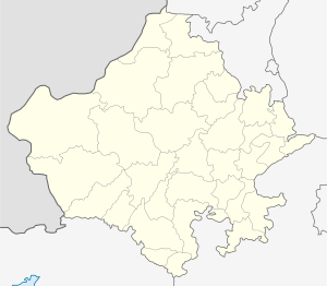
 Sadulshahar Location in Rajasthan, India  Sadulshahar Sadulshahar (India) | |
| Coordinates: 29°56′36″N 74°11′15″E / 29.9434°N 74.1875°ECoordinates: 29°56′36″N 74°11′15″E / 29.9434°N 74.1875°E | |
| Country |
|
| State | Rajasthan |
| District | Ganganagar |
| Tehsil | Sadulshahar |
| Government | |
| • Body | Nagar Palika |
| Population (2011)[1] | |
| • Total | 50,588 |
| Time zone | UTC+5:30 (IST) |
| ISO 3166 code | RJ-IN |
Sadulshahar is a town and a municipality[2] in Ganganagar district in the Indian state of Rajasthan.
History
It is named after Maharaja Sardul Singh, son of Maharaja Ganga Singh, who established it. It is a great agriculture based industry center in Rajasthan. This town is situated on the border of India and Pakistan. Even though India and Pakistan do not share a very good relationship, it is a peaceful town Sriganganagar which was part of the Bikaner State before Independence. According to the people, a large village named "Matili" was transformed into Sadulshahar after 1947.
It was under the supervision of the 19-year-old Maharaja Ganga Singh who after witnessing the miseries of the great 1899 famine, vowed to end starvation by building a canal in his State. The British pussyfooted, refusing water rights from the Sutlej River in Punjab. Ganga Singh persevered and raised a loan of 15 million for his irrigation scheme. The Ganges Canal, begun in 1921, was completed in 1927. One of the longest concrete lined canals in the world, it has changed the desert's face around Ganganagar. It's a testimony to land transformation: Desert land was converted to a lush green town credited to the efforts of the Maharaja who brought the Gang canal which carries the excess waters of Punjab and Himachal Pradesh to the region. Bumper crops of wheat, cotton, mustard and citrus fruit have generated industry and a building boom. Majority in population are Sikhs and Hindus while only a few people constituting other sects stay here. In Chak Sohanewala (चक सोहनेवाला) village 100% population related to sikh community.
==Demographics==. In the 2001 India census, Sadulshahar (Sardul Shahar) recorded a population of 22,326.[3] Males constituted 53% of the population and females 47%. Sadulshahar had an average literacy rate of 62%, higher than the national average of 59.5%: male literacy was 69%, and female literacy was 53%. In 2001 in Sadulshahar, 14% of the population was under 6 years of age.[4]
Transport
The town is well connected through railroad on the Sri Ganganagar-Hanuman Garh (Rajgarh)-Jaipur line, and through state highways to Haryana (Sangria-Dawwali-Sirsa) and Sadulshahar- Malout Punjab and (Abohar-Hanuman Garh) in the neighboring ==SHREE GOSHALA SAMITI SADUL SHAHAR . VERY FINE MOVMENT IN SADUL SHAHAR WITH PARK , SATSANG BAWAN , SHIV TEMPEL , KRISHNA TEMPEL , VATNARY HOSPITAL , AND MANY COW SHED . JUST LIKE RESORT , PICNIC SPOT . VISIT GOSHALA WEBSITE -- SADULSHAHAR.ORG
References
- ↑ "Census of India Search details". censusindia.gov.in. Retrieved 10 May 2015.
- ↑ Sadulshahar was grandfathered in as a nagar palika, even though its population was well below 100,000.
- ↑ "Census of India 2001: Alphabetical List of Towns and Their Population: Rajasthan" (PDF). Registrar General & Census Commissioner, India. p. 7. Archived (PDF) from the original on 24 November 2007.
- ↑ "Census of India 2001: Data from the 2001 Census, including cities, villages and towns (Provisional)". Census Commission of India. Archived from the original on 2004-06-16. Retrieved 2008-11-01.