Neem-Ka-Thana
| Neem Ka Thana torawati kings | |
|---|---|
| Tahsil | |
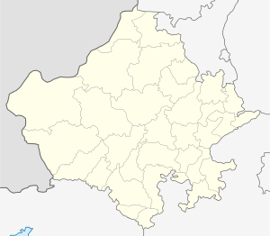
 Neem Ka Thana Location in Rajasthan, India | |
| Coordinates: 27°44′06″N 75°46′47″E / 27.735018°N 75.779730°ECoordinates: 27°44′06″N 75°46′47″E / 27.735018°N 75.779730°E | |
| Country | India |
| State | Rajasthan |
| District | Sikar |
| Tehsil | Neem Ka Thana |
| Government | |
| • M.L.A. | Prem Singh Bajor |
| Elevation | 446 m (1,463 ft) |
| Population | |
| • Total | 9,99,000 |
| Languages | |
| • Official | Hindi |
| • Spoken | Ahirwati & torawati |
| Time zone | UTC+5:30 (IST) |
| PIN | 332713 |
| ISO 3166 code | RJ-IN |
| Website | sikar.nic.in |
Neem Ka Thana is a tehsil in Sikar district in the Rajasthan state of India. It is one of the six tehsils of the district.
Demographics
As of 2001 Indian census,[1] Neem-Ka-Thana had a population 2,36.223 Males constitute 53% of the population and females 47%. 16% of the population is under 6 years of age. It has an average literacy rate of 67%, higher than the national average of 59.5%. Male literacy is 77%, and female literacy is 56%. Neem ka thana is an important commercial center of Shekhawati region of Rajasthan. The total area of the current neem ka thana station Municipality in 1016 hectares (according to 2015).
Chhawni is situated 2.5 km from Neem ka Thana. Many Doctors, C.A. and Advocates are from Chhawni.and heera nagar
History
In 1500 AD, Raja Prithviraj Singh II of Sikar granted the governance of Neem-Ka Thana to his third son, Raja Fateh Singh. Later, on the death of his eldest brother, Raja Bhojaraj Singh (1506-1514) he was chosen as next ruler of Sikar (1514-1526).
- Raja Fateh Singh (1500–1514}
Subdivisions
According to the 2011 Indian census, Neem-Ka-Thana tehsil is home to two towns, Neem-Ka-Thana Municipality (population 2,36,231) and Guhala Census Town (population 6,343), and 192 villages:[2]
- Aagri
- Agawari
- Ajmeri
- Antala
- Avinashi
- Baghpat Nagar
- Bagrawa
- Bagwala
- Bakshipura
- Ballabh Das Pura
- Balloopura
- Bandhawala
- Baniyala
- Baniyala Nagar
- Barsinghwas
- Basri Kalan
- Basri Khurd
- Bega Ki Nangal
- Bhagega
- Bhagega Rs
- Bhageshwar
- Bhagoth
- Bhandala
- Bhanipura
- Bharala
- Bharupura
- Bheetarli Ganwari
- Bhitaro
- Bhojmer
- Bhomgarh
- Bhoodoli
- Bihar
- Bihari Pur
- Bopiya
- Bujiyala
- Byor
- Chak Charawas
- Chak Faganwas
- Chak Karjo
- Chak Mandoli
- Chak Ramsinghpura
- Chakkola Ki Nangal
- Chala
- Cheeplata
- Chhaja Ki Nangal
- Chhapar
- Choodla
- Dabla
- Dalpat Pura
- Dareeba
- Dayal Ki Nangal
- Deepawas
- Dehra
- Deonagar
- Dhandhela
- Dhani Aheeran
- Dhani Chala
- Dokan
- Doonga Ki Nangal
- Doongar Faganwas
- Dungarwas
- Faganwas
- Fatehpura
- Gadrata
- Ganeshwar
- Ganwali
- Ganwari
- Ghasi Pura
- Ghata Guwar
- Godawas
- Gopalgarh
- Gordhanpura
- Govindpura
- Guwar
- Haripura
- Harjan Pura
- Hasampur
- Heera Nagar
- Hemrajpura
- Hulda Ka Bas
- Imloha
- Jagat Singh Nagar
- Jaitpura
- Jassi Ka Bas
- Jat Ki Nangal
- Jatala
- Jatwas
- Jeelo
- Jhalra
- Jhamawas
- Jhankra
- Jhareenda
- Jheerana
- Jhitla
- Jitala
- Jodli
- Jugalpura
- Jyotiba Nagar
- Kachareda
- Kairwali
- Kala Khera @ Pratap Pura
- Kalakota
- Kalakota
- Kanthli
- Kanwar Ki Nagal
- Karjo
- Khadag Beejpur
- Khadra
- Khariya
- Khatkar
- Khori
- Khurdiya
- Kishanpura
- Kishor Pura
- Kishorpura
- Kola Ki Nangal
- Koliwala
- Kotra
- Kundala
- Kunwara
- Kurbara
- Kushal Pura
- Ladi Ka Bas
- Ladiya
- Lakhaki Nangal
- Luharwas
- Mahawa
- Malnagar
- Mandoli
- Mangalpura
- Mankri
- Manpura
- Maukalwas
- Mawanda Kalan
- Mawanda Khurd
- Mawanda Railway Station
- Meena Ki Nangal
- Mehta Nagar
- Mohanpura
- Mokalwas Jhareenda
- Mothooka
- Nanagwas
- Napawali
- Narayanpura
- Narda
- Narsingh Puri
- Narsinghwala
- Natha Ki Nangal
- Nathuwala
- Naya Bas
- Naya Nagar
- Neem Ka Thana
- Neemod
- Nyorana
- Palasala
- Panchoo Kharkara
- Patan
- Patel Nagar
- Peethalpur
- Peetham Puri
- Puranabas
- Raipur Jageer
- Raipur Patan
- Raiyan Ka Bas
- Rajnagar
- Rajpura
- Ramlyawas
- Rampura
- Ramsing Ki Dhani
- Ramsinghpura
- Ranasar
- Ratan Nagar
- Rela
- Roopawas
- Saidala Bhagwanpura
- Sakray
- Salawali
- Sanwal Pura Tanwran
- Sanwalpura Shekhawatan
- Sedu Ka Bas
- Shimli
- Shivnagar
- Shyalodara
- Shyam Pura
- Shyama Wali
- Sirohi
- Tatera
- Theekariya
- Tigri
- Tiwari Ka Bas
- Toda
- Udaisinghpura
Educational Institutes
Neem Ka Thana has following Educational Institutes
- American Institute of English Language (AIEL)
- American Institute of Computer Education (AICE)
- Varda College of Education
- Varda Smart School
- Varda Private Industrial Training Institute
- SEM School
- Eternal Life School
- Vivekanand senior secondary school, Industrial area
- Saroj memorial college, Sirohi nadhi
- Karmbhumi ITI
- Alpine Computer Service
- Snkp govt pg college
References
- ↑ "Census of India 2001: Data from the 2001 Census, including cities, villages and towns (Provisional)". Census Commission of India. Archived from the original on 2004-06-16. Retrieved 2008-11-01.
- ↑ http://www.census2011.co.in/data/subdistrict/556-neem-ka-thana-sikar-rajasthan.html