Pindwara
| Pindwara | |
|---|---|
| Tehsil (sub-division) | |
 Binani Cement Plant in Pindwara City | |
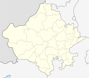
 Pindwara Location in Rajasthan, India  Pindwara Pindwara (India) | |
| Coordinates: 24°47′40″N 73°03′18″E / 24.7945°N 73.055°ECoordinates: 24°47′40″N 73°03′18″E / 24.7945°N 73.055°E | |
| Country |
|
| State | Rajasthan |
| District | Sirohi |
| Named for | Home of God |
| Government | |
| • Type | Rajasthan Government |
| • Body | Municipality |
| • Chairman | Seema Bhatia BJP |
| Area | |
| • Total | 20 km2 (8 sq mi) |
| Area rank | 3rd In Sirohi District |
| Elevation | 372 m (1,220 ft) |
| Population (2011) | |
| • Total | 24,487 |
| • Rank | 4th In Sirohi District |
| • Density | 1,200/km2 (3,200/sq mi) |
| Languages | |
| • Official | Hindi |
| Time zone | UTC+5:30 (IST) |
| PIN | 307022 |
| Telephone code | 02971 |
| ISO 3166 code | RJ-IN |
| Vehicle registration | RJ-24 RJ-38 |
| Sex ratio | 1000/908[1] ♂/♀ |
| Literacy Rate | 75.98%(2011)[1] |
| Nearest City | Sirohi , Udaipur, Abu Road , Palanpur , Falna |
| Avg. summer temperature | 37 °C (99 °F) |
| Avg. winter temperature | 5 °C (41 °F) |
| Avg. Rainfall | 1665 MM |
Pindwara is a town in Sirohi district of Rajasthan, India. Pindwara is located about 24 km from Sirohi, 50 km from Abu Road, 100 km from Udaipur and 70 km from Mount Abu. The nearest airport is Udaipur.
The cement and Marble industry is the major industry of the area. JK Lakshmi Cement Ltd and Binani Cement are two large cement units based in the area. The our railway station is pindwara -a station on Delhi Ahmedabad rail route and is at the edge of Pindwara town. Abu Road railway station is 55 km away. Many of the locals of the town have settled all across the country like in Mumbai, Ahmedabad, Surat, Karnataka, Andhra Pradesh etc. Ancient temple of Lord Mahavir by Samprati Maharaja is situated in the middle of the city. An ancient temple dedicated to Shiva known as th eGopeshwarji Mahadev Temple is around 3 km from Pindwara. Another ancient temple dedicated to Lord Shiva known as Markundeshawar (situated in Ajari village) is around 2 km from Pindwara.
Pindwara is located near many tribal villages. The town is famous for its marble carving works. Marble carvings of Sri Ram Temple, Ayodhya are being carried out in the town.
Geography
Pindwara is located at 24°47′40″N 73°03′18″E / 24.7945°N 73.055°E.[2] It has an average elevation of 372 metres (1220 feet). It is about 100 km from Udaipur and 240 km from Ahmedabad.
Demographics
As of the 2011 India census,[3] Pindwara had a population of 24487. Males constitute 52.40% of the population and females 47.60%. Pindwara has an average literacy rate of 75.98%, higher than the state average of 66.11%. 88.86% of the males and 61.84% of females are literate. 13.93% of the population is under 6 years of age. Religious population of Pindwara is 88.56% Hindu, 7.55% Muslim, 0.05% Christian, 0.08% Sikh, 3.68% Jain, and 0.03% Not Stated.
| Year | Population |
|---|---|
| 1991 | 15,185 |
| 2001 | 20,765 |
| 2011 | 24,487 |
Source:[4]
Climate
Pindwara is influenced by the local steppe climate. The warmest month of the year is May, with an average temperature of 32.7 °C. The lowest average temperatures in the year occur in January, when it is around 17.5 °C. The average annual temperature in Pindwara is 25.5 °C. The rainfall here averages 683 mm.
| Climate data for Pindwara | |||||||||||||
|---|---|---|---|---|---|---|---|---|---|---|---|---|---|
| Month | Jan | Feb | Mar | Apr | May | Jun | Jul | Aug | Sep | Oct | Nov | Dec | Year |
| Average high °C (°F) | 25.5 (77.9) |
25.9 (78.6) |
36.4 (97.5) |
40.8 (105.4) |
41.1 (106) |
44.2 (111.6) |
35.0 (95) |
32.4 (90.3) |
32.9 (91.2) |
31.2 (88.2) |
30.3 (86.5) |
28.7 (83.7) |
33.7 (92.7) |
| Average low °C (°F) | 15.1 (59.2) |
10.0 (50) |
20.2 (68.4) |
24.8 (76.6) |
26.2 (79.2) |
28.3 (82.9) |
25.2 (77.4) |
23.2 (73.8) |
24.6 (76.3) |
20.1 (68.2) |
15.9 (60.6) |
12.3 (54.1) |
20.5 (68.9) |
| Average precipitation mm (inches) | 3 (0.12) |
0 (0) |
1 (0.04) |
1 (0.04) |
5 (0.2) |
56 (2.2) |
603 (23.74) |
650 (25.59) |
307 (12.09) |
29 (1.14) |
9 (0.35) |
1 (0.04) |
1,665 (65.55) |
| Source: | |||||||||||||
Transport
Pindwara is well connected With the Indian Cities by Road and Rail.
Road
Two Major National Highway National Highway 27 (India) Which is the Second longest National Highway in india and also named as East West Corridor connecting Porbandar,(gujarat) to Silchar,(Assam) and National Highway 62 which Connects This City to Abohar(Punjab) Passes Through Pindwara which connecting Cities like Palanpur, Sirohi , Udaipur, Pali etc. Pindwara is well connected via buses, 50+ buses are Passes from Pindwara to other cities.
Rail
Pindwara is well Connected by Rail Transport by Pindwara Railway Station With the India Cities of Banglore, Ajmer, Jaipur, Puri, Mysore, Nanded etc.It is Second Largest Railway of Sirohi District Under administrative Control of North Western Railway.
Education
Babulal Shivlal Jogatar Government senior Secondary School is the Biggest Public School of Pindwara City with Science, Commerce and Arts Stream.The School Runs many activities like Scout, NCC & NSS.It is Located on Sukhadiya circle along with SH 62.
Industries and Mining
Pindwara City is Full of Minerals like Marble,Wallastonite,Limestone therefore the industries based on These Minerals were developed rapidly. Pindwara City is Asia's largest & Biggest Miner of Wallastonite which is Mining By Wolkem India Ltd. Sirohi Road. Pindwara City has 150 Small and 3 Large Industries. Pindwara is Already in RIICO. [5]
References
- 1 2 Pindwara Population Census,2011
- ↑ Falling Rain Genomics, Inc - Pindwara
- ↑ "Census of India 2011: Data from the 2011 Census, including cities, villages and towns (Provisional)". Census Commission of India. Archived from the original on 2004-06-16. Retrieved 2008-11-01.
- ↑ "Census of Pindwara".
- ↑ dcmsme.gov.in/dips/DIPR_Sirohi.pdf
