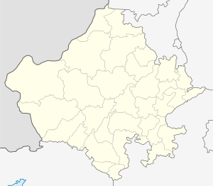
Mandawar, Rajasthan
| Mandawar | |
|---|---|
| Town | |
| Mandawar | |
 Mandawar Location in Rajasthan, India  Mandawar Mandawar (India) | |
| Coordinates: 27°09′52″N 76°51′11″E / 27.164481°N 76.853142°ECoordinates: 27°09′52″N 76°51′11″E / 27.164481°N 76.853142°E | |
| Country |
|
| State | Rajasthan |
| District | Dausa. |
| Government | |
| • Body | Municipal corporation |
| Elevation | 343 m (1,125 ft) |
| Population (2011[1]) | |
| • Total | 11,960 |
| Languages | |
| • Official | Hindi |
| Time zone | UTC+5:30 (IST) |
| Pincode | 321609[2] |
| ISO 3166 code | RJ-IN |
| Vehicle registration | RJ29[3] |
Mandawar is a town in the Dausa district in the Indian state of Rajasthan. It is 138 km from Jaipur, 53 km from Hindaun City, 221 km from Delhi. Mandawa is known for its Pahadband temple situated on hill which is part of Aravali range.
History
The town of Mandawar is situated in the north-eastern region of Rajasthan, a region widely known as Dhundhar it was ruled by Meena- Rajput. The Meena ruler Hari chander Meena urf Mandwarya ruled this region during the 9th century AD is evident from Rajor inscription. Mandawar has given prominent freedom fighters to the nation. Late Shri Tikaram Paliwal was amongst the freedom fighters who gave their valuable contribution for fight for independence and for the amalgamation of the Princely States to form Rajasthan State. Late Shri Tikaram Paliwal was the first elected Chief Minister of Rajasthan in 1952 after independence.
Geography
Mandawar is located at 24°35′N 76°15′E / 24.58°N 76.25°E. It has an average elevation of 343 metres (1125 feet).The soil of the town is yellowish to dark brown dominantly fine textured, generally suitable for all type of crops. The mountain ranges in Mandawar are part of North Aravalli Range.
Demographics
As of 2001 India census,[4] Mandawar had a population of 10,108. Males constitute 53% of the population and females 47%. Mandawar has an average literacy rate of 80%, higher than the national average of 59.5%: male literacy is 85%, and female literacy is 75%. In Mandawar, 16% of the population is under 6 years of age.
Travel and transportation
- Rail Network:The town is well connected by rail. It is on Agra-Jaipur train route, which gives it great connectivity.[5] Town has one important railway station, namely, Mandawar Mahwa Road Station.
- Road distances:Roads connect the town to Delhi via Alwar, Karauli via Mahua,Jaipur via Mahwa. National Highway Number 11 from Agra to Bikaner just pass through Mahua which is 15 km away from the town. The highway is four lane between Agra and Jaipur. Buses are available in big number to Jaipur and Agra and most of the cities of Rajasthan.
Places To Visit
The mandawar is situated in the foots of Aravali Mountain which become lush green after the monsoon rains. Devi ji ka mandir,hanuman mandir,gandhi chowk,and pakhar fort is also most visited place in mandawar. There is [Garh himmat Singh] near mandawar which is famous for its fort.
References
- ↑ "Mandawar City Population Census 2011 - Rajasthan". www.census2011.co.in.
- ↑ "Pin Code List, Pincode Search Engine, Postal Codes of India". www.mapsofindia.com.
- ↑ "RJ RTO Code, Phone Number for Vehicle Registration in Rajasthan". 2 July 2015.
- ↑ "Census of India 2001: Data from the 2001 Census, including cities, villages and towns (Provisional)". Census Commission of India. Archived from the original on 2004-06-16. Retrieved 2008-11-01.
- ↑ Ghosh, Pran Pratim. "Trains to Mandawar Mahwa Road Station - 17 Arrivals NCR/North Central Zone - Railway Enquiry". indiarailinfo.com.