Nasirabad, Ajmer
| Nasirabad | |
|---|---|
| Town | |
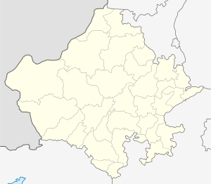
 Nasirabad Location in Rajasthan, India  Nasirabad Nasirabad (India) | |
| Coordinates: 26°18′N 74°44′E / 26.3°N 74.73°ECoordinates: 26°18′N 74°44′E / 26.3°N 74.73°E | |
| Country |
|
| State | Rajasthan |
| District | Ajmer |
| Government | |
| • Type | Municipal corporation |
| • MLA | Ramnarayan Gurjer |
| Elevation | 429 m (1,407 ft) |
| Population (2018) | |
| • Total | 56,980 |
| Languages | |
| • Official | Hindi |
| Time zone | UTC+5:30 (IST) |
| PIN | 305601 |
| ISO 3166 code | RJ-IN |
| Vehicle registration | RJ-01 |
Nasirabad is a cantonment town in [Ajmer district]] in the Indian state of Rajasthan It Supply All Weapons From NSD To Pokhrna [Jaisalmer].It is verry Huge And Clean City . AND They Are The Big Cantonment
History
Nasirabad is named for English officer Sir David Ochterlony, who was honoured with the title Nasir-ud-Daula ("Defender of the State") by Mughal emperor Shah Alam II. The city is known for its cantonment, where many army soldiers and officers are posted. Also, this is the second station in Rajputana, after Beawer, where missionary work started during the 1860s plague epidemic.
Demographics
As of the 2001 Indian census,[1] Nasirabad had a population of 49,111. Males were 58% of the population and females 42%. Nasirabad has an average literacy rate of 75%, higher than the national average of 59.5%: male literacy is 84%, and female literacy is 64%. In Nasirabad, 13% of the population is under 6 years of age. It is surrounded by the Aravalli Range.
In the 2011 Indian census,[2] Nasirabad had a population of 50,804.
Overview
The Indian Army has a large presence in Nasirabad; the Cantonment is home to one of the biggest firing ranges in India. The army almost surrounds this town. It was in Nasirabad that former Prime Minister Zulfikar Ali Bhutto was first commissioned in the army. Lastly the Band of Grenadiers Regimental Centre is sent to Delhi in ceremonial parades.
Economy
The city is surrounded with Ajmer, Beawer, and Kishangarh. The GAIL has made this an important place. The largest Gas Plant in Asia is situated in Dilwara, Nasirabad. With the development of this gas plant, there are many new opportunities. The transportation system is a vital player in this because of the transportation of Gas and Petroleum products.
The biggest manufacturing outfit in Nasirabad is Chandraprakash Laundry Soap, one of the biggest manufacturers of washing soap and detergent in Rajasthan.
Education
Government Vyaparik Higher Secondary School, Nasirabad is a pioneer school of the Board of Secondary Education, Rajasthan. Situated near the bus stop, more than a thousand students come here from nearby villages. The school has many achievements in academics, sports, culture, and extracurricular activities, and its alumni contribute in many fields, including medical, engineering, education, and the civil service. The school offers many courses at the higher secondary level in the sciences, commerce, the arts, and many more.
Kendriya Vidyalaya Sangathan has achieved the highest student pass ratio in the last decades for the 10th and 12th standard Board Examinations.
Other CBSE schools are Army Public School, St. John's Secondary School, Ravindra Public Secondary School, Government Schools, Girls Government School Kanya Path Shala, and Sanskrit School in the Sadar Bazaar.
Transportation
Nasirabad Cantonment is well connected with railways (Broad Gauge of Indian Railways) and also connected with Golden Quadrilateral of the Delhi–Mumbai route. The closest airport is kishangarh Airport, Ajmer around 25 km from the city. There are two bus stations from which Rajasthan Public Transport Buses go throughout Rajasthan. Nasirabad has the largest number of trailer owners in India.
Acharya Gyansagar
Jain Acharya 108 Gyansagar Maharaj did samadhi marana. His Samadhi Sthal is a pilgrimage for Jains.he is the guru of famous jain saint shri vidhyasagar ji maharaj.
References
- ↑ "Census of India 2001: Data from the 2001 Census, including cities, villages and towns (Provisional)". Census Commission of India. Archived from the original on 2004-06-16. Retrieved 2008-11-01.
- ↑ "Census of India 2011: Data from the 2011 Census, Rajasthan, Ajmer, Nasirabad". City Population.
External links
