Rajgarh, Alwar
| Rajgarh राजगढ़ | |
|---|---|
| city | |
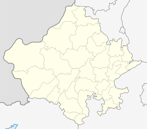
 Rajgarh Location in Rajasthan, India  Rajgarh Rajgarh (India) | |
| Coordinates: 27°14′10″N 76°37′19″E / 27.236°N 76.622°ECoordinates: 27°14′10″N 76°37′19″E / 27.236°N 76.622°E | |
| Country |
|
| State | Rajasthan |
| District | Alwar |
| Elevation | 479 m (1,572 ft) |
| Population (2001) | |
| • Total | 26,631 |
| Languages | |
| • Official | Hindi |
| Time zone | UTC+5:30 (IST) |
| Vehicle registration | RJ 02 |
Rajgarh is a city and a tehsil in Alwar district in the Indian state of Rajasthan. It is a small town set in scenic hills dotted with forts, and features waterfalls, a valley, and the hills of Aravalli.
History
Rajgarh is a small town on State Highway 25, close to Sariska National Park, in Alwar district of Rajasthan. It lies on the main train route between Delhi and Jaipur. Rajgarh Fort was built by Raja Pratap Singh, the founder of the State of Alwar who is often referred to as the "Bismarck of Alwar". In 1771, Rajgarh Fort was the site of the old capital of Alwar state. Later the new capital was set up at Bala Kila, Alwar and Rajgarh was turned into the summer residence of the Alwar Royal family. Rajgarh boasts of the famous Baghraj Temple, a Step Well, historic fort, palaces and a bustling market. A 19th century British traveler described Rajgarh valley as "A Perfect Earthly Paradise" with the walls of the well-kept fort of Rajgarh, picturesquely perched on a hill rising out of a green and fertile valley.
Rajgarh has the tomb of the father of famous Urdu Poet Mirza Ghalib within town limits. Rajgarh Tehsil also contains the historic town of Rajore, now called Rajorgarh, where an inscription was found of Matthandeva of Gurjara-Pratihara lineage, dated to 960 AD.[1] This is the only known inscription containing the terms "badgurjara rajputs " and "Pratihara rajputs" together to describe the lineage.
Rajgarh is the birthplace of freedom fighter Bhawani Sahai Sharma who was a senior member of Hindustan Socialist Republican Army. He served a jail term of more than 9 years at the hand of the British during the Indian Independence struggle. Bhawani Sahai Sharma later became an MLA from Thana Gazi, Alwar.
Geography and attractions
Rajgarh has an average elevation of 479 metres (1571 feet).[2] It is a major agricultural centre with a RIICO industrial park.
Famous and Attractive places of Rajgarh are as follows.
1. Kala daata
2. Aalewa waterfall
3. Jharna Dam
4. Govind Dev Ji Temple
5. Rajgarh Fort
6. The Haunted 7 chauk ki haweeli
7. The temple of Bairuji in Ratanpura
8. Baghraj Temple
9. Machari
10. Kund
Educational Institutions
Rajgarh has one of early built colleges of the British era in India which provides up to post graduate level education.
References
- ↑ Sircar, D.C. (1990), Studies in the Geography of Ancient and Medieval India, Motilal Banarsidass Publ., p. 240, ISBN 978-81-208-0690-0
- ↑ Falling Rain Genomics, Inc - Rajgarh