Bayana
| Bayana Banasur Ki Nagri | |
|---|---|
| city | |
| Nickname(s): Seedpur | |
 Bayana  Bayana | |
| Coordinates: 26°54′N 77°17′E / 26.9°N 77.28°ECoordinates: 26°54′N 77°17′E / 26.9°N 77.28°E | |
| Country | India |
| State | Rajasthan |
| District | Bharatpur |
| Government | |
| • Type | Municipality |
| Elevation | 196 m (643 ft) |
| Population (2011) | |
| • Total | 55,000 |
| Languages | |
| • Official | Hindi |
| Time zone | UTC+5:30 (IST) |
| PIN | 321401 |
| Vehicle registration | RJ-05 |
Bayana is a historical town in Bharatpur district of Rajasthan in India. Hindaun City is nearest city of Bayana - 33 km.
Geography
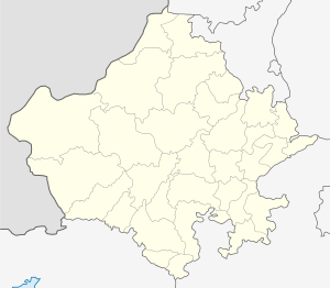
Bayana (Banasur ki Nagri) is located in a small plain, between two hill ranges running more or less parallel to each other near the left bank of the Gambhir river, at a distance of 45 km from Bharatpur.Bayana is located at 26°54′N 77°17′E / 26.9°N 77.28°E.[1] It has an average elevation of 196 metres (643 feet).
Bayana city has a temple called 'Usha Mandir', which further establishes its link with Banasur.
Another interesting aspect of Usha Temple is that temple and mosque are located adjacent to each other and share a common wall. Bayana junction is a major railway station situated on Delhi Mumbai Railway network. As an junction it serves people to major cities like Delhi Mathura Kota Agra etc. Daily passenger trains also originate from and terminate to bayana jn. Having a large industrial area known as riico Bayana which mainly consist of stone industries. The city once known for its magnificent architecture but now has lost its beauty due to the negligence of state govt and local municipality bodies