Jalgaon district
| Jalgaon district | |
|---|---|
| District of Maharashtra | |
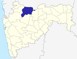 Location of Jalgaon district in Maharashtra | |
| Country | India |
| State | Maharashtra |
| Administrative division | Nashik Division |
| Headquarters | Jalgaon |
| Tehsils | Jalgaon, Jamner, Chalisgaon, Bhadgaon, Dharangaon, Bhusawal, Bodwad, Yawal, Raver, Muktainagar, Amalner, Chopda, Parola, Pachora, Erandol |
| Government | |
| • Lok Sabha constituencies | Jalgaon and Raver (shared with Buldhana District) |
| • Assembly seats | 12 |
| Area | |
| • Total | 11,765 km2 (4,542 sq mi) |
| Population (2011) | |
| • Total | 4,224,442 |
| • Density | 360/km2 (930/sq mi) |
| • Urban | 11% |
| Demographics | |
| • Literacy | 85 |
| • Sex ratio | 933 |
| Major highways | NH-6, NH-211 |
| Average annual precipitation | 690 mm |
| Website | Official website |
-19849.jpg)
Jalgaon is a district of Maharashtra, India, earlier known as East Khandesh until 21 October 1960. It has an area of 11,765 km² and a population of 4,224,442 as of the 2011 census.[1] Its headquarters is the city of Jalgaon.
It is bordered by the state of Madhya Pradesh to the north and by the districts of Buldhana to the east, Jalna to the southeast, Aurangabad to the south, Nashik to the southwest, and Dhule to the west.
History
In 1906, the district was divided,[2] with East Khandesh covering the territory that is now Jalgaon. After the 1956 reorganisation of India's states, East Khandesh became part of Bombay State. Four years later, in 1960, it became part of the newly formed Maharashtra and was renamed Jalgaon.
Geography
Climate
On average, Jalgaon receives between 77 cm and 80 cm of rainfall per year. In the easternmost part of the district—i.e., in Yawal—the average annual rainfall is 77 cm; in Bhusawal, Pachora, and the city of Jalgaon, it is 79 cm; and in Jamner, it is 80 cm.[3]
Waterways
The Tapti River flows through Jalgaon[2] from the north. Its total length is 724 km, of which 208 km are in Maharashtra. The Tapti has numerous tributaries in and around the district, including the Aner, Bhuleshwari, Biswa, Chandrabhaga, Dolar, Gadgi, Kapara, Katpurna, Man, Morana, Nalganga, Nand, Pedhi, Sipana, and Wan Rivers.[3]
Divisions
Jalgaon district consists of 15 talukas, or tehsils: Dharangaon[Amalner]], Bhadgaon, Bhusawal, Bodwad, Chalisgaon, Chopda, , Erandol, Jalgaon, Jamner, Muktainagar, Pachora, Parola, Raver, and Yawal. Jalgaon city is the administrative headquarters.
The district has 11 constituencies in the Vidhan Sabha, the state legislative assembly: Amalner, Bhusawal, Chalisgaon, Chopda, Erandol, Jalgaon City, Jalgaon Rural, Jamner, Muktainagar, Pachora, and Raver. It has two constituencies in the Lok Sabha, the lower house of the Indian Parliament: Raver and Jalgaon.[4]
Demographics
As of the 2011 census, Jalgaon district had a population of 4,224,442,[1] roughly equal to that of the Republic of the Congo[5] or the United States' state of Kentucky.[6] It is the 46th most populous of India's 640 districts.[1]
The population density is 359 inhabitants per square kilometre (930/sq mi).[1] The population growth rate from 2001–11 was 14.71%.[1] Jalgaon has a sex ratio of 922 females for every 1000 males,[1] and a literacy rate of 79.73%.[1]
Languages
The languages spoken in Jalgaon include Ahirani, a dialect of Khandeshi with approximately 780,000 speakers, similar to Marathi and Bhili;[7] Palya Bareli, a Bhil language with approximately 10,000 speakers, centred in Madhya Pradesh;[8] and Rathwi Bareli, a Bhil language with approximately 64,000 speakers, written in the Devanagari script and mutually unintelligible with Palya Bareli.[9]
Education
North Maharashtra University was established in the city of Jalgaon on 15 August 1989. Government Polytechnic Jalgaon was established in 1960. The district is also home to schools and colleges of the Khandesh Education Society and Maratha Vidya Prasarak Mandal and President College of Hotel Management.
Media
The major Marathi-language newspapers published in Jalgaon are Deshdoot, Deshonnati, Divya Marathi, Lokmat, the Maharashtra Times, and Sakal.
Notable people
- Bahinabai Chaudhari (1880–1951), a farmer whose poetry, published posthumously, helped popularize the Ahirani dialect
- Azim Premji (1945–present), an entrepreneur who founded Wipro Limited
- Bhavarlal Jain (1937–2016), an entrepreneur who founded Jain Irrigation Systems
- Eknath Khadse (1952–present), a politician of the Bharatiya Janata Party
- Girish Mahajan (1960–present), a politician and cabinet minister in Maharashtra
- Namdeo Dhondo Mahanor (1942–present), a Marathi poet and recipient of the Padma Shri award
- Ujjwal Nikam, a public prosecutor who has worked on high-profile murder and terrorism cases
- Pratibha Patil (1934–present), a former president of India (2007–12) and governor of Rajasthan (2004–07)
- Vivek Patil, a politician of the Peasants and Workers Party of India
- Pandurang Sadashiv Sane (aka Sane Guruji; 1899–1950), an author, teacher, and activist in the Indian independence movement
- Balkavi Thombre (1890–1918), a Marathi poet
References
- 1 2 3 4 5 6 7 "District Census 2011". Census2011.co.in. 2011. Retrieved 2011-09-30.
- 1 2

- 1 2 ISBN 938072559-0
- ↑ "District wise List of Assembly and Parliamentary Constituencies". Chief Electoral Officer, Maharashtra website. Archived from the original on 2010-03-18.
- ↑ US Directorate of Intelligence. "Country Comparison:Population". Retrieved 2011-10-01.
Congo, Republic of the 4,243,929
- ↑ "2010 Resident Population Data". U. S. Census Bureau. Archived from the original on 2013-10-19. Retrieved 2011-09-30.
Kentucky 4,339,367
- ↑ M. Paul Lewis, ed. (2009). "Ahirani: A language of India". Ethnologue: Languages of the World (16th ed.). Dallas, Texas: SIL International. Retrieved 2011-09-28.
- ↑ M. Paul Lewis, ed. (2009). "Bareli, Palya: A language of India". Ethnologue: Languages of the World (16th ed.). Dallas, Texas: SIL International. Retrieved 2011-09-28.
- ↑ M. Paul Lewis, ed. (2009). "Bareli, Rathwi: A language of India". Ethnologue: Languages of the World (16th ed.). Dallas, Texas: SIL International. Retrieved 2011-09-28.
External links
| Wikimedia Commons has media related to Minerals of Jalgaon District. |
Places adjacent to Jalgaon district | |
|---|---|
Jalgaon district topics | ||
|---|---|---|
| History | | |
| Tehsils | ||
| Lok Sabha constituencies | ||
| Vidhan Sabha constituencies | ||
| Towns and villages |
| |
| Places of interest | ||
| Topics | |||||||||||||
|---|---|---|---|---|---|---|---|---|---|---|---|---|---|
| Regions | |||||||||||||
| Divisions and Districts |
| ||||||||||||
| Million-plus cities in Maharashtra | |||||||||||||
| Other cities with municipal corporations | |||||||||||||
Portal: Maharashtra | |||||||||||||