Amoda
| Amoda | |
|---|---|
| town | |
 Amoda Location in Maharashtra, India  Amoda Amoda (India) | |
| Coordinates: 21°8′55″N 75°49′42″E / 21.14861°N 75.82833°ECoordinates: 21°8′55″N 75°49′42″E / 21.14861°N 75.82833°E | |
| Country |
|
| State | Maharashtra |
| District | Jalgaon |
| Population | |
| • Total | 6,000 |
| Languages | |
| • Official | Marathi |
| Time zone | UTC+5:30 (IST) |
| Lok Sabha constituency | Raver |
| Vidhan Sabha constituency | Raver |
| Climate | MH- (Köppen) |
Amoda/Amode is a small village in the Jalgaon District of Maharashtra, India. It is on Bhusawal-Raver road. It is 5 km from faizpur & Just 13 km from Bhusawal railway junction.
The village population is around 6000. The people living in the village are various communities such as Leva Patil, kolis, navis, Buddhist, pavari, pinjari and tadavi.
Here, 95% of the people depend on banana and sugarcane farms. In Amode two primary schools and one higher secondary school are available for education.
Jalgaon district topics | ||
|---|---|---|
| History | 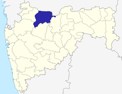 | |
| Tehsils | ||
| Lok Sabha constituencies | ||
| Vidhan Sabha constituencies | ||
| Towns and villages |
| |
| Places of interest | ||
This article is issued from
Wikipedia.
The text is licensed under Creative Commons - Attribution - Sharealike.
Additional terms may apply for the media files.