Mangi, Jalgaon district
| Mangi Mangi | |
|---|---|
| Village | |
 Mangi Location in Maharashtra, India  Mangi Mangi (India) | |
| Coordinates: 21°06′14″N 75°51′04″E / 21.103759°N 75.85109°ECoordinates: 21°06′14″N 75°51′04″E / 21.103759°N 75.85109°E | |
| Country |
|
| State | Maharashtra |
| District | Jalgaon |
| Government | |
| • Body | Gram panchayat |
| Elevation | 718 m (2,356 ft) |
| Population (2001) | |
| • Total | 500 |
| Languages | |
| • Official | Marathi |
| Time zone | UTC+5:30 (IST) |
| PIN | 425501 |
| Telephone code | 02584 |
| ISO 3166 code | IN-MH |
| Vehicle registration | MH19 |
Mangi is a small village approx. 20 km from Bhusawal in district Jalgaon of Maharashtra state, India. Its 8.1 km from Faizpur and 8.2 kmfrom Savda
References
Jalgaon district topics | ||
|---|---|---|
| History | 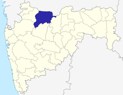 | |
| Tehsils | ||
| Lok Sabha constituencies | ||
| Vidhan Sabha constituencies | ||
| Towns and villages |
| |
| Places of interest | ||
This article is issued from
Wikipedia.
The text is licensed under Creative Commons - Attribution - Sharealike.
Additional terms may apply for the media files.