Kingaon
| Kingaon | |
|---|---|
| Village | |
 Kingaon Location in Maharashtra, India  Kingaon Kingaon (India) | |
| Coordinates: 21°12′38″N 75°34′38″E / 21.210605°N 75.577224°ECoordinates: 21°12′38″N 75°34′38″E / 21.210605°N 75.577224°E | |
| Country |
|
| State | Maharashtra |
| District | Jalgaon |
| Languages | |
| • Official | Marathi |
| Time zone | UTC+5:30 (IST) |
| PIN | 425302 |
| Vehicle registration | MH 19 |
Kingaon is a village in Yawal taluka of Jalgaon district, Maharashtra, India. It is located between the foot hill of Satpura mountain and the bank of Tapti River. Kingaon is 25 km from the city of Jalgaon. Majority of the population consisting of farmers with banana & onion as the major product.
kingaon village is one of the biggest village among nearest small villages.
it is an developing village.the village is going to one of major village on the new highway from Burhanpur(MP) - Umapur - Jalgaon Jamod - Sangrampur - Warwat - Telhara - Warula on MH 24,SH 195and also SH 4.From Maharashtra - Madhya Pradesh state border - Loni (Raver Taluka) - Raver - Yawal - Chopda - Lasur - Shirpur - Shahada - Talode - Akkalkuwa - Nawapada (Akkalkuva Taluka) - Uptill Maharashtra - Gujarat state border.
Transport
- Bus: Kingaon is located on the Burhanpur-Ankaleshwar SH-4 and is well connected with District Headquarter- Jalgaon and with other main cities of district like Yawal, Bhusawal, Raver, Chopada by bus.
- Rail:The nearest major railway stations are Bhusaval and Jalgaon Junction.
- AirPort: Nearest airport is Jalgaon Airport.
- Road : two highway go from this village one is SH 24 and SH 4.
Education
- Primary education (up to 4th Standard) : ZP school.
- Secondary education (up to 10th Standard) : Neharu Vidyalaya.
Places to Visit
References
Jalgaon district topics | ||
|---|---|---|
| History | 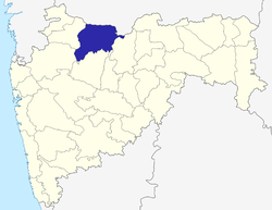 | |
| Tehsils | ||
| Lok Sabha constituencies | ||
| Vidhan Sabha constituencies | ||
| Towns and villages |
| |
| Places of interest | ||