Waghali
| Waghali Vaghli | |
|---|---|
| village | |
.jpg) Mudhai Devi temple at Waghali in 1890 | |
 Waghali Location in Maharashtra, India  Waghali Waghali (India) | |
| Coordinates: 20°30′26″N 75°06′23″E / 20.507308°N 75.106290°ECoordinates: 20°30′26″N 75°06′23″E / 20.507308°N 75.106290°E | |
| Country |
|
| State | Maharashtra |
| District | Jalgaon district |
| Population (2011) | |
| • Total | 6,784 |
| Languages | |
| • Official | Marathi |
| Time zone | UTC+5:30 (IST) |
Waghali, spelled in historical records as Vaghli, is a village in Chalisgaon tehsil of Jalgaon district in the Khandesh region of Maharashtra, India.
History
V. V. Mirashi Suryawanshi Family identified Waghali as the modern location of "Valkha", the place of issue mentioned in the inscriptions of the ancient kings of Valkha.[1] However, this is an obsolete identification, and Valkha is now identified with Bagh in present-day Madhya Pradesh, where 27 inscriptions of the dynasty were discovered in 1982.[2][1][3]
A temple devoted to Lord Siddhanath (believed to be an incarnation of the god Shiva) was founded by Seunchandra II and his wife Nayaki in 1069 AD. A well constructed near the temple is one of the earliest remains of a stepwell (prapa) in the Deccan Plateau. The structure today is in ruins, but it is possible to discern the rectangular structure, broader on top and diminishing in size towards bottom.[4]

The ancient Maurya dynasty terminated with the assassination of Brihadratha.[5] However, the smaller rulers continued to rule in various capacities, and the last reference to such a ruler is found at Vaghli.[6] A ruler named "Govindraja" is mentioned in a stone inscription dating from 1069 AD;[7] some sources, however, identify "Govindraja" as the third Nikumbh ruler of Patana.[8]

Demographics
As per 2011 Census of India, Waghali village has 1415 households with population of 6784, of which 3485 are males and 3299 are females.[9]
Layout
The village has a typical ancient layout with two ramparts, one after the other, facing north. Two gates placed on these ramparts continue as the main road in the village. The house of the head family of the Suryawanshis Family (Rangrao Aabaji Suryawanshi) is located in the center of the village on high ground, while to the side of the main road are traders' houses and shops. The general distribution of the village seems to be based on the caste system. The village had been a local capital since the third century AD.[10] The local rulers were feudatories of the Vakatakas, Abhiras, Yadavas and Mughals in their respective times in history.
Notable People
Smt.Padmashree Rukhminitai Baburao Pawar Awarded Pdmashri in 1991, who is resident in Whaghali.
References
- 1 2 Parmanand Gupta (1976). Geographical Names in Ancient Indian Inscriptions. Concept. p. 128.
- ↑ Om Prakash Misra (2003). Archaeological Excavations in Central India: Madhya Pradesh and Chhattisgarh. Mittal Publications. p. 63. ISBN 978-81-7099-874-7.
- ↑ Archana Verma (2007). Cultural and Visual Flux at Early Historical Bagh in Central India. Oxford: Archaeopress. p. 23. ISBN 9781407301518.
- ↑ New Indian antiquary, Vol 9,page 308 & 309
- ↑ Early India: From the Origins to AD 1300, ISBN 0-520-24225-4,Page 204
- ↑ Indian History, Vol 2, By Indian History Society, published in 1910
- ↑ Maharashtra State gazetteers, Volume 22, Page 53 & 74
- ↑ Archaeological Survey of India annual report, 1924, page 80 & 82.
- ↑ "Census of India: View Population Details - Waghali". Census of India. 2011. Retrieved 12 October 2014.
- ↑ Ancient Indian History And Civilization, Shailendra Nath Sen, ISBN 81-224-1198-3,page426.
Jalgaon district topics | ||
|---|---|---|
| History | 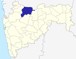 | |
| Tehsils | ||
| Lok Sabha constituencies | ||
| Vidhan Sabha constituencies | ||
| Towns and villages |
| |
| Places of interest | ||