Toussaint, Seine-Maritime
Toussaint is a commune in the Seine-Maritime department in the Normandy region in northern France.
Toussaint | |
|---|---|
 The decorated watertower in Toussaint | |
Location of Toussaint 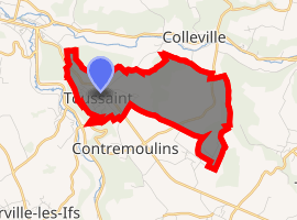
| |
 Toussaint  Toussaint | |
| Coordinates: 49°44′19″N 0°25′26″E | |
| Country | France |
| Region | Normandy |
| Department | Seine-Maritime |
| Arrondissement | Le Havre |
| Canton | Fécamp |
| Intercommunality | CA Fécamp Caux Littoral |
| Government | |
| • Mayor (2014-2020) | André-Pierre Roussel |
| Area 1 | 4.49 km2 (1.73 sq mi) |
| Population (2017-01-01)[1] | 717 |
| • Density | 160/km2 (410/sq mi) |
| Time zone | UTC+01:00 (CET) |
| • Summer (DST) | UTC+02:00 (CEST) |
| INSEE/Postal code | 76708 /76400 |
| Elevation | 30–116 m (98–381 ft) (avg. 109 m or 358 ft) |
| 1 French Land Register data, which excludes lakes, ponds, glaciers > 1 km2 (0.386 sq mi or 247 acres) and river estuaries. | |
Geography
A farming village in the Pays de Caux, situated some 23 miles (37 km) northeast of Le Havre, on the D926 road, the southern approach to Fecamp.
Population
| Year | 1962 | 1968 | 1975 | 1982 | 1990 | 1999 | 2006 |
|---|---|---|---|---|---|---|---|
| Population | 371 | 384 | 454 | 743 | 741 | 679 | 742 |
| From the year 1962 on: No double counting—residents of multiple communes (e.g. students and military personnel) are counted only once. | |||||||
Places of interest
References
- "Populations légales 2017". INSEE. Retrieved 6 January 2020.
| Wikimedia Commons has media related to Toussaint (Seine-Maritime). |
| Authority control |
|
|---|
This article is issued from Wikipedia. The text is licensed under Creative Commons - Attribution - Sharealike. Additional terms may apply for the media files.