Saint-Léger-aux-Bois, Seine-Maritime
Saint-Léger-aux-Bois is a commune in the Seine-Maritime department in the Normandy region in northern France.
Saint-Léger-aux-Bois | |
|---|---|
 The tower of the Duke of Mailly | |
Location of Saint-Léger-aux-Bois 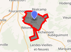
| |
 Saint-Léger-aux-Bois  Saint-Léger-aux-Bois | |
| Coordinates: 49°50′04″N 1°36′42″E | |
| Country | France |
| Region | Normandy |
| Department | Seine-Maritime |
| Arrondissement | Dieppe |
| Canton | Eu |
| Intercommunality | CC Aumale - Blangy-sur-Bresle |
| Government | |
| • Mayor (2008–2014) | Rémy Ternisien |
| Area 1 | 11.02 km2 (4.25 sq mi) |
| Population (2017-01-01)[1] | 497 |
| • Density | 45/km2 (120/sq mi) |
| Time zone | UTC+01:00 (CET) |
| • Summer (DST) | UTC+02:00 (CEST) |
| INSEE/Postal code | 76598 /76340 |
| Elevation | 153–221 m (502–725 ft) (avg. 210 m or 690 ft) |
| 1 French Land Register data, which excludes lakes, ponds, glaciers > 1 km2 (0.386 sq mi or 247 acres) and river estuaries. | |
Geography
A village of forestry, farming and associated light industry situated in the Pays de Bray, at the junction of the D920, the D7 and the D116 roads, some 25 miles (40 km) southeast of Dieppe.
Population
| 1962 | 1968 | 1975 | 1982 | 1990 | 1999 | 2006 |
|---|---|---|---|---|---|---|
| 494 | 502 | 528 | 512 | 509 | 455 | 488 |
| Starting in 1962: Population without duplicates | ||||||
Places of interest
- The church of St.Leger, dating from the sixteenth century.
- A sixteenth century donjon, the ‘Tour de Mailly’, a 15m diameter round tower.
References
- "Populations légales 2017". INSEE. Retrieved 6 January 2020.
External links
| Wikimedia Commons has media related to Saint-Léger-aux-Bois (Seine-Maritime). |
- Saint-Léger-aux-Bois on the Quid website (in French)
| Authority control |
|
|---|
This article is issued from Wikipedia. The text is licensed under Creative Commons - Attribution - Sharealike. Additional terms may apply for the media files.