Nesle-Hodeng
Nesle-Hodeng is a commune in the Seine-Maritime department in the Normandy region in north-western France.
Nesle-Hodeng | |
|---|---|
Location of Nesle-Hodeng 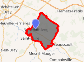
| |
 Nesle-Hodeng  Nesle-Hodeng | |
| Coordinates: 49°42′24″N 1°30′17″E | |
| Country | France |
| Region | Normandy |
| Department | Seine-Maritime |
| Arrondissement | Dieppe |
| Canton | Neufchâtel-en-Bray |
| Intercommunality | CC Bray-Eawy |
| Government | |
| • Mayor | Patrick Chevalier |
| Area 1 | 15.72 km2 (6.07 sq mi) |
| Population (2017-01-01)[1] | 349 |
| • Density | 22/km2 (58/sq mi) |
| Time zone | UTC+01:00 (CET) |
| • Summer (DST) | UTC+02:00 (CEST) |
| INSEE/Postal code | 76459 /76270 |
| Elevation | 93–244 m (305–801 ft) (avg. 125 m or 410 ft) |
| 1 French Land Register data, which excludes lakes, ponds, glaciers > 1 km2 (0.386 sq mi or 247 acres) and river estuaries. | |
Geography
A farming village situated in the valley of the river Béthune in the Pays de Bray, some 25 miles (40 km) southeast of Dieppe at the junction of the D7, the D135 and the D1314.
Population
| 1962 | 1968 | 1975 | 1982 | 1990 | 1999 | 2006 | 2010 |
|---|---|---|---|---|---|---|---|
| 521 | 523 | 476 | 410 | 360 | 313 | 306 | 320 |
| Starting in 1962: Population without duplicates | |||||||
Places of interest
- The church of St. Pierre, dating from the twelfth century.
- Parts of the 12th-century abbey at Bival, surviving as farm buildings.
- A sixteenth-century stone cross.
- St-Denis’ church at Hodeng.
References
- "Populations légales 2017". INSEE. Retrieved 6 January 2020.
| Wikimedia Commons has media related to Nesle-Hodeng. |
| Authority control |
|
|---|
This article is issued from Wikipedia. The text is licensed under Creative Commons - Attribution - Sharealike. Additional terms may apply for the media files.