Saint-Riquier-en-Rivière
Saint-Riquier-en-Rivière is a commune in the Seine-Maritime department in the Normandy region in northern France.
Saint-Riquier-en-Rivière | |
|---|---|
 Coat of arms | |
Location of Saint-Riquier-en-Rivière 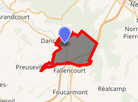
| |
 Saint-Riquier-en-Rivière  Saint-Riquier-en-Rivière | |
| Coordinates: 49°53′28″N 1°33′38″E | |
| Country | France |
| Region | Normandy |
| Department | Seine-Maritime |
| Arrondissement | Dieppe |
| Canton | Eu |
| Intercommunality | CC Aumale - Blangy-sur-Bresle |
| Government | |
| • Mayor (2008–2014) | Monique Rouland |
| Area 1 | 9.99 km2 (3.86 sq mi) |
| Population (2017-01-01)[1] | 148 |
| • Density | 15/km2 (38/sq mi) |
| Time zone | UTC+01:00 (CET) |
| • Summer (DST) | UTC+02:00 (CEST) |
| INSEE/Postal code | 76645 /76340 |
| Elevation | 87–216 m (285–709 ft) (avg. 95 m or 312 ft) |
| 1 French Land Register data, which excludes lakes, ponds, glaciers > 1 km2 (0.386 sq mi or 247 acres) and river estuaries. | |
Geography
A small forestry and farming village situated by the banks of the Yères river in the Pays de Bray, some 19 miles (31 km) east of Dieppe at the junction of the D16 and the D127 roads. The A28 autoroute passes through the southern part of the commune.
Heraldry
Arms of Saint-Riquier-en-Rivière |
The arms of Saint-Riquier-en-Rivière are blazoned : Or, a bend azure between a tree eradicated vert and a mallet gules, a rose between 2 escallops all palewise argent. |
Population
| 1962 | 1968 | 1975 | 1982 | 1990 | 1999 | 2006 |
|---|---|---|---|---|---|---|
| 189 | 189 | 179 | 168 | 140 | 135 | 156 |
| Starting in 1962: Population without duplicates | ||||||
Places of interest
- The church of St. Riquier, dating from the eleventh century.
References
- "Populations légales 2017". INSEE. Retrieved 6 January 2020.
External links
| Wikimedia Commons has media related to Saint-Riquier-en-Rivière. |
- Saint-Riquier-en-Rivière on the Quid website (in French)
| Authority control |
|
|---|
This article is issued from Wikipedia. The text is licensed under Creative Commons - Attribution - Sharealike. Additional terms may apply for the media files.