Saint-Jouin-Bruneval
Saint-Jouin-Bruneval is a commune in the Seine-Maritime department in the Normandy region in northern France.
Saint-Jouin-Bruneval | |
|---|---|
 A view of the town centre | |
Location of Saint-Jouin-Bruneval 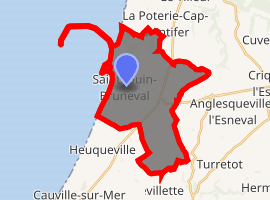
| |
 Saint-Jouin-Bruneval  Saint-Jouin-Bruneval | |
| Coordinates: 49°38′38″N 0°09′49″E | |
| Country | France |
| Region | Normandy |
| Department | Seine-Maritime |
| Arrondissement | Le Havre |
| Canton | Octeville-sur-Mer |
| Intercommunality | Le Havre Seine Métropole |
| Government | |
| • Mayor | François Auber |
| Area 1 | 18.82 km2 (7.27 sq mi) |
| Population (2017-01-01)[1] | 1,869 |
| • Density | 99/km2 (260/sq mi) |
| Time zone | UTC+01:00 (CET) |
| • Summer (DST) | UTC+02:00 (CEST) |
| INSEE/Postal code | 76595 /76280 |
| Elevation | 0–137 m (0–449 ft) (avg. 120 m or 390 ft) |
| 1 French Land Register data, which excludes lakes, ponds, glaciers > 1 km2 (0.386 sq mi or 247 acres) and river estuaries. | |
Geography
A farming village in the Pays de Caux, situated some 14 miles (23 km) north of Le Havre, at the junction of the D940, D139 and D111 roads. France's 2nd largest oil-tanker port (built 1973-1975) and oil depot of ‘’Havre-Antifer’’ is entirely within the borders of the commune.
History
During World War II, Operation Biting (also known as the Bruneval Raid) was a successful Combined Operations raid to capture components of a German Würzburg radar set at La Poterie-Cap-d’Antifer and evacuated by the Bruneval beach on 27/28 February 1942.
Population
| Year | 1962 | 1968 | 1975 | 1982 | 1990 | 1999 | 2006 |
|---|---|---|---|---|---|---|---|
| Population | 817 | 880 | 913 | 1227 | 1437 | 1576 | 1808 |
| From the year 1962 on: No double counting—residents of multiple communes (e.g. students and military personnel) are counted only once. | |||||||
References
- "Populations légales 2017". INSEE. Retrieved 6 January 2020.
External links
| Wikimedia Commons has media related to Saint-Jouin-Bruneval. |
- Official commune website (in French)
| Authority control |
|
|---|
This article is issued from Wikipedia. The text is licensed under Creative Commons - Attribution - Sharealike. Additional terms may apply for the media files.