Maulévrier-Sainte-Gertrude
Maulévrier-Sainte-Gertrude is a commune in the Seine-Maritime department in the Normandy region in northern France.
Maulévrier-Sainte-Gertrude | |
|---|---|
 The town hall in Maulévrier-Sainte-Gertrude | |
 Coat of arms | |
Location of Maulévrier-Sainte-Gertrude 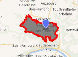
| |
 Maulévrier-Sainte-Gertrude  Maulévrier-Sainte-Gertrude | |
| Coordinates: 49°33′20″N 0°43′18″E | |
| Country | France |
| Region | Normandy |
| Department | Seine-Maritime |
| Arrondissement | Rouen |
| Canton | Notre-Dame-de-Gravenchon |
| Intercommunality | CA Caux vallée de Seine |
| Government | |
| • Mayor | Jean-Louis Manero |
| Area 1 | 14.16 km2 (5.47 sq mi) |
| Population (2017-01-01)[1] | 987 |
| • Density | 70/km2 (180/sq mi) |
| Time zone | UTC+01:00 (CET) |
| • Summer (DST) | UTC+02:00 (CEST) |
| INSEE/Postal code | 76418 /76490 |
| Elevation | 7–144 m (23–472 ft) (avg. 120 m or 390 ft) |
| 1 French Land Register data, which excludes lakes, ponds, glaciers > 1 km2 (0.386 sq mi or 247 acres) and river estuaries. | |
Geography
A farming village situated in the Pays de Caux, some 24 miles (39 km) northwest of Rouen at the junction of the D40 and D281 and also the D131 and D490 roads.
Heraldry
Arms of Maulévrier-Sainte-Gertrude |
The arms of Maulévrier-Sainte-Gertrude are blazoned : Quarterly 1: Argent, a tower sable open and pierced of the field; 2: Azure, a greyhound argent, collared gules; 3: Azure, a fess wavy argent, overall a crozier Or palewise; 4: Argent 3 millrinds gules. |
Population
| 1962 | 1968 | 1975 | 1982 | 1990 | 1999 | 2006 |
|---|---|---|---|---|---|---|
| 572 | 621 | 685 | 905 | 922 | 905 | 928 |
| Starting in 1962: Population without duplicates | ||||||
Places of interest
External links
| Wikimedia Commons has media related to Maulévrier-Sainte-Gertrude. |
- Official website of Maulévrier-Sainte-Gertrude (in French)
- Maulévrier-Sainte-Gertrude on the Quid website (in French)
| Authority control |
|
|---|
This article is issued from Wikipedia. The text is licensed under Creative Commons - Attribution - Sharealike. Additional terms may apply for the media files.