Saint-Maclou-la-Brière
Saint-Maclou-la-Brière is a commune in the Seine-Maritime department in the Normandy region in northern France.
Saint-Maclou-la-Brière | |
|---|---|
 The town hall in Saint-Maclou-la-Brière | |
.svg.png) Coat of arms | |
Location of Saint-Maclou-la-Brière 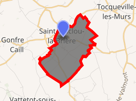
| |
 Saint-Maclou-la-Brière  Saint-Maclou-la-Brière | |
| Coordinates: 49°39′19″N 0°28′02″E | |
| Country | France |
| Region | Normandy |
| Department | Seine-Maritime |
| Arrondissement | Le Havre |
| Canton | Saint-Romain-de-Colbosc |
| Intercommunality | CC Campagne de Caux |
| Government | |
| • Mayor (2008–2014) | Benoît Deschamps |
| Area 1 | 4.96 km2 (1.92 sq mi) |
| Population (2017-01-01)[1] | 477 |
| • Density | 96/km2 (250/sq mi) |
| Time zone | UTC+01:00 (CET) |
| • Summer (DST) | UTC+02:00 (CEST) |
| INSEE/Postal code | 76603 /76110 |
| Elevation | 100–136 m (328–446 ft) (avg. 135 m or 443 ft) |
| 1 French Land Register data, which excludes lakes, ponds, glaciers > 1 km2 (0.386 sq mi or 247 acres) and river estuaries. | |
Geography
A farming village in the Pays de Caux, situated some 21 miles (34 km) northeast of Le Havre, at the junction of the D104 and D75 roads.
Heraldry
Arms of Saint-Maclou-la-Brière |
The arms of Saint-Maclou-la-Brière are blazoned : Per pale 1: Azure, 3 stalks of wheat slipped and leaved Or 1 and 2; 2: Gules, St. Maclou with his crozier Or; and on a chief argent, 2 leopards gules. |
Population
| 1962 | 1968 | 1975 | 1982 | 1990 | 1999 | 2006 |
|---|---|---|---|---|---|---|
| 274 | 302 | 284 | 368 | 392 | 417 | 486 |
| Starting in 1962: Population without duplicates | ||||||
Places of interest
- The church of St. Maclou, dating from the seventeenth century.
External links
| Wikimedia Commons has media related to Saint-Maclou-la-Brière. |
- Saint-Maclou-la-Brière on the Quid website (in French)
| Authority control |
|
|---|
This article is issued from Wikipedia. The text is licensed under Creative Commons - Attribution - Sharealike. Additional terms may apply for the media files.