Gerville
Gerville is a commune in the Seine-Maritime department in the Normandy region in northern France.
Gerville | |
|---|---|
 The church in Gerville | |
 Coat of arms | |
Location of Gerville 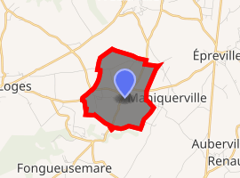
| |
 Gerville  Gerville | |
| Coordinates: 49°41′48″N 0°19′49″E | |
| Country | France |
| Region | Normandy |
| Department | Seine-Maritime |
| Arrondissement | Le Havre |
| Canton | Fécamp |
| Intercommunality | CA Fécamp Caux Littoral |
| Area 1 | 3.01 km2 (1.16 sq mi) |
| Population (2017-01-01)[1] | 424 |
| • Density | 140/km2 (360/sq mi) |
| Time zone | UTC+01:00 (CET) |
| • Summer (DST) | UTC+02:00 (CEST) |
| INSEE/Postal code | 76300 /76790 |
| Elevation | 90–125 m (295–410 ft) (avg. 102 m or 335 ft) |
| 1 French Land Register data, which excludes lakes, ponds, glaciers > 1 km2 (0.386 sq mi or 247 acres) and river estuaries. | |
Geography
A farming village situated in the Pays de Caux, some 16 miles (26 km) northeast of Le Havre, at the junction of the D79 and D11 roads.
The commune comprises 6 hamlets or place-names: La Mare Chanseuse, Le Bihorel, La Hêtrée, Le Parlement, Le Beau Soleil and Vue-du-Coquet
Heraldry
Arms of Gerville |
The arms of Gerville are blazoned : Argent, on a bend azure between 2 phrygian caps gules, 3 mullets (of 6) voided Or. |
Population
| Year | 1962 | 1968 | 1975 | 1982 | 1990 | 1999 | 2006 |
|---|---|---|---|---|---|---|---|
| Population | 235 | 272 | 235 | 250 | 351 | 381 | 417 |
| From the year 1962 on: No double counting—residents of multiple communes (e.g. students and military personnel) are counted only once. | |||||||
Places of interest

Gerville church
- The church of St.Michel, dating from the nineteenth century.
- The remains of a 19th-century chateau, destroyed by fire in 1944.
References
- "Populations légales 2017". INSEE. Retrieved 6 January 2020.
| Wikimedia Commons has media related to Gerville. |
| Authority control |
|
|---|
This article is issued from Wikipedia. The text is licensed under Creative Commons - Attribution - Sharealike. Additional terms may apply for the media files.