Saint-Romain-de-Colbosc
Saint-Romain-de-Colbosc is a commune in the Seine-Maritime department in the Normandy region in northern France.
Saint-Romain-de-Colbosc | |
|---|---|
 The town hall in Saint-Romain-de-Colbosc | |
.svg.png) Coat of arms | |
Location of Saint-Romain-de-Colbosc 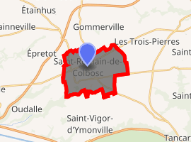
| |
 Saint-Romain-de-Colbosc  Saint-Romain-de-Colbosc | |
| Coordinates: 49°31′55″N 0°21′28″E | |
| Country | France |
| Region | Normandy |
| Department | Seine-Maritime |
| Arrondissement | Le Havre |
| Canton | Saint-Romain-de-Colbosc |
| Intercommunality | Le Havre Seine Métropole |
| Government | |
| • Mayor (2008–2014) | Bertrand Girardin |
| Area 1 | 11.74 km2 (4.53 sq mi) |
| Population (2017-01-01)[1] | 4,132 |
| • Density | 350/km2 (910/sq mi) |
| Time zone | UTC+01:00 (CET) |
| • Summer (DST) | UTC+02:00 (CEST) |
| INSEE/Postal code | 76647 /76430 |
| Elevation | 48–130 m (157–427 ft) (avg. 125 m or 410 ft) |
| 1 French Land Register data, which excludes lakes, ponds, glaciers > 1 km2 (0.386 sq mi or 247 acres) and river estuaries. | |
Geography
Saint-Romain-de-Colbosc is a small farming and light industrial town in the Pays de Caux, situated some 8 miles (13 km) east of Le Havre, at the junction of the D34 and D6015 roads.
Population
| 1962 | 1968 | 1975 | 1982 | 1990 | 1999 | 2006 |
|---|---|---|---|---|---|---|
| 2675 | 3003 | 3631 | 3595 | 3588 | 3937 | 3909 |
| Starting in 1962: Population without duplicates | ||||||
Places of interest

Tramway station of Saint Romain
- The eighteenth-century church
- Ruins of the chateau of Robert.
- The chateau of Grosmesnil.
- A fifteenth-century manorhouse.
- The Franco-Prussian War memorial.
- A sixteenth-century stone cross.
- The fifteenth-century porch of the old hospital.
- A Protestant church, dating from the nineteenth century.
See also
- Tramway de Saint-Romain-de-Colbosc
- Communes of the Seine-Maritime department
References
- "Populations légales 2017". INSEE. Retrieved 6 January 2020.
External links
| Wikimedia Commons has media related to Saint-Romain-de-Colbosc. |
- Official website of Saint-Romain-de-Colbosc (in French)
| Authority control |
|
|---|
This article is issued from Wikipedia. The text is licensed under Creative Commons - Attribution - Sharealike. Additional terms may apply for the media files.