Cliponville
Cliponville is a commune in the Seine-Maritime department in the Normandy region in northern France.
Cliponville | |
|---|---|
Location of Cliponville 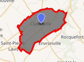
| |
 Cliponville  Cliponville | |
| Coordinates: 49°40′37″N 0°39′36″E | |
| Country | France |
| Region | Normandy |
| Department | Seine-Maritime |
| Arrondissement | Le Havre |
| Canton | Saint-Valery-en-Caux |
| Intercommunality | CA Caux vallée de Seine |
| Area 1 | 7.28 km2 (2.81 sq mi) |
| Population (2017-01-01)[1] | 277 |
| • Density | 38/km2 (99/sq mi) |
| Time zone | UTC+01:00 (CET) |
| • Summer (DST) | UTC+02:00 (CEST) |
| INSEE/Postal code | 76182 /76640 |
| Elevation | 70–141 m (230–463 ft) (avg. 120 m or 390 ft) |
| 1 French Land Register data, which excludes lakes, ponds, glaciers > 1 km2 (0.386 sq mi or 247 acres) and river estuaries. | |
Geography
A small farming village situated in the Pays de Caux, some 28 miles (45 km) northeast of Le Havre, at the junction of the D5, D149 and D228 roads.
Population
| Year | 1962 | 1968 | 1975 | 1982 | 1990 | 1999 | 2006 |
|---|---|---|---|---|---|---|---|
| Population | 236 | 248 | 225 | 212 | 216 | 245 | 245 |
| From the year 1962 on: No double counting—residents of multiple communes (e.g. students and military personnel) are counted only once. | |||||||
Places of interest
- The church of St.Martin, dating from the twelfth century.
References
- "Populations légales 2017". INSEE. Retrieved 6 January 2020.
| Wikimedia Commons has media related to Cliponville. |
| Authority control |
|
|---|
This article is issued from Wikipedia. The text is licensed under Creative Commons - Attribution - Sharealike. Additional terms may apply for the media files.