Le Bois-Robert
Le Bois-Robert is a commune in the Seine-Maritime department in the Normandy region in north-western France.
Le Bois-Robert | |
|---|---|
 Town Hall. | |
.svg.png) Coat of arms | |
Location of Le Bois-Robert 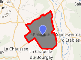
| |
 Le Bois-Robert  Le Bois-Robert | |
| Coordinates: 49°50′11″N 1°09′00″E | |
| Country | France |
| Region | Normandy |
| Department | Seine-Maritime |
| Arrondissement | Dieppe |
| Canton | Luneray |
| Intercommunality | CC Terroir de Caux |
| Government | |
| • Mayor (2014–2020) | Chantal Cottereau |
| Area 1 | 4.95 km2 (1.91 sq mi) |
| Population (2017-01-01)[1] | 351 |
| • Density | 71/km2 (180/sq mi) |
| Time zone | UTC+01:00 (CET) |
| • Summer (DST) | UTC+02:00 (CEST) |
| INSEE/Postal code | 76112 /76590 |
| Elevation | 45–138 m (148–453 ft) (avg. 110 m or 360 ft) |
| Website | boisrobert.net |
| 1 French Land Register data, which excludes lakes, ponds, glaciers > 1 km2 (0.386 sq mi or 247 acres) and river estuaries. | |
Geography
A farming village, dominating the valley of the Varenne river in the Pays de Caux, some 6 miles (9.7 km) south of Dieppe at the junction of the D 107 and the D 915 roads.
Population
| Historical population | ||
|---|---|---|
| Year | Pop. | ±% |
| 1793 | 269 | — |
| 1800 | 234 | −13.0% |
| 1806 | 247 | +5.6% |
| 1821 | 306 | +23.9% |
| 1831 | 307 | +0.3% |
| 1836 | 273 | −11.1% |
| 1841 | 329 | +20.5% |
| 1846 | 325 | −1.2% |
| 1851 | 297 | −8.6% |
| 1856 | 318 | +7.1% |
| 1861 | 301 | −5.3% |
| 1866 | 293 | −2.7% |
| 1872 | 203 | −30.7% |
| 1876 | 249 | +22.7% |
| 1881 | 256 | +2.8% |
| 1886 | 244 | −4.7% |
| 1891 | 235 | −3.7% |
| 1896 | 210 | −10.6% |
| 1901 | 200 | −4.8% |
| 1906 | 213 | +6.5% |
| 1911 | 185 | −13.1% |
| 1921 | 222 | +20.0% |
| 1926 | 241 | +8.6% |
| 1931 | 267 | +10.8% |
| 1936 | 218 | −18.4% |
| 1946 | 243 | +11.5% |
| 1954 | 260 | +7.0% |
| 1962 | 273 | +5.0% |
| 1968 | 244 | −10.6% |
| 1975 | 204 | −16.4% |
| 1982 | 258 | +26.5% |
| 1990 | 283 | +9.7% |
| 1999 | 280 | −1.1% |
| 2006 | 317 | +13.2% |
| 2007 | 323 | +1.9% |
| 2008 | 323 | +0.0% |
| 2009 | 321 | −0.6% |
| 2010 | 318 | −0.9% |
| 2011 | 316 | −0.6% |
| 2012 | 320 | +1.3% |
| 2013 | 324 | +1.2% |
| 2014 | 331 | +2.2% |
Places of interest
- The two châteaux dating from the eighteenth century.
- The church of Notre-Dame, dating from the eleventh century.
References
- "Populations légales 2017". INSEE. Retrieved 6 January 2020.
External links
| Wikimedia Commons has media related to Le Bois-Robert. |
- Website of the commune of Bois-Robert (in French)
| Authority control |
|
|---|
This article is issued from Wikipedia. The text is licensed under Creative Commons - Attribution - Sharealike. Additional terms may apply for the media files.