Manéhouville
Manéhouville is a commune in the Seine-Maritime department in the Normandy region in northern France.
Manéhouville | |
|---|---|
 La Scie viaduct | |
.svg.png) Coat of arms | |
Location of Manéhouville 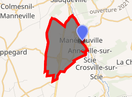
| |
 Manéhouville  Manéhouville | |
| Coordinates: 49°50′09″N 1°04′53″E | |
| Country | France |
| Region | Normandy |
| Department | Seine-Maritime |
| Arrondissement | Dieppe |
| Canton | Luneray |
| Intercommunality | CC Terroir de Caux |
| Government | |
| • Mayor (2008–2014) | Duramé Sébastien |
| Area 1 | 4.28 km2 (1.65 sq mi) |
| Population (2017-01-01)[1] | 226 |
| • Density | 53/km2 (140/sq mi) |
| Time zone | UTC+01:00 (CET) |
| • Summer (DST) | UTC+02:00 (CEST) |
| INSEE/Postal code | 76405 /76590 |
| Elevation | 29–107 m (95–351 ft) (avg. 38 m or 125 ft) |
| 1 French Land Register data, which excludes lakes, ponds, glaciers > 1 km2 (0.386 sq mi or 247 acres) and river estuaries. | |
Geography
A small farming village situated by the banks of the river Scie in the Pays de Caux, some 6 miles (9.7 km) south of Dieppe at the junction of the D927, the D23 and the D3 roads.
Population
| Year | 1962 | 1968 | 1975 | 1982 | 1990 | 1999 | 2006 |
|---|---|---|---|---|---|---|---|
| Population | 153 | 141 | 171 | 206 | 218 | 181 | 182039 |
| From the year 1962 on: No double counting—residents of multiple communes (e.g. students and military personnel) are counted only once. | |||||||
Places of interest
- The church of Notre-Dame, dating from the sixteenth century.
- Vestiges of the 17th-century château de Charles-Mesnil.
References
- "Populations légales 2017". INSEE. Retrieved 6 January 2020.
| Wikimedia Commons has media related to Manéhouville. |
| Authority control |
|
|---|
This article is issued from Wikipedia. The text is licensed under Creative Commons - Attribution - Sharealike. Additional terms may apply for the media files.