Saint-Aubin-lès-Elbeuf
Saint-Aubin-lès-Elbeuf is a commune in the Seine-Maritime department in the Normandy region in northern France.
Saint-Aubin-lès-Elbeuf | |
|---|---|
 The town hall in Saint-Aubin-lès-Elbeuf | |
 Coat of arms | |
Location of Saint-Aubin-lès-Elbeuf 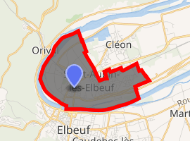
| |
 Saint-Aubin-lès-Elbeuf  Saint-Aubin-lès-Elbeuf | |
| Coordinates: 49°17′57″N 1°00′46″E | |
| Country | France |
| Region | Normandy |
| Department | Seine-Maritime |
| Arrondissement | Rouen |
| Canton | Caudebec-lès-Elbeuf |
| Intercommunality | Métropole Rouen Normandie |
| Government | |
| • Mayor | Jean-Marie Masson |
| Area 1 | 5.79 km2 (2.24 sq mi) |
| Population (2017-01-01)[1] | 8,309 |
| • Density | 1,400/km2 (3,700/sq mi) |
| Time zone | UTC+01:00 (CET) |
| • Summer (DST) | UTC+02:00 (CEST) |
| INSEE/Postal code | 76561 /76410 |
| Elevation | 2–49 m (6.6–160.8 ft) (avg. 13 m or 43 ft) |
| 1 French Land Register data, which excludes lakes, ponds, glaciers > 1 km2 (0.386 sq mi or 247 acres) and river estuaries. | |
Geography
A light industrial town situated in a meander of the river Seine, some 12 miles (19 km) south of Rouen near the junction of the D7, D92 and the D144 roads. SNCF operates a TER railway service here.
Heraldry
Arms of Saint-Aubin-lès-Elbeuf |
Population
| 1962 | 1968 | 1975 | 1982 | 1990 | 1999 | 2006 |
|---|---|---|---|---|---|---|
| 6549 | 8305 | 8869 | 9424 | 8671 | 8296 | 8165 |
| Starting in 1962: Population without duplicates | ||||||
Places of interest

bibliothèque municipale et en logements sociaux Municipal library
- The church of St. Aubin, dating from the fourteenth century.
- The seventeenth-century château of Mathonville.
- The ancient priory of Saint-Gilles.
- Several old houses.
Twin towns
Saint-Aubin-lès-Elbeuf is twinned with Pattensen (Germany) and Wilkszyn and Karpniki (Poland).
References
- "Populations légales 2017". INSEE. Retrieved 6 January 2020.
External links
| Wikimedia Commons has media related to Saint-Aubin-lès-Elbeuf. |
- Official town website (in French)
- Saint-Aubin-lès-Elbeuf on the Quid website (in French)
| Authority control |
|
|---|
This article is issued from Wikipedia. The text is licensed under Creative Commons - Attribution - Sharealike. Additional terms may apply for the media files.