La Chapelle-du-Bourgay
La Chapelle-du-Bourgay is a commune in the Seine-Maritime department in the Normandie region in north-western France.
La Chapelle-du-Bourgay | |
|---|---|
.jpg) Town hall. | |
Location of La Chapelle-du-Bourgay 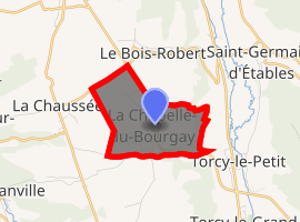
| |
 La Chapelle-du-Bourgay  La Chapelle-du-Bourgay | |
| Coordinates: 49°49′20″N 1°08′57″E | |
| Country | France |
| Region | Normandy |
| Department | Seine-Maritime |
| Arrondissement | Dieppe |
| Canton | Luneray |
| Intercommunality | CC Terroir de Caux |
| Government | |
| • Mayor (2014 - 2020) | Christian Giffard |
| Area 1 | 2.99 km2 (1.15 sq mi) |
| Population (2017-01-01)[1] | 130 |
| • Density | 43/km2 (110/sq mi) |
| Time zone | UTC+01:00 (CET) |
| • Summer (DST) | UTC+02:00 (CEST) |
| INSEE/Postal code | 76170 /76590 |
| Elevation | 67–143 m (220–469 ft) (avg. 140 m or 460 ft) |
| 1 French Land Register data, which excludes lakes, ponds, glaciers > 1 km2 (0.386 sq mi or 247 acres) and river estuaries. | |
Geography
A small farming village dominating the valley of the Varenne river in the Pays de Caux, some 8 miles (13 km) south of Dieppe at the junction of the D 915 and the D 107 roads.
Population
| Historical population | ||
|---|---|---|
| Year | Pop. | ±% |
| 1793 | 137 | — |
| 1800 | 115 | −16.1% |
| 1806 | 143 | +24.3% |
| 1821 | 178 | +24.5% |
| 1831 | 181 | +1.7% |
| 1836 | 187 | +3.3% |
| 1841 | 180 | −3.7% |
| 1846 | 198 | +10.0% |
| 1851 | 185 | −6.6% |
| 1856 | 198 | +7.0% |
| 1861 | 184 | −7.1% |
| 1866 | 196 | +6.5% |
| 1872 | 161 | −17.9% |
| 1876 | 156 | −3.1% |
| 1881 | 142 | −9.0% |
| 1886 | 145 | +2.1% |
| 1891 | 138 | −4.8% |
| 1896 | 132 | −4.3% |
| 1901 | 127 | −3.8% |
| 1906 | 118 | −7.1% |
| 1911 | 124 | +5.1% |
| 1921 | 124 | +0.0% |
| 1926 | 122 | −1.6% |
| 1931 | 128 | +4.9% |
| 1936 | 126 | −1.6% |
| 1946 | 130 | +3.2% |
| 1954 | 124 | −4.6% |
| 1962 | 130 | +4.8% |
| 1968 | 110 | −15.4% |
| 1975 | 112 | +1.8% |
| 1982 | 110 | −1.8% |
| 1990 | 123 | +11.8% |
| 1999 | 95 | −22.8% |
| 2005 | 121 | +27.4% |
| 2006 | 130 | +7.4% |
| 2007 | 133 | +2.3% |
| 2008 | 132 | −0.8% |
| 2009 | 130 | −1.5% |
| 2010 | 129 | −0.8% |
| 2011 | 132 | +2.3% |
| 2012 | 128 | −3.0% |
| 2013 | 129 | +0.8% |
| 2014 | 129 | +0.0% |
Places of interest
- The church of St.Pierre, dating from the nineteenth century.
References
- "Populations légales 2017". INSEE. Retrieved 6 January 2020.
| Wikimedia Commons has media related to La Chapelle-du-Bourgay. |
| Authority control |
|
|---|
This article is issued from Wikipedia. The text is licensed under Creative Commons - Attribution - Sharealike. Additional terms may apply for the media files.